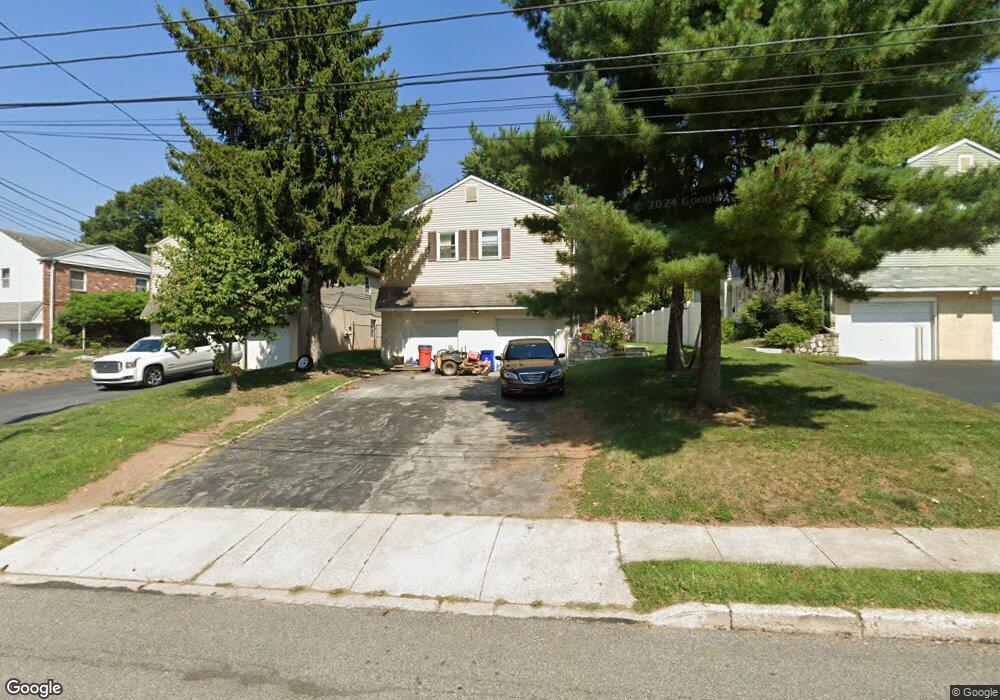
4217 Garrett Rd Drexel Hill, PA 19026
Estimated Value: $295,000 - $381,000
4
Beds
2
Baths
1,768
Sq Ft
$200/Sq Ft
Est. Value
About This Home
This home is located at 4217 Garrett Rd, Drexel Hill, PA 19026 and is currently estimated at $354,012, approximately $200 per square foot. 4217 Garrett Rd is a home located in Delaware County with nearby schools including Garrettford El School, Drexel Hill Middle School, and Upper Darby High School.
Ownership History
Date
Name
Owned For
Owner Type
Purchase Details
Closed on
Feb 19, 2020
Sold by
Secretary Of Housing & Urban Development
Bought by
Rojas Karla J and Vasquez Alonzo Elber
Current Estimated Value
Purchase Details
Closed on
Aug 23, 2019
Sold by
Wells Fargo Bank Na
Bought by
Secretary Of Housing & Urban Development
Purchase Details
Closed on
Sep 13, 2016
Sold by
Hopper Mary Mcfall
Bought by
Wells Fargo Bank Na
Purchase Details
Closed on
Sep 27, 2007
Sold by
Harrer Damien S and Estate Of William R Harrer
Bought by
Daly Maureen
Home Financials for this Owner
Home Financials are based on the most recent Mortgage that was taken out on this home.
Original Mortgage
$192,971
Interest Rate
6.59%
Mortgage Type
FHA
Create a Home Valuation Report for This Property
The Home Valuation Report is an in-depth analysis detailing your home's value as well as a comparison with similar homes in the area
Home Values in the Area
Average Home Value in this Area
Purchase History
| Date | Buyer | Sale Price | Title Company |
|---|---|---|---|
| Rojas Karla J | $120,200 | Devon Abstract Llc | |
| Secretary Of Housing & Urban Development | -- | None Available | |
| Wells Fargo Bank Na | $1,735 | None Available | |
| Daly Maureen | $196,000 | None Available |
Source: Public Records
Mortgage History
| Date | Status | Borrower | Loan Amount |
|---|---|---|---|
| Previous Owner | Daly Maureen | $192,971 |
Source: Public Records
Tax History Compared to Growth
Tax History
| Year | Tax Paid | Tax Assessment Tax Assessment Total Assessment is a certain percentage of the fair market value that is determined by local assessors to be the total taxable value of land and additions on the property. | Land | Improvement |
|---|---|---|---|---|
| 2025 | $7,787 | $184,130 | $50,160 | $133,970 |
| 2024 | $7,787 | $184,130 | $50,160 | $133,970 |
| 2023 | $7,714 | $184,130 | $50,160 | $133,970 |
| 2022 | $7,506 | $184,130 | $50,160 | $133,970 |
| 2021 | $10,121 | $184,130 | $50,160 | $133,970 |
| 2020 | $8,274 | $127,910 | $38,810 | $89,100 |
| 2019 | $8,129 | $127,910 | $38,810 | $89,100 |
| 2018 | $8,035 | $127,910 | $0 | $0 |
| 2017 | $7,826 | $127,910 | $0 | $0 |
| 2016 | $702 | $127,910 | $0 | $0 |
| 2015 | $716 | $127,910 | $0 | $0 |
| 2014 | $702 | $127,910 | $0 | $0 |
Source: Public Records
Map
Nearby Homes
- 4130 Rosemont Ave
- 461 Wilde Ave
- 469 Wilde Ave
- 4426 Huey Ave
- 4014 Rosemont Ave
- 4044 Dayton Rd
- 521 Blythe Ave
- 4032 Dayton Rd
- 4400 School Ln
- 4410 School Ln
- 523 Bloomfield Ave
- 3811 Berry Ave
- 3810 Huey Ave
- 3804 Rosemont Ave
- 4123 School Ln
- 543 Bloomfield Ave
- 4009 Redden Rd
- 5134 Westley Dr
- 506 Burmont Rd
- 337 Cheswold Rd
- 4215 Garrett Rd
- 4219 Garrett Rd
- 4221 Garrett Rd
- 426 Burnley Ln
- 421 Wilde Ave
- 4223 Garrett Rd
- 423 Wilde Ave
- 430 Burnley Ln
- 425 Wilde Ave
- 4222 Garrett Rd
- 4220 Garrett Rd
- 4225 Garrett Rd
- 432 Burnley Ln
- 4218 Garrett Rd
- 4224 Garrett Rd
- 427 Wilde Ave
- 420 Wilde Ave
- 4207 Garrett Rd
- 434 Burnley Ln
- 4216 Garrett Rd