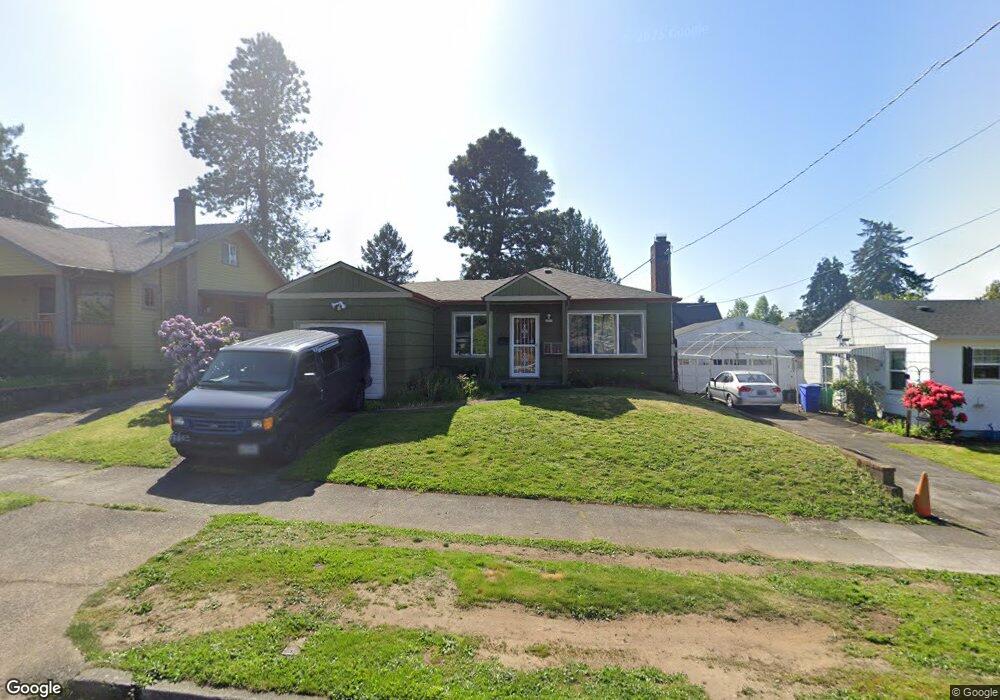
4217 NE 69th Ave Portland, OR 97218
Roseway NeighborhoodEstimated Value: $420,000 - $503,000
3
Beds
1
Bath
988
Sq Ft
$477/Sq Ft
Est. Value
About This Home
This home is located at 4217 NE 69th Ave, Portland, OR 97218 and is currently estimated at $470,864, approximately $476 per square foot. 4217 NE 69th Ave is a home located in Multnomah County with nearby schools including Scott Elementary School, Roseway Heights School, and Leodis V. McDaniel High School.
Ownership History
Date
Name
Owned For
Owner Type
Purchase Details
Closed on
Nov 28, 2007
Sold by
Fox Ruth J
Bought by
Fox Ruth J and Ruth J Fox Revocable Trust
Current Estimated Value
Purchase Details
Closed on
Apr 28, 1999
Sold by
Chaney John R
Bought by
Fox Russell A and Fox Ruth J
Home Financials for this Owner
Home Financials are based on the most recent Mortgage that was taken out on this home.
Original Mortgage
$95,200
Outstanding Balance
$24,476
Interest Rate
6.98%
Mortgage Type
Purchase Money Mortgage
Estimated Equity
$446,388
Create a Home Valuation Report for This Property
The Home Valuation Report is an in-depth analysis detailing your home's value as well as a comparison with similar homes in the area
Home Values in the Area
Average Home Value in this Area
Purchase History
| Date | Buyer | Sale Price | Title Company |
|---|---|---|---|
| Fox Ruth J | -- | Accommodation | |
| Fox Russell A | $119,000 | Chicago Title Insurance Co |
Source: Public Records
Mortgage History
| Date | Status | Borrower | Loan Amount |
|---|---|---|---|
| Open | Fox Russell A | $95,200 |
Source: Public Records
Tax History Compared to Growth
Tax History
| Year | Tax Paid | Tax Assessment Tax Assessment Total Assessment is a certain percentage of the fair market value that is determined by local assessors to be the total taxable value of land and additions on the property. | Land | Improvement |
|---|---|---|---|---|
| 2024 | $5,494 | $205,330 | -- | -- |
| 2023 | $5,283 | $199,350 | $0 | $0 |
| 2022 | $5,168 | $193,550 | $0 | $0 |
| 2021 | $5,081 | $187,920 | $0 | $0 |
| 2020 | $4,661 | $182,450 | $0 | $0 |
| 2019 | $4,490 | $177,140 | $0 | $0 |
| 2018 | $4,358 | $171,990 | $0 | $0 |
| 2017 | $4,177 | $166,990 | $0 | $0 |
| 2016 | $3,823 | $162,130 | $0 | $0 |
| 2015 | $3,722 | $157,410 | $0 | $0 |
| 2014 | $3,666 | $152,830 | $0 | $0 |
Source: Public Records
Map
Nearby Homes
- 4230 NE 71st Ave
- 4330 NE 71st Ave
- 7006 NE Prescott St
- 4026 NE 64th Ave
- 6525 NE Prescott St
- 4232 NE 73rd Ave
- 6318 NE Prescott St
- 3541 NE 72nd Ave
- 4600 NE 72nd Ave Unit 4608
- 3606 NE 72nd Ave
- 4416 NE 75th Ave
- 3943 NE 76th Ave
- 6028 NE Mason St Unit 1
- 6026 NE Mason St Unit 3
- 6022 NE Mason St Unit 7
- 6020 NE Mason St Unit 9
- 6010 NE Mason St Unit 6
- 6408 NE Wygant St
- 6016 NE Mason St Unit 11
- 3920 NE 76th Ave
- 4211 NE 69th Ave
- 4231 NE 69th Ave
- 4218 NE 68th Ave
- 4143 NE 69th Ave
- 6824 NE Skidmore St
- 4210 NE 68th Ave
- 4230 NE 68th Ave
- 4144 NE 68th Ave
- 6808 NE Skidmore St
- 4137 NE 69th Ave
- 4220 NE 69th Ave
- 4210 NE 69th Ave
- 4230 NE 69th Ave
- 4136 NE 68th Ave
- 4146 NE 69th Ave
- 6910 NE Skidmore St
- 4127 NE 69th Ave
- 4134 NE 69th Ave
- 4122 NE 68th Ave
- 6805 NE Skidmore St