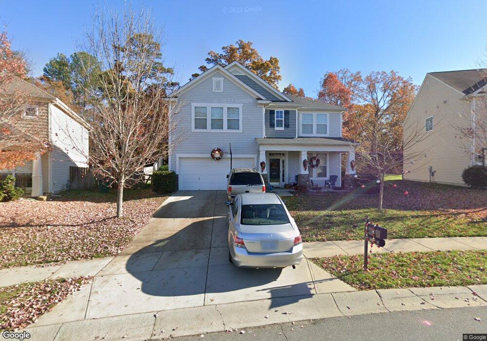
4218 Lawrence Daniel Dr Matthews, NC 28104
Estimated Value: $409,000 - $456,000
3
Beds
2
Baths
2,250
Sq Ft
$197/Sq Ft
Est. Value
About This Home
This home is located at 4218 Lawrence Daniel Dr, Matthews, NC 28104 and is currently estimated at $442,605, approximately $196 per square foot. 4218 Lawrence Daniel Dr is a home located in Union County with nearby schools including Stallings Elementary School, Porter Ridge Middle School, and Porter Ridge High School.
Ownership History
Date
Name
Owned For
Owner Type
Purchase Details
Closed on
Apr 27, 2007
Sold by
The Ryland Group Inc
Bought by
Ferrell Matthew and Ferrell Christina
Current Estimated Value
Home Financials for this Owner
Home Financials are based on the most recent Mortgage that was taken out on this home.
Original Mortgage
$164,480
Outstanding Balance
$97,690
Interest Rate
6.1%
Mortgage Type
Unknown
Estimated Equity
$344,915
Purchase Details
Closed on
Oct 18, 2004
Sold by
Woodbridge At Stallings Lp
Bought by
The Ryland Group Inc
Create a Home Valuation Report for This Property
The Home Valuation Report is an in-depth analysis detailing your home's value as well as a comparison with similar homes in the area
Purchase History
| Date | Buyer | Sale Price | Title Company |
|---|---|---|---|
| Ferrell Matthew | $206,000 | None Available | |
| The Ryland Group Inc | $240,000 | -- |
Source: Public Records
Mortgage History
| Date | Status | Borrower | Loan Amount |
|---|---|---|---|
| Open | Ferrell Matthew | $164,480 |
Source: Public Records
Tax History
| Year | Tax Paid | Tax Assessment Tax Assessment Total Assessment is a certain percentage of the fair market value that is determined by local assessors to be the total taxable value of land and additions on the property. | Land | Improvement |
|---|---|---|---|---|
| 2025 | $2,887 | $421,300 | $0 | $0 |
| 2024 | $2,481 | $281,500 | $55,000 | $226,500 |
| 2023 | $2,380 | $281,500 | $55,000 | $226,500 |
| 2022 | $2,359 | $281,500 | $55,000 | $226,500 |
| 2021 | $2,358 | $281,500 | $55,000 | $226,500 |
| 2020 | $1,946 | $189,900 | $37,500 | $152,400 |
| 2019 | $1,938 | $189,900 | $37,500 | $152,400 |
| 2018 | $1,938 | $189,900 | $37,500 | $152,400 |
| 2017 | $2,146 | $205,100 | $37,500 | $167,600 |
| 2016 | $2,162 | $205,100 | $37,500 | $167,600 |
| 2015 | $2,184 | $205,100 | $37,500 | $167,600 |
| 2014 | $1,487 | $210,060 | $32,500 | $177,560 |
Source: Public Records
Map
Nearby Homes
- 4324 Stallingswood Dr
- 4006 Scarlet Dr Unit 29
- 1419 Vickery Dr
- 1301 Mountain Laurel Ct
- 5028 Haven Lodge Rd
- 5401 Stevens Mill Rd
- 7803 Stinson Hartis Rd
- 310 Cedarwood Ln
- 2108 Stallings Rd
- 3501 Timber Mill Dr
- 0000 White Oak Ln
- 14818 Hooks Rd
- 300 Forest Park Rd
- 2409 Autumn Olive Ln
- 804 Dogwood Creek Ln
- 1105 May Apple Dr
- 14010 Mareshead Ln
- 10019 Elibren Ln
- 14348 Brooks Knoll Ln
- 2131 Stevens Mill Rd
- 4220 Lawrence Daniel Dr
- 4216 Lawrence Daniel Dr
- 4216 Lawrence Daniel Dr Unit 9/24
- 4222 Lawrence Daniel Dr
- 4214 Lawrence Daniel Dr
- 610 Caroline Aubrey Way Unit 20
- 4215 Lawrence Daniel Dr
- 4212 Lawrence Daniel Dr
- 4213 Lawrence Daniel Dr
- 4223 Lawrence Daniel Dr
- 4210 Lawrence Daniel Dr
- 4210 Lawrence Daniel Dr Unit 27
- 4226 Lawrence Daniel Dr
- 4211 Lawrence Daniel Dr
- 4209 Stallingswood Dr
- 4225 Lawrence Daniel Dr
- 4208 Lawrence Daniel Dr
- 4228 Lawrence Daniel Dr
- 4209 Lawrence Daniel Dr
- 607 Caroline Aubrey Way
Your Personal Tour Guide
Ask me questions while you tour the home.