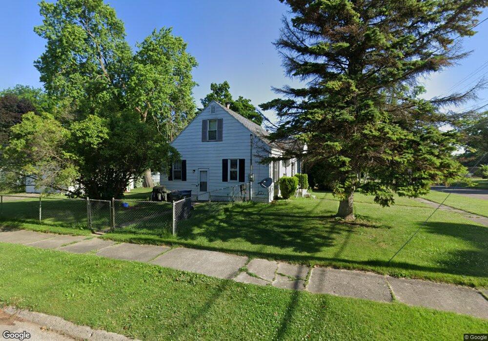
4218 Ogema Ave Flint, MI 48507
Circle Drive NeighborhoodEstimated Value: $66,000 - $87,000
2
Beds
1
Bath
1,080
Sq Ft
$74/Sq Ft
Est. Value
About This Home
This home is located at 4218 Ogema Ave, Flint, MI 48507 and is currently estimated at $80,143, approximately $74 per square foot. 4218 Ogema Ave is a home located in Genesee County with nearby schools including Freeman Elementary School, Flint Southwestern Classical Academy, and International Academy of Flint (K-12).
Ownership History
Date
Name
Owned For
Owner Type
Purchase Details
Closed on
Feb 28, 2012
Sold by
Pacific Bay Capital Group Llc
Bought by
S & S Property Management Llc
Current Estimated Value
Purchase Details
Closed on
Aug 4, 2010
Sold by
Hopson Nareah and Hopson Ronald T
Bought by
Federal Home Loan Mortgage Corp
Purchase Details
Closed on
Dec 23, 2009
Sold by
Hopson Nareah and Hopson Ronald T
Bought by
Federal Home Loan Mortgage Corp
Create a Home Valuation Report for This Property
The Home Valuation Report is an in-depth analysis detailing your home's value as well as a comparison with similar homes in the area
Home Values in the Area
Average Home Value in this Area
Purchase History
| Date | Buyer | Sale Price | Title Company |
|---|---|---|---|
| S & S Property Management Llc | -- | None Available | |
| Federal Home Loan Mortgage Corp | $82,367 | None Available | |
| Federal Home Loan Mortgage Corp | $75,194 | None Available |
Source: Public Records
Tax History Compared to Growth
Tax History
| Year | Tax Paid | Tax Assessment Tax Assessment Total Assessment is a certain percentage of the fair market value that is determined by local assessors to be the total taxable value of land and additions on the property. | Land | Improvement |
|---|---|---|---|---|
| 2025 | $894 | $40,500 | $0 | $0 |
| 2024 | $834 | $36,100 | $0 | $0 |
| 2023 | $820 | $31,900 | $0 | $0 |
| 2022 | $0 | $25,800 | $0 | $0 |
| 2021 | $828 | $23,900 | $0 | $0 |
| 2020 | $768 | $19,300 | $0 | $0 |
| 2019 | $755 | $15,000 | $0 | $0 |
| 2018 | $732 | $13,600 | $0 | $0 |
| 2017 | $715 | $0 | $0 | $0 |
| 2016 | $710 | $0 | $0 | $0 |
| 2015 | -- | $0 | $0 | $0 |
| 2014 | -- | $0 | $0 | $0 |
| 2012 | -- | $17,000 | $0 | $0 |
Source: Public Records
Map
Nearby Homes
- 621 Burroughs Ave
- 630 Buckingham Ave
- 810 Macdonald Ave
- 4310 Cheyenne Ave
- 4424 Cheyenne Ave
- 4127 Custer Ave
- 454 E Atherton Rd
- 4205 Red Arrow Rd
- 3614 Comanche Ave
- 326 Burroughs Ave
- 3505 Comanche Ave
- 3343 Cheyenne Ave
- 3115 Circle Dr
- 4010 Milton Dr
- 3512 Barcey Ct
- 2910 Shawnee Ave
- 0000 E Bristol Rd
- 2207 E Boatfield Ave
- 2130 E Whittemore Ave
- 1453 Carman St
- 4214 Ogema Ave
- 629 Lochhead Ave
- 4208 Ogema Ave
- 625 Lochhead Ave
- 632 Lochhead Ave
- 4202 Ogema Ave
- 632 Mckinley Ave
- 4215 Ogema Ave
- 4211 Ogema Ave
- 620 Lochhead Ave
- 4207 Ogema Ave
- 4301 Ogema Ave
- 624 Mckinley Ave
- 4307 Ogema Ave
- 617 Lochhead Ave
- 607 Dell Ave
- 613 Dell Ave
- 601 Dell Ave
- 4321 Circle Dr
- 711 Lochhead Ave