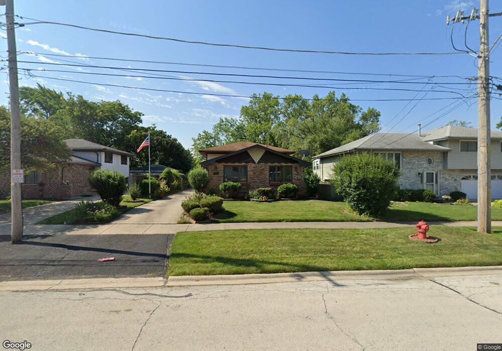
4219 142nd St Crestwood, IL 60445
Estimated Value: $264,000 - $327,000
3
Beds
2
Baths
1,189
Sq Ft
$247/Sq Ft
Est. Value
About This Home
This home is located at 4219 142nd St, Crestwood, IL 60445 and is currently estimated at $293,833, approximately $247 per square foot. 4219 142nd St is a home located in Cook County with nearby schools including Kolmar Elementary School, A B Shepard High School, and St. Christopher School.
Ownership History
Date
Name
Owned For
Owner Type
Purchase Details
Closed on
Jul 16, 2012
Sold by
Swallow Daniel W
Bought by
Swallow Daniel W and The Daniel W Swallow Declaration Of Trus
Current Estimated Value
Purchase Details
Closed on
May 3, 2012
Sold by
Swallow Daniel W
Bought by
Swallow Daniel W and The Daniel W Swallow Declaration Of Trus
Purchase Details
Closed on
Oct 22, 2010
Sold by
Swallow Daniel W and Swallow Victoria A
Bought by
Swallow Daniel W
Home Financials for this Owner
Home Financials are based on the most recent Mortgage that was taken out on this home.
Original Mortgage
$105,000
Interest Rate
4.5%
Mortgage Type
New Conventional
Create a Home Valuation Report for This Property
The Home Valuation Report is an in-depth analysis detailing your home's value as well as a comparison with similar homes in the area
Home Values in the Area
Average Home Value in this Area
Purchase History
| Date | Buyer | Sale Price | Title Company |
|---|---|---|---|
| Swallow Daniel W | -- | None Available | |
| Swallow Daniel W | -- | None Available | |
| Swallow Daniel W | -- | Ctic |
Source: Public Records
Mortgage History
| Date | Status | Borrower | Loan Amount |
|---|---|---|---|
| Closed | Swallow Daniel W | $105,000 |
Source: Public Records
Tax History Compared to Growth
Tax History
| Year | Tax Paid | Tax Assessment Tax Assessment Total Assessment is a certain percentage of the fair market value that is determined by local assessors to be the total taxable value of land and additions on the property. | Land | Improvement |
|---|---|---|---|---|
| 2024 | $4,265 | $22,000 | $4,000 | $18,000 |
| 2023 | $3,905 | $22,000 | $4,000 | $18,000 |
| 2022 | $3,905 | $15,654 | $3,500 | $12,154 |
| 2021 | $3,677 | $15,654 | $3,500 | $12,154 |
| 2020 | $3,668 | $15,654 | $3,500 | $12,154 |
| 2019 | $4,037 | $17,057 | $3,250 | $13,807 |
| 2018 | $3,866 | $17,057 | $3,250 | $13,807 |
| 2017 | $3,958 | $17,057 | $3,250 | $13,807 |
| 2016 | $3,875 | $15,320 | $2,750 | $12,570 |
| 2015 | $3,777 | $15,320 | $2,750 | $12,570 |
| 2014 | $3,177 | $15,320 | $2,750 | $12,570 |
| 2013 | $3,788 | $16,780 | $2,750 | $14,030 |
Source: Public Records
Map
Nearby Homes
- 14145 Kedvale Ave Unit 3
- 14244 Kostner Ave
- 14401 Kolin Ave
- 14431 Tripp Ave
- 14501 Tripp Ave
- 14401 Pulaski Rd
- 14224 Springfield Ave
- 14501 Keystone Ave Unit 8
- 4210 Midlothian Turnpike
- 14341 Kenton Ave
- 14601 Tripp Ave
- 4424 Midlothian Turnpike
- 14544 Kostner Ave
- 4118 W Midlothian Turnpike
- 14539 Crawford Ave
- 14601 Keystone Ave Unit B3
- 14618 Keystone Ave
- 14348 Knox Ave
- 14309 Kilpatrick Ave
- 14632 Kostner Ave
- 4215 142nd St
- 4225 142nd St
- 4211 142nd St
- 4235 142nd St
- 4207 142nd St
- 14209 Kildare Ave
- 4245 142nd St
- 4224 142nd St
- 14210 Keeler Ave
- 14218 Keeler Ave
- 4216 142nd St
- 4228 142nd St
- 14220 Keeler Ave
- 4208 142nd St
- 4255 142nd St
- 14222 Keeler Ave
- 14217 Kildare Ave
- 14226 Keeler Ave
- 14224 Keeler Ave
- 14142 Keeler Ave