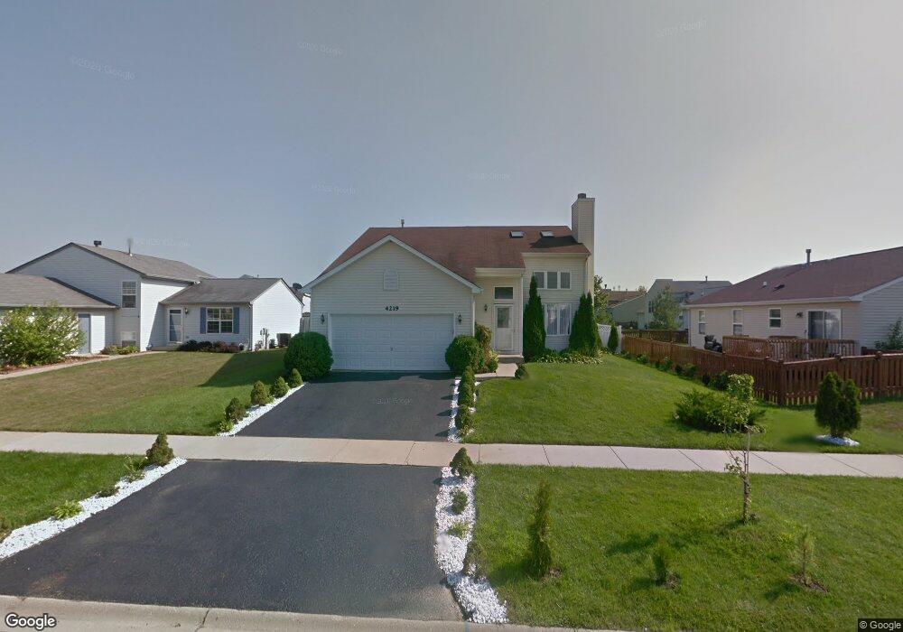
4219 Quail St Zion, IL 60099
West Zion NeighborhoodEstimated Value: $299,000 - $324,000
3
Beds
3
Baths
1,617
Sq Ft
$192/Sq Ft
Est. Value
About This Home
This home is located at 4219 Quail St, Zion, IL 60099 and is currently estimated at $310,586, approximately $192 per square foot. 4219 Quail St is a home located in Lake County with nearby schools including Newport Elementary School, Beach Park Middle School, and Zion-Benton Township High School.
Ownership History
Date
Name
Owned For
Owner Type
Purchase Details
Closed on
Dec 3, 2024
Sold by
White Antoinette M
Bought by
White Antoinette M and White Trinity
Current Estimated Value
Home Financials for this Owner
Home Financials are based on the most recent Mortgage that was taken out on this home.
Original Mortgage
$160,000
Outstanding Balance
$158,822
Interest Rate
7.13%
Mortgage Type
New Conventional
Estimated Equity
$151,764
Purchase Details
Closed on
Dec 11, 2006
Sold by
White Michael S
Bought by
White Antoinette M
Purchase Details
Closed on
Nov 10, 1999
Sold by
Bank Of Waukegan
Bought by
White Michael S and White Antoinette M
Home Financials for this Owner
Home Financials are based on the most recent Mortgage that was taken out on this home.
Original Mortgage
$141,992
Interest Rate
7.88%
Mortgage Type
FHA
Create a Home Valuation Report for This Property
The Home Valuation Report is an in-depth analysis detailing your home's value as well as a comparison with similar homes in the area
Home Values in the Area
Average Home Value in this Area
Purchase History
| Date | Buyer | Sale Price | Title Company |
|---|---|---|---|
| White Antoinette M | -- | None Listed On Document | |
| White Antoinette M | -- | None Available | |
| White Michael S | $146,666 | Chicago Title Insurance Co |
Source: Public Records
Mortgage History
| Date | Status | Borrower | Loan Amount |
|---|---|---|---|
| Open | White Antoinette M | $160,000 | |
| Previous Owner | White Michael S | $141,992 |
Source: Public Records
Tax History Compared to Growth
Tax History
| Year | Tax Paid | Tax Assessment Tax Assessment Total Assessment is a certain percentage of the fair market value that is determined by local assessors to be the total taxable value of land and additions on the property. | Land | Improvement |
|---|---|---|---|---|
| 2024 | $7,104 | $73,583 | $9,873 | $63,710 |
| 2023 | $7,883 | $65,606 | $8,803 | $56,803 |
| 2022 | $7,883 | $66,414 | $7,233 | $59,181 |
| 2021 | $7,736 | $62,110 | $6,785 | $55,325 |
| 2020 | $7,169 | $58,418 | $6,382 | $52,036 |
| 2019 | $6,947 | $54,418 | $5,945 | $48,473 |
| 2018 | $6,161 | $48,517 | $5,420 | $43,097 |
| 2017 | $6,022 | $45,007 | $5,028 | $39,979 |
| 2016 | $5,529 | $40,856 | $4,564 | $36,292 |
| 2015 | $5,248 | $37,071 | $4,141 | $32,930 |
| 2014 | $5,410 | $36,710 | $4,259 | $32,451 |
| 2012 | $5,854 | $39,095 | $4,536 | $34,559 |
Source: Public Records
Map
Nearby Homes
- 1305 Reed Rd
- 1210 Lorelei Dr
- 4004 Gregory Dr
- 4014 Ridge Rd
- 4013 Ridge Rd
- 1524 Anderson Trail
- 4108 Douglas Dr
- 1712 Dusk Dr
- 3903 9th St
- 4539 Illinois 173
- 4533 Illinois 173
- 11778 W 12th St
- 1907 Dawn Ln
- 1521 Southport Ct
- 1405 Lewis Ave
- 12434 W Van Ct
- 42908 N Lewis Ave
- 4109 Sarah Dr
- 41616 N Delany Rd
- 2407 Phillip Dr
- 4217 Quail St
- 1209 Cardinal Dr
- 1211 Cardinal Dr
- 4215 Quail St
- 1238 Pheasant Run
- 1236 Pheasant Run
- 1234 Pheasant Run
- 1213 Cardinal Dr
- 4213 Quail St
- 1205 Cardinal Dr
- 4218 Quail St
- 4216 Quail St
- 1232 Pheasant Run
- 4214 Quail St
- 4211 Quail St
- 1230 Pheasant Run
- 4212 Quail St
- 1203 Cardinal Dr
- 4210 Quail St
- 4209 Quail St