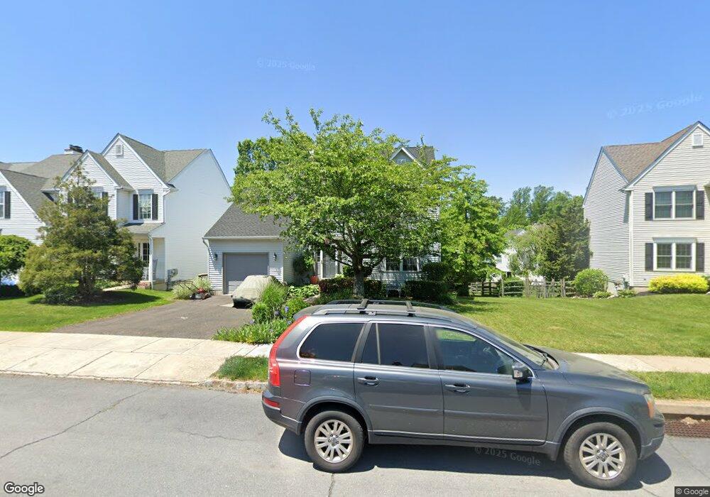
4219 Sir Andrew Cir Doylestown, PA 18902
Estimated Value: $601,114 - $696,000
3
Beds
3
Baths
1,742
Sq Ft
$364/Sq Ft
Est. Value
About This Home
This home is located at 4219 Sir Andrew Cir, Doylestown, PA 18902 and is currently estimated at $634,529, approximately $364 per square foot. 4219 Sir Andrew Cir is a home located in Bucks County with nearby schools including Cold Spring Elementary School, Holicong Middle School, and Central Bucks High School - East.
Ownership History
Date
Name
Owned For
Owner Type
Purchase Details
Closed on
Jul 22, 2010
Sold by
Esser Michael A and Esser Patricia
Bought by
Esser Michael A
Current Estimated Value
Home Financials for this Owner
Home Financials are based on the most recent Mortgage that was taken out on this home.
Original Mortgage
$260,000
Outstanding Balance
$175,090
Interest Rate
4.99%
Mortgage Type
New Conventional
Estimated Equity
$459,439
Purchase Details
Closed on
Aug 15, 2001
Sold by
Zanolini Sherry S
Bought by
Esser Michael A and Esser Patricia
Home Financials for this Owner
Home Financials are based on the most recent Mortgage that was taken out on this home.
Original Mortgage
$175,000
Interest Rate
7.16%
Purchase Details
Closed on
Nov 20, 1996
Sold by
Westrum Buckingham Square Ltd Prtnrshp
Bought by
Zanolini Sherry S
Home Financials for this Owner
Home Financials are based on the most recent Mortgage that was taken out on this home.
Original Mortgage
$100,000
Interest Rate
7.46%
Create a Home Valuation Report for This Property
The Home Valuation Report is an in-depth analysis detailing your home's value as well as a comparison with similar homes in the area
Home Values in the Area
Average Home Value in this Area
Purchase History
| Date | Buyer | Sale Price | Title Company |
|---|---|---|---|
| Esser Michael A | -- | Lsi | |
| Esser Michael A | $226,200 | -- | |
| Zanolini Sherry S | $158,890 | Lawyers Title Insurance Co |
Source: Public Records
Mortgage History
| Date | Status | Borrower | Loan Amount |
|---|---|---|---|
| Open | Esser Michael A | $260,000 | |
| Closed | Esser Michael A | $175,000 | |
| Previous Owner | Zanolini Sherry S | $100,000 |
Source: Public Records
Tax History Compared to Growth
Tax History
| Year | Tax Paid | Tax Assessment Tax Assessment Total Assessment is a certain percentage of the fair market value that is determined by local assessors to be the total taxable value of land and additions on the property. | Land | Improvement |
|---|---|---|---|---|
| 2025 | $5,216 | $32,040 | $6,240 | $25,800 |
| 2024 | $5,216 | $32,040 | $6,240 | $25,800 |
| 2023 | $5,040 | $32,040 | $6,240 | $25,800 |
| 2022 | $4,979 | $32,040 | $6,240 | $25,800 |
| 2021 | $4,920 | $32,040 | $6,240 | $25,800 |
| 2020 | $4,920 | $32,040 | $6,240 | $25,800 |
| 2019 | $4,888 | $32,040 | $6,240 | $25,800 |
| 2018 | $4,888 | $32,040 | $6,240 | $25,800 |
| 2017 | $4,848 | $32,040 | $6,240 | $25,800 |
| 2016 | $4,896 | $32,040 | $6,240 | $25,800 |
| 2015 | -- | $32,040 | $6,240 | $25,800 |
| 2014 | -- | $32,040 | $6,240 | $25,800 |
Source: Public Records
Map
Nearby Homes
- 4201 Sir Andrew Cir
- 4190 Milords Ln
- 4542 Deep Creek Way
- 4605 Twinbrook Cir
- 3865 Burnt House Hill Rd
- 4925 Redfield Rd
- 4936 Davis Dr
- 4250 Aly Dr
- 4221 Enders Way
- 3689 Hancock Ln
- 3975 Amberton Ct
- 4964 Point Pleasant Pike
- 5063 Sagewood Ct
- 3555 Northview Ln
- 4306 Kleinot Dr
- 4298 Kleinot Dr
- 4330 Kleinot Dr
- 4246 Kleinot Dr
- 4080 Holly Way
- 4464 Kleinot Dr
- 4221 Sir Andrew Cir
- 4217 Sir Andrew Cir
- 4223 Sir Andrew Cir
- 4242 Miladies Ln
- 4244 Miladies Ln
- 4215 Sir Andrew Cir
- 4240 Miladies Ln
- 4225 Sir Andrew Cir
- 4246 Miladies Ln
- 4216 Sir Andrew Cir
- 4238 Miladies Ln
- 4213 Sir Andrew Cir
- 4236 Miladies Ln
- 4227 Sir Andrew Cir
- 4214 Sir Andrew Cir
- 4222 Sir Andrew Cir
- 4248 Miladies Ln
- 4211 Sir Andrew Cir
- 4212 Sir Andrew Cir
- 4224 Sir Andrew Cir