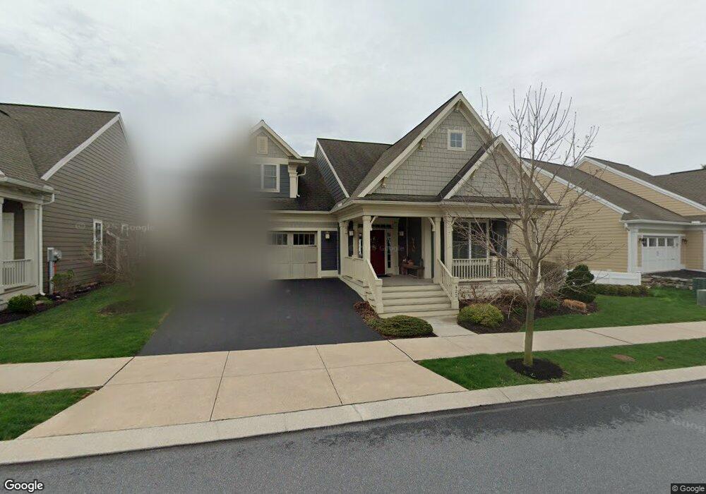
422 Declaration Ave Ephrata, PA 17522
Estimated Value: $562,000 - $593,000
2
Beds
3
Baths
2,518
Sq Ft
$231/Sq Ft
Est. Value
About This Home
This home is located at 422 Declaration Ave, Ephrata, PA 17522 and is currently estimated at $582,561, approximately $231 per square foot. 422 Declaration Ave is a home with nearby schools including Ephrata Intermediate School, Clay Elementary School, and Ephrata Senior High School.
Ownership History
Date
Name
Owned For
Owner Type
Purchase Details
Closed on
Apr 4, 2014
Sold by
Lincoln Land Group Inc
Bought by
Reeh Robert A and Reeh Dorothy M
Current Estimated Value
Home Financials for this Owner
Home Financials are based on the most recent Mortgage that was taken out on this home.
Original Mortgage
$292,500
Outstanding Balance
$97,114
Interest Rate
4.37%
Mortgage Type
Construction
Estimated Equity
$485,447
Create a Home Valuation Report for This Property
The Home Valuation Report is an in-depth analysis detailing your home's value as well as a comparison with similar homes in the area
Home Values in the Area
Average Home Value in this Area
Purchase History
| Date | Buyer | Sale Price | Title Company |
|---|---|---|---|
| Reeh Robert A | $365,629 | None Available |
Source: Public Records
Mortgage History
| Date | Status | Borrower | Loan Amount |
|---|---|---|---|
| Open | Reeh Robert A | $292,500 |
Source: Public Records
Tax History Compared to Growth
Tax History
| Year | Tax Paid | Tax Assessment Tax Assessment Total Assessment is a certain percentage of the fair market value that is determined by local assessors to be the total taxable value of land and additions on the property. | Land | Improvement |
|---|---|---|---|---|
| 2025 | $8,572 | $374,300 | $87,300 | $287,000 |
| 2024 | $8,572 | $374,300 | $87,300 | $287,000 |
| 2023 | $8,351 | $374,300 | $87,300 | $287,000 |
| 2022 | $8,160 | $374,300 | $87,300 | $287,000 |
| 2021 | $7,984 | $374,300 | $87,300 | $287,000 |
| 2020 | $7,984 | $374,300 | $87,300 | $287,000 |
| 2019 | $7,872 | $374,300 | $87,300 | $287,000 |
| 2018 | $6,217 | $374,300 | $87,300 | $287,000 |
| 2017 | $7,801 | $306,100 | $42,200 | $263,900 |
| 2016 | $7,801 | $306,100 | $42,200 | $263,900 |
| 2015 | $1,541 | $306,100 | $42,200 | $263,900 |
Source: Public Records
Map
Nearby Homes
- 308 Liberty St
- 65 Weidmansville Rd
- Amberbrook Plan at Wyndale
- Northfield Plan at Wyndale
- Logan Plan at Wyndale
- Stonecroft Plan at Wyndale
- Darien Plan at Wyndale
- Atworth Plan at Wyndale
- Magnolia Plan at Wyndale
- Baker Plan at Wyndale
- Huntington Plan at Wyndale
- Westbrooke Plan at Wyndale
- Perry Plan at Wyndale
- Charlotte Plan at Wyndale
- Kingston Plan at Wyndale
- Brookfield Plan at Wyndale
- Silverbrooke Plan at Wyndale
- Lawrence Plan at Wyndale
- 00 Morning Dr
- 124 Morning Dr
- 418 Declaration Ave
- 428 Declaration Ave
- 512 Constitution Dr
- 414 Declaration Ave
- 423 Declaration Ave
- 427 Declaration Ave
- 520 Constitution Dr
- 419 Declaration Ave
- 410 Declaration Ave
- 431 Declaration Ave
- 415 Declaration Ave
- 524 Constitution Dr
- 501 Constitution Dr
- 505 Constitution Dr
- 406 Declaration Ave
- 411 Declaration Ave
- 411 Declaration Ave Unit 118
- 429 Ashton Cir
- 509 Constitution Dr
- 528 Constitution Dr