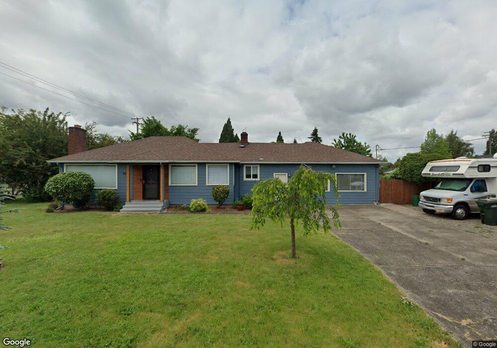
422 Fairfield Ave Eugene, OR 97402
Bethel NeighborhoodEstimated Value: $337,000 - $373,000
2
Beds
2
Baths
1,513
Sq Ft
$236/Sq Ft
Est. Value
About This Home
This home is located at 422 Fairfield Ave, Eugene, OR 97402 and is currently estimated at $356,312, approximately $235 per square foot. 422 Fairfield Ave is a home located in Lane County with nearby schools including Fairfield Elementary School, Cascade Middle School, and Willamette High School.
Ownership History
Date
Name
Owned For
Owner Type
Purchase Details
Closed on
Sep 11, 2015
Sold by
Brabham Vicki
Bought by
Brabham Vicki R and Whitfield Joanne Leslie
Current Estimated Value
Home Financials for this Owner
Home Financials are based on the most recent Mortgage that was taken out on this home.
Original Mortgage
$109,000
Outstanding Balance
$85,140
Interest Rate
3.91%
Mortgage Type
New Conventional
Estimated Equity
$271,172
Purchase Details
Closed on
Aug 2, 2000
Sold by
Howells James
Bought by
Brabham Vicki
Create a Home Valuation Report for This Property
The Home Valuation Report is an in-depth analysis detailing your home's value as well as a comparison with similar homes in the area
Home Values in the Area
Average Home Value in this Area
Purchase History
| Date | Buyer | Sale Price | Title Company |
|---|---|---|---|
| Brabham Vicki R | -- | Western Title & Escrow Co | |
| Brabham Vicki | -- | -- |
Source: Public Records
Mortgage History
| Date | Status | Borrower | Loan Amount |
|---|---|---|---|
| Open | Brabham Vicki R | $109,000 |
Source: Public Records
Tax History
| Year | Tax Paid | Tax Assessment Tax Assessment Total Assessment is a certain percentage of the fair market value that is determined by local assessors to be the total taxable value of land and additions on the property. | Land | Improvement |
|---|---|---|---|---|
| 2025 | $2,879 | $165,509 | -- | -- |
| 2024 | $2,806 | $160,689 | -- | -- |
| 2023 | $2,806 | $156,009 | $0 | $0 |
| 2022 | $2,612 | $151,466 | $0 | $0 |
| 2021 | $2,557 | $147,055 | $0 | $0 |
| 2020 | $2,483 | $142,772 | $0 | $0 |
| 2019 | $2,361 | $138,614 | $0 | $0 |
| 2018 | $2,295 | $130,657 | $0 | $0 |
| 2017 | $2,193 | $130,657 | $0 | $0 |
| 2016 | $2,137 | $126,851 | $0 | $0 |
| 2015 | $2,095 | $123,156 | $0 | $0 |
| 2014 | $2,063 | $119,569 | $0 | $0 |
Source: Public Records
Map
Nearby Homes
- 0 Elmira Rd
- 465 Davis St
- 3520 Elmira Rd
- 280 Baxter St
- 279 Lacasa St
- 630 Gilbert St
- 338 Archie St
- 201 Lacasa St
- 3118 Richard Ave Unit 1
- 1047 Baxter St
- 166 Iowa St
- 1293 Highway 99 N
- 1281 Highway 99 N
- 3939 Cross St
- 1035 Madera St
- 647 Ellsworth St
- 0 Wallis St Unit 19292181
- 1219 Waite St
- 3461 Concord St
- 1384 Jacobs Dr
Your Personal Tour Guide
Ask me questions while you tour the home.