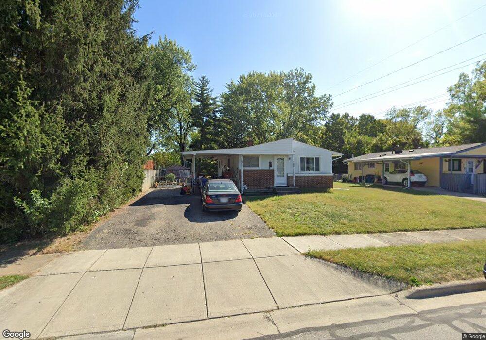
422 Mariemont Dr W Westerville, OH 43081
Estimated Value: $242,765 - $288,000
3
Beds
1
Bath
994
Sq Ft
$267/Sq Ft
Est. Value
About This Home
This home is located at 422 Mariemont Dr W, Westerville, OH 43081 and is currently estimated at $265,191, approximately $266 per square foot. 422 Mariemont Dr W is a home located in Franklin County with nearby schools including Whittier Elementary School, Blendon Middle School, and Westerville South High School.
Ownership History
Date
Name
Owned For
Owner Type
Purchase Details
Closed on
Aug 20, 2008
Sold by
Moerch Brenda J and Moerch Douglas
Bought by
Adkins Terry M
Current Estimated Value
Home Financials for this Owner
Home Financials are based on the most recent Mortgage that was taken out on this home.
Original Mortgage
$48,000
Outstanding Balance
$31,643
Interest Rate
6.42%
Mortgage Type
Purchase Money Mortgage
Estimated Equity
$233,548
Purchase Details
Closed on
Aug 5, 2008
Sold by
Adkins Michael L
Bought by
Moerch Brenda J and Adkins Brenda J
Home Financials for this Owner
Home Financials are based on the most recent Mortgage that was taken out on this home.
Original Mortgage
$48,000
Outstanding Balance
$31,643
Interest Rate
6.42%
Mortgage Type
Purchase Money Mortgage
Estimated Equity
$233,548
Purchase Details
Closed on
Apr 1, 1975
Bought by
Adkins Michael L
Create a Home Valuation Report for This Property
The Home Valuation Report is an in-depth analysis detailing your home's value as well as a comparison with similar homes in the area
Home Values in the Area
Average Home Value in this Area
Purchase History
| Date | Buyer | Sale Price | Title Company |
|---|---|---|---|
| Adkins Terry M | $60,000 | Talon Group | |
| Moerch Brenda J | -- | Talon Group | |
| Adkins Michael L | -- | -- |
Source: Public Records
Mortgage History
| Date | Status | Borrower | Loan Amount |
|---|---|---|---|
| Open | Adkins Terry M | $48,000 |
Source: Public Records
Tax History Compared to Growth
Tax History
| Year | Tax Paid | Tax Assessment Tax Assessment Total Assessment is a certain percentage of the fair market value that is determined by local assessors to be the total taxable value of land and additions on the property. | Land | Improvement |
|---|---|---|---|---|
| 2024 | $3,616 | $63,630 | $14,280 | $49,350 |
| 2023 | $3,540 | $63,630 | $14,280 | $49,350 |
| 2022 | $3,626 | $49,770 | $20,160 | $29,610 |
| 2021 | $3,656 | $49,770 | $20,160 | $29,610 |
| 2020 | $3,646 | $49,770 | $20,160 | $29,610 |
| 2019 | $3,178 | $40,950 | $16,800 | $24,150 |
| 2018 | $3,054 | $40,950 | $16,800 | $24,150 |
| 2017 | $3,108 | $40,950 | $16,800 | $24,150 |
| 2016 | $3,090 | $36,860 | $12,850 | $24,010 |
| 2015 | $2,993 | $36,860 | $12,850 | $24,010 |
| 2014 | $2,995 | $36,860 | $12,850 | $24,010 |
| 2013 | $1,496 | $36,855 | $12,845 | $24,010 |
Source: Public Records
Map
Nearby Homes
- 502 Foxtrail Cir E Unit 502
- 206 Charring Cross Dr S Unit 2206
- 470 S State St
- 466 S State St
- 476 S State St
- 465 W Schrock Rd
- 79 W Park St
- 559 Allview Ct
- 25 King Arthur Blvd
- 66 Daleview Dr
- 53 W College Ave
- 0 Cooper Rd
- 360 Potawatomi Dr
- 0 Cherrington Rd Unit 225023909
- 199 E College Ave
- 417 E Park St
- 106 E Ticonderoga Dr
- 106 E Ticonderoga Dr Unit A
- 92 N Vine St
- 134 W Ticonderoga Dr Unit D
- 428 Mariemont Dr W
- 143 Mariemont Dr N
- 137 Mariemont Dr N
- 245 Foxtrail Place
- 0 W Mariemont Dr N
- 0 Mariemont Dr W
- 421 Mariemont Dr W
- 255 Foxtrail Place Unit 255
- 131 Mariemont Dr N
- 243 Foxtrail Place
- 257 Foxtrail Place
- 427 Mariemont Dr W
- 415 Mariemont Dr W
- 259 Foxtrail Place Unit 259
- 261 Foxtrail Place
- 154 Mariemont Dr N
- 409 Mariemont Dr W
- 125 Mariemont Dr N
- 144 Mariemont Dr N
- 150 Mariemont Dr N