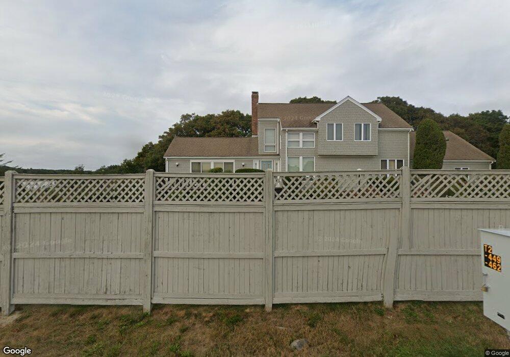
422 Menauhant Rd East Falmouth, MA 02536
Estimated Value: $1,368,000 - $2,490,000
4
Beds
3
Baths
2,575
Sq Ft
$781/Sq Ft
Est. Value
About This Home
This home is located at 422 Menauhant Rd, East Falmouth, MA 02536 and is currently estimated at $2,010,198, approximately $780 per square foot. 422 Menauhant Rd is a home located in Barnstable County with nearby schools including East Falmouth Elementary School, Morse Pond School, and Lawrence School.
Ownership History
Date
Name
Owned For
Owner Type
Purchase Details
Closed on
Aug 25, 2021
Sold by
Mcdonough Robert J and Mcdonough Judith M
Bought by
Robert J Mcdonough Ft and Mcdonough
Current Estimated Value
Purchase Details
Closed on
Apr 9, 2004
Sold by
Mcdonough Robert J
Bought by
Mcdonough Judith M and Mcdonough Robert J
Home Financials for this Owner
Home Financials are based on the most recent Mortgage that was taken out on this home.
Original Mortgage
$280,000
Interest Rate
5.6%
Mortgage Type
Purchase Money Mortgage
Purchase Details
Closed on
May 26, 1992
Sold by
Luccio Richard A and Luccio Catherine A
Bought by
Mcdonough Robert J
Create a Home Valuation Report for This Property
The Home Valuation Report is an in-depth analysis detailing your home's value as well as a comparison with similar homes in the area
Home Values in the Area
Average Home Value in this Area
Purchase History
| Date | Buyer | Sale Price | Title Company |
|---|---|---|---|
| Robert J Mcdonough Ft | -- | None Available | |
| Mcdonough Judith M | -- | -- | |
| Mcdonough Robert J | $215,000 | -- |
Source: Public Records
Mortgage History
| Date | Status | Borrower | Loan Amount |
|---|---|---|---|
| Previous Owner | Mcdonough Judith M | $280,000 | |
| Previous Owner | Mcdonough Robert J | $300,000 | |
| Previous Owner | Mcdonough Robert J | $50,000 | |
| Previous Owner | Mcdonough Robert J | $275,000 | |
| Previous Owner | Mcdonough Robert J | $300,000 |
Source: Public Records
Tax History Compared to Growth
Tax History
| Year | Tax Paid | Tax Assessment Tax Assessment Total Assessment is a certain percentage of the fair market value that is determined by local assessors to be the total taxable value of land and additions on the property. | Land | Improvement |
|---|---|---|---|---|
| 2025 | $10,154 | $1,729,800 | $990,200 | $739,600 |
| 2024 | $10,458 | $1,665,300 | $990,200 | $675,100 |
| 2023 | $10,884 | $1,572,800 | $990,200 | $582,600 |
| 2022 | $10,497 | $1,304,000 | $823,100 | $480,900 |
| 2021 | $10,286 | $1,210,100 | $787,400 | $422,700 |
| 2020 | $9,779 | $1,138,400 | $715,700 | $422,700 |
| 2019 | $9,633 | $1,125,300 | $715,700 | $409,600 |
| 2018 | $9,571 | $1,112,900 | $715,700 | $397,200 |
| 2017 | $9,349 | $1,096,000 | $715,700 | $380,300 |
| 2016 | $9,174 | $1,096,000 | $715,700 | $380,300 |
| 2015 | $8,976 | $1,096,000 | $715,700 | $380,300 |
| 2014 | $8,821 | $1,082,300 | $715,700 | $366,600 |
Source: Public Records
Map
Nearby Homes
- LOTA Commodore Ln
- 472 & 474 Davisville Rd
- 37 Seashell Ln
- 21 Kilmer Rd
- 15 Beach St
- Lot 2 Pine Grove Ave
- 84 Portside Cir
- 224 Menauhant Rd
- 214 Menauhant Rd
- 26 Sanddollar Cir
- 16 Pacheco Path Unit 1-A100-B
- 16 Pacheco Path
- 16A Pacheco Path
- 231 Great Bay St
- 241 Davisville Rd
- 69 Reynolds St
- 16 Edgewood Dr
- 27 Harborview Dr
- 27 Sycamore St
- 5 Massasoit St
- 40 Green Meadow Ln
- 418 Menauhant Rd
- 51 Harbor Farms Rd
- 426 Menauhant Rd
- 38 Green Meadow Ln
- 49 Harbor Farms Rd
- 53 Harbor Farms Rd
- 434 Menauhant Rd
- 74 Green Harbor Rd
- 47 Harbor Farms Rd
- 77 Green Harbor Rd
- 435 Menauhant Rd
- 442 Menauhant Rd
- 71 Green Harbor Rd
- 43 Harbor Farms Rd
- 33 Green Meadow Ln
- 439 Menauhant Rd
- 54 Harbor Farms Rd
- 70 Green Harbor Rd Unit +boat
- 67 Green Harbor Rd