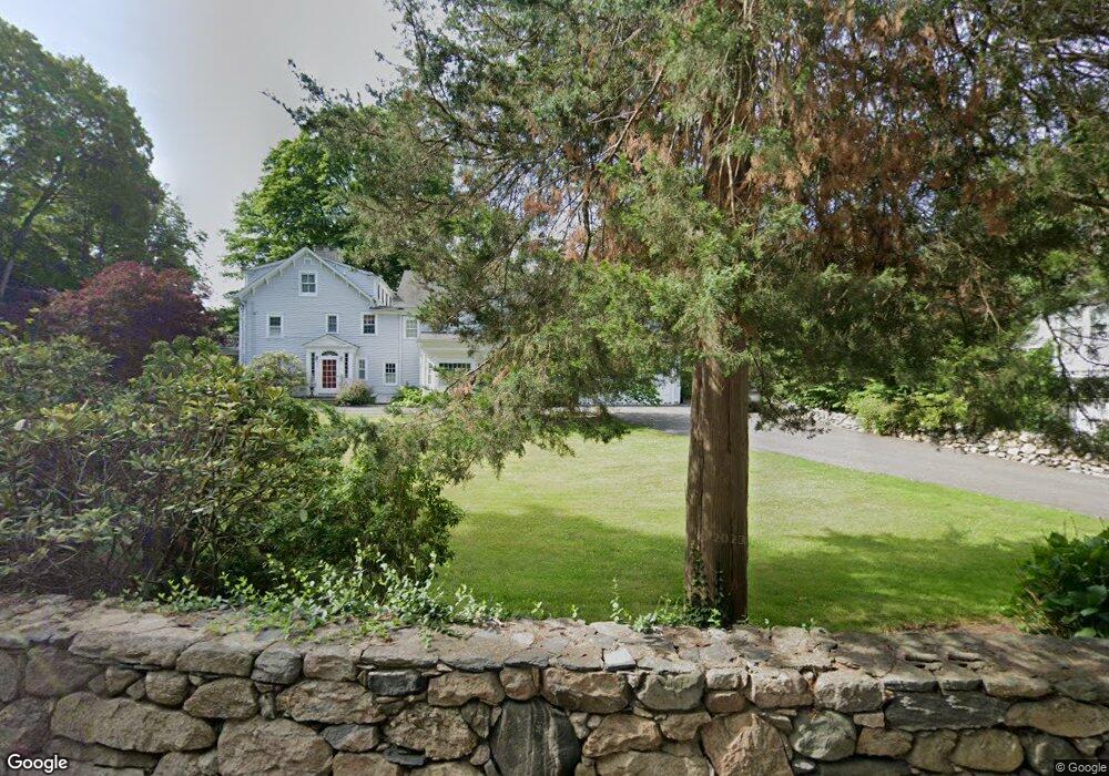
422 Scofieldtown Rd Stamford, CT 06903
North Stamford NeighborhoodEstimated Value: $1,506,000 - $2,021,000
5
Beds
6
Baths
5,662
Sq Ft
$318/Sq Ft
Est. Value
About This Home
This home is located at 422 Scofieldtown Rd, Stamford, CT 06903 and is currently estimated at $1,797,823, approximately $317 per square foot. 422 Scofieldtown Rd is a home located in Fairfield County with nearby schools including Northeast Elementary School, Turn of River School, and Westhill High School.
Ownership History
Date
Name
Owned For
Owner Type
Purchase Details
Closed on
Mar 29, 1999
Sold by
Jones Christopher F and Jones Eileen C W
Bought by
Devlin Timothy J and Devlin Margaret A
Current Estimated Value
Purchase Details
Closed on
Jun 24, 1991
Sold by
Usa
Bought by
State St Mtg Co
Purchase Details
Closed on
Feb 27, 1991
Sold by
State St Mgt Co
Bought by
Jones Christopher and Jones Eileen
Create a Home Valuation Report for This Property
The Home Valuation Report is an in-depth analysis detailing your home's value as well as a comparison with similar homes in the area
Home Values in the Area
Average Home Value in this Area
Purchase History
| Date | Buyer | Sale Price | Title Company |
|---|---|---|---|
| Devlin Timothy J | $630,000 | -- | |
| State St Mtg Co | $175,000 | -- | |
| Jones Christopher | $301,000 | -- |
Source: Public Records
Mortgage History
| Date | Status | Borrower | Loan Amount |
|---|---|---|---|
| Open | Jones Christopher | $345,000 | |
| Closed | Jones Christopher | $372,400 | |
| Closed | Jones Christopher | $200,000 |
Source: Public Records
Tax History Compared to Growth
Tax History
| Year | Tax Paid | Tax Assessment Tax Assessment Total Assessment is a certain percentage of the fair market value that is determined by local assessors to be the total taxable value of land and additions on the property. | Land | Improvement |
|---|---|---|---|---|
| 2025 | $23,786 | $1,022,180 | $287,720 | $734,460 |
| 2024 | $23,265 | $1,022,180 | $287,720 | $734,460 |
| 2023 | $25,003 | $1,022,180 | $287,720 | $734,460 |
| 2022 | $22,239 | $844,630 | $217,560 | $627,070 |
| 2021 | $21,935 | $844,630 | $217,560 | $627,070 |
| 2020 | $21,394 | $844,630 | $217,560 | $627,070 |
| 2019 | $21,394 | $844,630 | $217,560 | $627,070 |
| 2018 | $20,651 | $844,630 | $217,560 | $627,070 |
| 2017 | $19,523 | $762,900 | $199,430 | $563,470 |
| 2016 | $17,901 | $721,220 | $199,430 | $521,790 |
| 2015 | $17,901 | $741,570 | $199,430 | $542,140 |
| 2014 | $17,227 | $739,060 | $199,430 | $539,630 |
Source: Public Records
Map
Nearby Homes
- 164 Janes Ln
- 107 Deepwood Rd
- 185 Haviland Rd
- 42 Hannahs Rd
- 210 Red Fox Rd
- 295 Haviland Rd
- 27 Wellington Dr
- 60 Redmont Rd
- 105 N Stamford Rd
- 30 Partridge Rd
- 19 Skymeadow Dr
- 271 Hunting Ridge Rd
- 185 Interlaken Rd
- 400 Wire Mill Rd
- 40 Hoyclo Rd
- 239 E Hunting Ridge Rd
- 49 Pinner Ln
- 95 Foxwood Rd
- 65 Malibu Rd
- 81 Fox Ridge Rd
- 431 Scofieldtown Rd
- 14 Chestnut Hill Rd
- 23 Georgian Ct
- 12 Georgian Ct
- 441 Scofieldtown Rd
- 238 Brookdale Rd
- 272 Brookdale Rd
- 27 Georgian Ct
- 31 Chestnut Hill Rd
- 380 Scofieldtown Rd
- 44 Chestnut Hill Rd
- LOTS 2 3 & 4-44 Chestnut Hill Rd
- LOTS 44-2 3 and 4 Chestnut Hill Rd
- 44 Chestnut Hill Rd
- 44 Chestnut Hill Rd
- 20 Georgian Ct
- 236 Brookdale Rd
- 373 Scofieldtown Rd
- 476 Scofieldtown Rd
- 252 Brookdale Rd