M
Seller's Agent in 2013
Michelle Nurnberger
Bagley & Assoc.

Estimated Value: $220,315
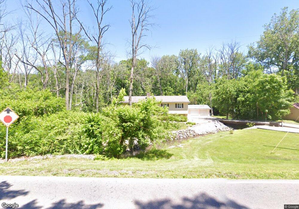
Remodeled interior maximizing all 2600 sq feet. Living room complete with cathedral ceiling highlighting rustic beams and a brick wood buring fireplace. Kitchen includes all appliances, dining area with french doors opening to a 16 x 14 deck. Bedrooms are a comfortable size, and include a master with bathroom. Lower level features an incredible game room complete with wet bar and dining area. Beautiful setting nestled within the trees. Almost an acres of landscaped beauty. Including $3000 to cover buyers closing costs and pre paids.
Last Agent to Sell the Property
Michelle Nurnberger
Bagley & Assoc. License #475154208 Listed on: 05/02/2013
Last Buyer's Agent
Carla Brinkoetter
Brinkoetter REALTORS® License #471001404
| Date | Buyer | Sale Price | Title Company |
|---|---|---|---|
| Patterson Mark | $137,000 | None Available | |
| Miller Chad E | $146,000 | None Available | |
| -- | $69,000 | -- |
| Date | Status | Borrower | Loan Amount |
|---|---|---|---|
| Open | Patterson Mark | $134,518 | |
| Previous Owner | Miller Chad E | $21,900 | |
| Previous Owner | Miller Chad E | $116,800 |
| Date | Event | Price | List to Sale | Price per Sq Ft |
|---|---|---|---|---|
| 09/13/2013 09/13/13 | Sold | $137,000 | -13.8% | $53 / Sq Ft |
| 08/13/2013 08/13/13 | Pending | -- | -- | -- |
| 05/02/2013 05/02/13 | For Sale | $159,000 | -- | $61 / Sq Ft |
| Year | Tax Paid | Tax Assessment Tax Assessment Total Assessment is a certain percentage of the fair market value that is determined by local assessors to be the total taxable value of land and additions on the property. | Land | Improvement |
|---|---|---|---|---|
| 2024 | $3,537 | $62,253 | $7,561 | $54,692 |
| 2023 | $3,421 | $57,846 | $7,026 | $50,820 |
| 2022 | $3,205 | $54,390 | $6,606 | $47,784 |
| 2021 | $3,103 | $51,563 | $6,263 | $45,300 |
| 2020 | $2,975 | $49,280 | $5,986 | $43,294 |
| 2019 | $2,975 | $49,280 | $5,986 | $43,294 |
| 2018 | $2,898 | $48,200 | $5,855 | $42,345 |
| 2017 | $2,885 | $47,605 | $5,783 | $41,822 |
| 2016 | $2,884 | $47,577 | $5,780 | $41,797 |
| 2015 | $2,788 | $46,967 | $5,706 | $41,261 |
| 2014 | $2,706 | $46,967 | $5,706 | $41,261 |
| 2013 | $2,755 | $46,967 | $5,706 | $41,261 |
M
Seller's Agent in 2013
Michelle Nurnberger
Bagley & Assoc.
C
Buyer's Agent in 2013
Carla Brinkoetter
Brinkoetter REALTORS®
Source: Central Illinois Board of REALTORS®
MLS Number: 5191200
APN: 09-13-29-376-006
Ask me questions while you tour the home.
