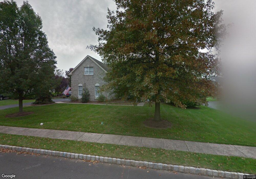
4220 Leslie Dr Doylestown, PA 18902
Estimated Value: $901,237 - $989,000
4
Beds
3
Baths
3,158
Sq Ft
$296/Sq Ft
Est. Value
About This Home
This home is located at 4220 Leslie Dr, Doylestown, PA 18902 and is currently estimated at $933,309, approximately $295 per square foot. 4220 Leslie Dr is a home located in Bucks County with nearby schools including Cold Spring Elementary School, Holicong Middle School, and Central Bucks High School - East.
Ownership History
Date
Name
Owned For
Owner Type
Purchase Details
Closed on
May 7, 2021
Sold by
Carson John W and Carson Jennifer S
Bought by
Carson Jennifer S
Current Estimated Value
Home Financials for this Owner
Home Financials are based on the most recent Mortgage that was taken out on this home.
Original Mortgage
$500,000
Outstanding Balance
$453,125
Interest Rate
3.1%
Mortgage Type
New Conventional
Estimated Equity
$480,184
Purchase Details
Closed on
Nov 30, 1998
Sold by
Cold Spring Hunt Lp
Bought by
James Clifford
Home Financials for this Owner
Home Financials are based on the most recent Mortgage that was taken out on this home.
Original Mortgage
$130,000
Interest Rate
6.25%
Create a Home Valuation Report for This Property
The Home Valuation Report is an in-depth analysis detailing your home's value as well as a comparison with similar homes in the area
Home Values in the Area
Average Home Value in this Area
Purchase History
| Date | Buyer | Sale Price | Title Company |
|---|---|---|---|
| Carson Jennifer S | -- | Diversified Stlmt Svcs Inc | |
| James Clifford | $312,868 | -- |
Source: Public Records
Mortgage History
| Date | Status | Borrower | Loan Amount |
|---|---|---|---|
| Open | Carson Jennifer S | $500,000 | |
| Previous Owner | James Clifford | $130,000 |
Source: Public Records
Tax History Compared to Growth
Tax History
| Year | Tax Paid | Tax Assessment Tax Assessment Total Assessment is a certain percentage of the fair market value that is determined by local assessors to be the total taxable value of land and additions on the property. | Land | Improvement |
|---|---|---|---|---|
| 2025 | $8,867 | $54,460 | $10,120 | $44,340 |
| 2024 | $8,867 | $54,460 | $10,120 | $44,340 |
| 2023 | $8,566 | $54,460 | $10,120 | $44,340 |
| 2022 | $8,464 | $54,460 | $10,120 | $44,340 |
| 2021 | $8,362 | $54,460 | $10,120 | $44,340 |
| 2020 | $8,362 | $54,460 | $10,120 | $44,340 |
| 2019 | $8,308 | $54,460 | $10,120 | $44,340 |
| 2018 | $8,308 | $54,460 | $10,120 | $44,340 |
| 2017 | $8,240 | $54,460 | $10,120 | $44,340 |
| 2016 | $8,321 | $54,460 | $10,120 | $44,340 |
| 2015 | -- | $54,460 | $10,120 | $44,340 |
| 2014 | -- | $54,460 | $10,120 | $44,340 |
Source: Public Records
Map
Nearby Homes
- 4925 Redfield Rd
- 4936 Davis Dr
- 5063 Sagewood Ct
- 3821 Nanlyn Farm Cir
- 5087 Beacon Hill Ct
- 5115 Sugar Hill Ct
- 5184 Lovering Dr
- 4605 Twinbrook Cir
- 5281 Harrington Ct
- 5491 Long Ln
- 4221 Sir Andrew Cir
- 4964 Point Pleasant Pike
- 5182 Point Pleasant Pike
- 6680 Point Pleasant Pike
- 4190 Milords Ln
- 3689 Hancock Ln
- 3468 Holicong Rd
- 3479 Durham Rd
- 3455 Durham Rd
- 5555 Bittersweet Ln
- 4230 Leslie Dr
- 4210 Leslie Dr
- 4215 Michener Rd
- 4225 Michener Rd
- 4215 Leslie Dr
- 4240 Leslie Dr
- 4225 Leslie Dr
- 4205 Leslie Dr
- 4241 Michener Rd
- 4235 Leslie Dr
- 5061 Mead Dr
- 4214 Michener Rd
- 5051 Mead Dr
- 4195 Leslie Dr
- 4250 Leslie Dr
- 5020 Mead Dr
- 5085 Grundy Way
- 5041 Mead Dr
- 4253 Leslie Dr
- 5093 Grundy Way