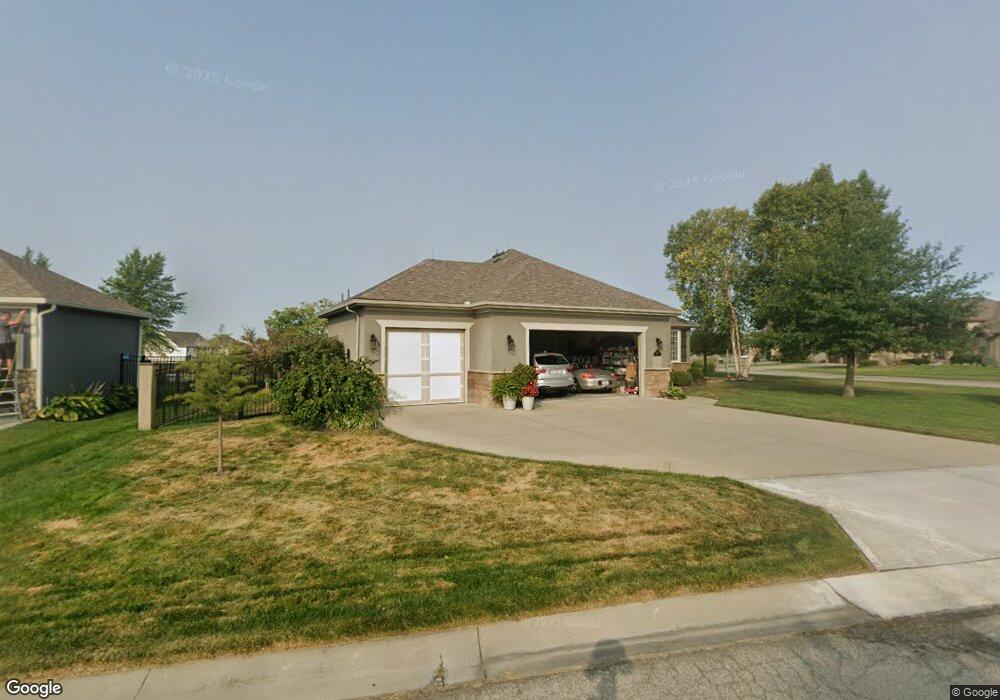
4220 S White Sands Ct Blue Springs, MO 64015
Little Blue NeighborhoodEstimated Value: $582,769 - $637,000
3
Beds
3
Baths
2,002
Sq Ft
$300/Sq Ft
Est. Value
About This Home
This home is located at 4220 S White Sands Ct, Blue Springs, MO 64015 and is currently estimated at $601,442, approximately $300 per square foot. 4220 S White Sands Ct is a home located in Jackson County with nearby schools including James Lewis Elementary School, Brittany Hill Middle School, and Blue Springs High School.
Ownership History
Date
Name
Owned For
Owner Type
Purchase Details
Closed on
Dec 21, 2009
Sold by
Cornick John D and Cornick Cary E
Bought by
Cornick John D and Cornick Cary E
Current Estimated Value
Purchase Details
Closed on
Sep 24, 2009
Sold by
T E Woods Construction Inc
Bought by
Cornick John and Cornick Cary
Home Financials for this Owner
Home Financials are based on the most recent Mortgage that was taken out on this home.
Original Mortgage
$275,000
Interest Rate
5.12%
Purchase Details
Closed on
Aug 3, 2009
Sold by
Sailors Woods Development Llc
Bought by
T E Woods Construction Inc
Home Financials for this Owner
Home Financials are based on the most recent Mortgage that was taken out on this home.
Original Mortgage
$275,000
Interest Rate
5.12%
Create a Home Valuation Report for This Property
The Home Valuation Report is an in-depth analysis detailing your home's value as well as a comparison with similar homes in the area
Home Values in the Area
Average Home Value in this Area
Purchase History
| Date | Buyer | Sale Price | Title Company |
|---|---|---|---|
| Cornick John D | -- | None Available | |
| Cornick John | -- | First American Title | |
| T E Woods Construction Inc | -- | First American Title |
Source: Public Records
Mortgage History
| Date | Status | Borrower | Loan Amount |
|---|---|---|---|
| Previous Owner | Cornick John | $275,000 | |
| Previous Owner | T E Woods Construction Inc | $259,000 |
Source: Public Records
Tax History Compared to Growth
Tax History
| Year | Tax Paid | Tax Assessment Tax Assessment Total Assessment is a certain percentage of the fair market value that is determined by local assessors to be the total taxable value of land and additions on the property. | Land | Improvement |
|---|---|---|---|---|
| 2025 | $5,787 | $97,014 | $13,718 | $83,296 |
| 2024 | $5,666 | $84,360 | $8,244 | $76,116 |
| 2023 | $5,666 | $117,557 | $18,088 | $99,469 |
| 2022 | $6,477 | $84,360 | $8,863 | $75,497 |
| 2021 | $6,475 | $84,360 | $8,863 | $75,497 |
| 2020 | $5,974 | $76,696 | $8,863 | $67,833 |
| 2019 | $5,775 | $76,696 | $8,863 | $67,833 |
| 2018 | $1,767,189 | $66,750 | $7,713 | $59,037 |
| 2017 | $4,966 | $66,750 | $7,713 | $59,037 |
| 2016 | $4,966 | $64,277 | $4,009 | $60,268 |
| 2014 | $4,427 | $57,000 | $4,286 | $52,714 |
Source: Public Records
Map
Nearby Homes
- 22908 E 41st Terrace S
- 3605 NW Pier Ct
- 4013 NW Sol Dr
- 4043 NW Eclipse Place
- 2413 NW Sunnyvale Ct
- 2433 NW Sunnyvale Ct
- 2437 NW Sunnyvale Ct
- 4508 NW Valley View Rd
- 4012 NW Delwood Ct
- 1618 NW Samantha Ct
- 4301 NW Briarwood Dr
- 5200 NW Primrose Ct
- 5205 NW Primrose Ct
- 704 NW 39th St
- 3212 NW Canterbury Rd
- 3213 NW Canterbury Place
- 1401 NW Birdseye Ct
- 1515 NW Primrose Ln
- 1029 NW Berkshire Dr
- 1204 NW 55th St
- 4220 S White Sands Ct
- 4224 S White Sands Ct
- 22809 E 42nd Terrace S
- 4228 S White Sands Ct
- 4217 S White Sands Ct
- 22805 E 42nd Terrace S
- 22804 E 42nd Terrace S
- 4233 S White Sands Ct
- 4232 S White Sands Ct
- 22800 E 42nd Terrace S
- 4211 S White Sands Ct
- 4221 S White Sands Ct
- 22801 E 42nd Terrace S
- 4133 S Eagle Point Ct
- 4329 S Stone Canyon Dr
- 4229 S White Sands Ct
- 4129 S Eagle Point Ct
- 22712 E 42nd Terrace S
- 22713 E 42nd Terrace S
- 4325 S Stone Canyon Dr