Estimated Value: $210,827 - $273,000
3
Beds
--
Bath
1,386
Sq Ft
$182/Sq Ft
Est. Value
About This Home
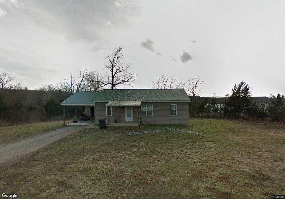
This home is located at 42201 Maries Road 638, Dixon, MO 65459 and is currently estimated at $252,207, approximately $181 per square foot. 42201 Maries Road 638 is a home with nearby schools including Dixon Elementary School, Dixon Middle School, and Dixon High School.
Ownership History
Date
Name
Owned For
Owner Type
Purchase Details
Closed on
Mar 6, 2024
Sold by
Akery Heath and Akery Kristy
Bought by
Awtrey Alden and Aldrich Natasha
Current Estimated Value
Home Financials for this Owner
Home Financials are based on the most recent Mortgage that was taken out on this home.
Original Mortgage
$153,000
Outstanding Balance
$112,330
Interest Rate
6.69%
Mortgage Type
New Conventional
Estimated Equity
$139,877
Purchase Details
Closed on
Mar 23, 2009
Sold by
Hsbc Bank
Bought by
Akery Heath and Akery Kristy
Purchase Details
Closed on
Jul 17, 2008
Sold by
Storm Carl E and Storm Sherri
Bought by
Hsbc Bank
Create a Home Valuation Report for This Property
The Home Valuation Report is an in-depth analysis detailing your home's value as well as a comparison with similar homes in the area
Home Values in the Area
Average Home Value in this Area
Purchase History
| Date | Buyer | Sale Price | Title Company |
|---|---|---|---|
| Awtrey Alden | -- | None Listed On Document | |
| Akery Heath | -- | None Available | |
| Hsbc Bank | -- | None Available |
Source: Public Records
Mortgage History
| Date | Status | Borrower | Loan Amount |
|---|---|---|---|
| Open | Awtrey Alden | $153,000 |
Source: Public Records
Tax History Compared to Growth
Tax History
| Year | Tax Paid | Tax Assessment Tax Assessment Total Assessment is a certain percentage of the fair market value that is determined by local assessors to be the total taxable value of land and additions on the property. | Land | Improvement |
|---|---|---|---|---|
| 2025 | $1,174 | $29,830 | $0 | $0 |
| 2024 | $1,174 | $26,680 | $0 | $0 |
| 2023 | $1,169 | $26,680 | $0 | $0 |
| 2022 | $1,169 | $26,680 | $0 | $0 |
| 2021 | $1,173 | $26,680 | $0 | $0 |
| 2020 | $1,173 | $26,680 | $0 | $0 |
| 2019 | $1,173 | $26,680 | $0 | $0 |
| 2018 | $1,165 | $26,570 | $0 | $0 |
| 2017 | $1,168 | $26,570 | $0 | $0 |
| 2016 | $1,164 | $26,570 | $0 | $0 |
| 2015 | -- | $26,570 | $0 | $0 |
| 2011 | -- | $0 | $0 | $0 |
Source: Public Records
Map
Nearby Homes
- 0 Maries 638 Rd Unit MIS25067458
- 10771 Crest Rd
- 16560 Highway 133
- 11880 Cypress Rd
- TBD Tavern Creek Rd
- 42485 Highway Bb
- 580 Tavern Creek Rd
- 12810 State Route N
- 10935 Barnard Rd
- 451 Tavern Creek Rd
- 15005 Carthage Rd
- 602 W 6th St
- 442 Tavern Creek Rd
- 615 W 4th St
- 44.54 Acres Highway Bb
- 105 S Oak St
- 501 W 5th St
- 200 W 6th St
- 204 W 4th St
- 100 E 6th St
- 42391 Maries Road 638
- 21800 Maries Road 637
- 42358 Maries Road 638
- 42347 Maries Road 638
- 42178 Maries Road 638
- 42182 Maries Road 638
- 42176 Maries Road 638
- 21918 Maries Road 637
- 42131 Maries Road 638
- 42131 Maries Road 638
- 42509 Maries Road 638
- 42509 Maries Road 638
- 42176 Maries 638 Rd
- 42180 Maries Road 638
- 42180 Maries Road 638
- 21922 Cherry Rd
- 21922 Cherry Rd
- 21922 Cherry Rd
- 21922 Maries Road 637
- 21922 Marie's Co Rd 637