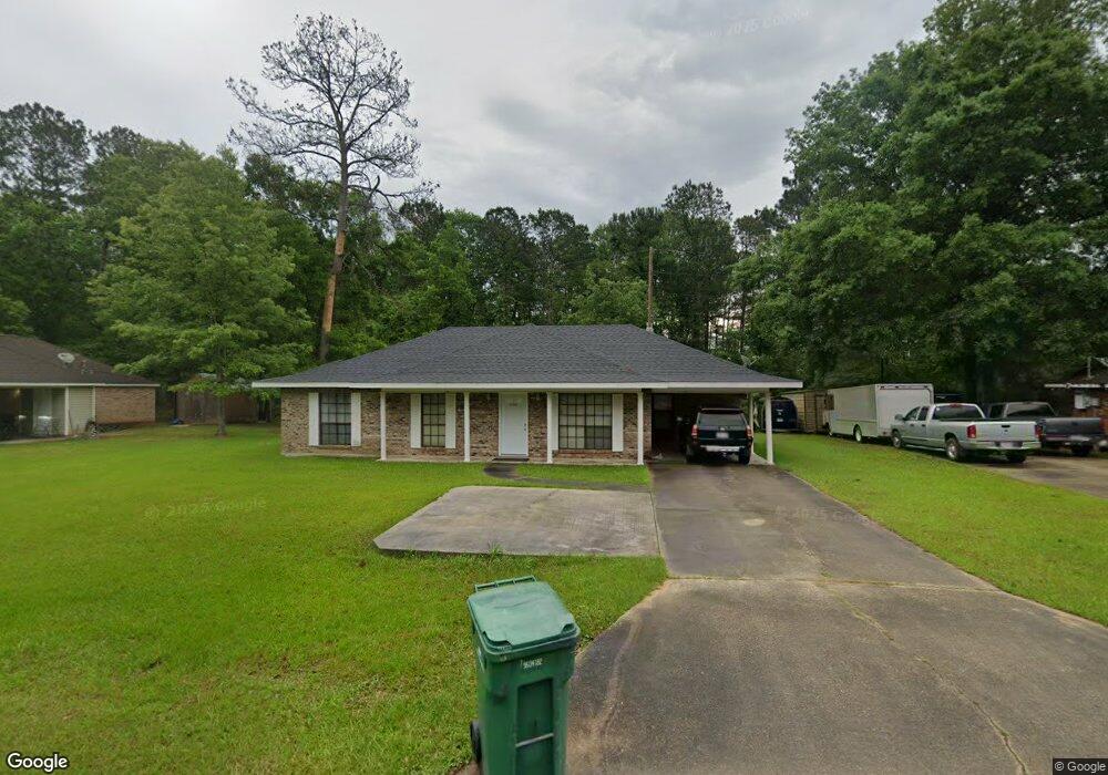
42206 Deborah Dr Hammond, LA 70403
Estimated Value: $160,000 - $218,000
3
Beds
2
Baths
1,350
Sq Ft
$141/Sq Ft
Est. Value
About This Home
This home is located at 42206 Deborah Dr, Hammond, LA 70403 and is currently estimated at $190,667, approximately $141 per square foot. 42206 Deborah Dr is a home located in Tangipahoa Parish with nearby schools including Perrin Early Learning Center, Tucker Memorial Elementary School, and D.C. Reeves Elementary School.
Ownership History
Date
Name
Owned For
Owner Type
Purchase Details
Closed on
Feb 23, 2017
Sold by
Collins Kevin James and Collins Marice Ware
Bought by
Earl Bobby Demetrius
Current Estimated Value
Purchase Details
Closed on
Mar 11, 2011
Sold by
Gauthreaux Judith Leblanc and Leblane Richard Wayne
Bought by
Eultz Tyrin Jerome
Home Financials for this Owner
Home Financials are based on the most recent Mortgage that was taken out on this home.
Original Mortgage
$98,445
Interest Rate
5.06%
Mortgage Type
New Conventional
Create a Home Valuation Report for This Property
The Home Valuation Report is an in-depth analysis detailing your home's value as well as a comparison with similar homes in the area
Home Values in the Area
Average Home Value in this Area
Purchase History
| Date | Buyer | Sale Price | Title Company |
|---|---|---|---|
| Earl Bobby Demetrius | $110,000 | Le Fleur De Lis Title | |
| Eultz Tyrin Jerome | $95,000 | None Available |
Source: Public Records
Mortgage History
| Date | Status | Borrower | Loan Amount |
|---|---|---|---|
| Previous Owner | Eultz Tyrin Jerome | $98,445 |
Source: Public Records
Tax History
| Year | Tax Paid | Tax Assessment Tax Assessment Total Assessment is a certain percentage of the fair market value that is determined by local assessors to be the total taxable value of land and additions on the property. | Land | Improvement |
|---|---|---|---|---|
| 2025 | $878 | $8,189 | $1,134 | $7,055 |
| 2024 | $870 | $8,189 | $1,134 | $7,055 |
| 2023 | $922 | $8,568 | $1,050 | $7,518 |
| 2022 | $909 | $8,568 | $1,050 | $7,518 |
| 2021 | $119 | $8,568 | $1,050 | $7,518 |
| 2020 | $908 | $8,568 | $1,050 | $7,518 |
| 2019 | $915 | $8,568 | $1,050 | $7,518 |
| 2018 | $935 | $8,568 | $1,050 | $7,518 |
| 2017 | $909 | $8,568 | $1,050 | $7,518 |
| 2016 | $917 | $8,568 | $1,050 | $7,518 |
| 2015 | $155 | $8,940 | $1,050 | $7,890 |
| 2014 | $146 | $8,940 | $1,050 | $7,890 |
Source: Public Records
Map
Nearby Homes
- 0 Happywoods Rd Unit 2533050
- 14408 Ann Dr
- 42465 Happywoods Rd
- 0 Technology Ln
- 14235 Happywoods Dr
- 42262 Broadwalk Ave
- 14106 W Club Deluxe Rd
- 42773 Robinwood Dr
- 41318 Schafer Dr
- 41386 Schafer Dr
- 0 W Yellow Water Rd
- 41213 Schafer Dr
- 41139 Happywoods Rd
- 43099 Anthon Ln
- 43265 Anthon Ln
- 42251 Jefferson Dr
- 15008 Monticeno Ln
- 42214 Deborah Dr
- 42198 Deborah Dr
- Lot 10 Deborah Dr
- 0 Deborah Dr Unit 461294
- 0 Deborah Dr Unit 444942
- 15 Deborah Dr
- 0 Deborah Dr Unit 2143547
- 0 Deborah Dr Unit 2359565
- 0 Deborah Dr
- 42219 Deborah Dr
- 42188 Deborah Dr
- 14046 Lorraine Dr
- 14040 Lorraine Dr
- 14045 Lorraine Dr
- 14039 Lorraine Dr
- 42238 Deborah Dr
- 21174 Valor Ln
- 21140 Valor Ln
- 21152 Valor Ln
- 21162 Valor Ln
Your Personal Tour Guide
Ask me questions while you tour the home.