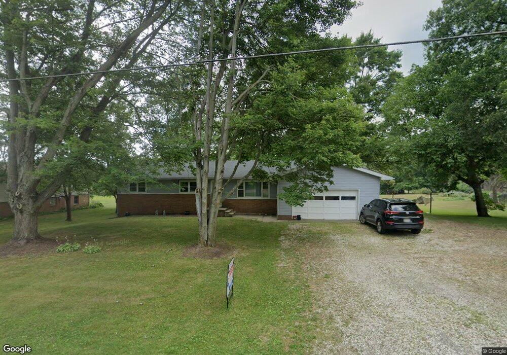
4221 Meese Rd Louisville, OH 44641
Estimated Value: $242,000 - $274,000
3
Beds
3
Baths
1,596
Sq Ft
$160/Sq Ft
Est. Value
About This Home
This home is located at 4221 Meese Rd, Louisville, OH 44641 and is currently estimated at $255,803, approximately $160 per square foot. 4221 Meese Rd is a home located in Stark County with nearby schools including Louisville High School and St. Thomas Aquinas High School & Middle School.
Ownership History
Date
Name
Owned For
Owner Type
Purchase Details
Closed on
Jul 8, 2024
Sold by
Lemonte Susan L
Bought by
Anderson Steven and Anderson Leygh-Ann
Current Estimated Value
Home Financials for this Owner
Home Financials are based on the most recent Mortgage that was taken out on this home.
Original Mortgage
$156,100
Outstanding Balance
$154,250
Interest Rate
7.03%
Mortgage Type
New Conventional
Estimated Equity
$101,553
Purchase Details
Closed on
Sep 22, 2021
Sold by
Lemonte William Scott
Bought by
Lemonte William S and Lemonte Susan L
Purchase Details
Closed on
Jun 9, 1994
Sold by
Scranage John L
Bought by
Lemonte William S
Home Financials for this Owner
Home Financials are based on the most recent Mortgage that was taken out on this home.
Original Mortgage
$53,500
Interest Rate
8.45%
Mortgage Type
New Conventional
Create a Home Valuation Report for This Property
The Home Valuation Report is an in-depth analysis detailing your home's value as well as a comparison with similar homes in the area
Home Values in the Area
Average Home Value in this Area
Purchase History
| Date | Buyer | Sale Price | Title Company |
|---|---|---|---|
| Anderson Steven | $241,100 | None Listed On Document | |
| Lemonte William S | -- | None Available | |
| Lemonte William S | $73,500 | -- |
Source: Public Records
Mortgage History
| Date | Status | Borrower | Loan Amount |
|---|---|---|---|
| Open | Anderson Steven | $156,100 | |
| Previous Owner | Lemonte William S | $53,500 |
Source: Public Records
Tax History Compared to Growth
Tax History
| Year | Tax Paid | Tax Assessment Tax Assessment Total Assessment is a certain percentage of the fair market value that is determined by local assessors to be the total taxable value of land and additions on the property. | Land | Improvement |
|---|---|---|---|---|
| 2025 | -- | $70,740 | $14,110 | $56,630 |
| 2024 | -- | $70,740 | $14,110 | $56,630 |
| 2023 | $1,970 | $49,700 | $10,010 | $39,690 |
| 2022 | $1,997 | $49,700 | $10,010 | $39,690 |
| 2021 | $2,003 | $49,700 | $10,010 | $39,690 |
| 2020 | $1,627 | $43,900 | $9,000 | $34,900 |
| 2019 | $1,628 | $43,900 | $9,000 | $34,900 |
| 2018 | $1,629 | $43,900 | $9,000 | $34,900 |
| 2017 | $1,574 | $41,170 | $8,440 | $32,730 |
| 2016 | $1,539 | $41,170 | $8,440 | $32,730 |
| 2015 | $1,543 | $41,170 | $8,440 | $32,730 |
| 2014 | $1,397 | $35,910 | $7,350 | $28,560 |
| 2013 | $702 | $35,910 | $7,350 | $28,560 |
Source: Public Records
Map
Nearby Homes
- 2110 Edmar St
- 1812 E Broad St
- 1715 High St
- 2015 E Main St
- 641 S Nickelplate St
- 3390 Meese Rd NE
- 0 Michigan Blvd
- 308 Superior St
- 520 S Silver St
- 728 E Broad St
- 908 Sand Lot Cir
- 1170 Winding Ridge Ave
- 510 S Bauman Ct
- 204 E Broad St
- 325 Lincoln Ave
- 107 E Broad St
- 910 Crosswyck Cir
- 8225 Georgetown St
- 5495 Meese Rd NE
- 1702 View Pointe Ave
- 4221 Meese Rd NE
- 4201 Meese Rd
- 4255 Meese Rd
- 2215 Briarwood St
- 808 Meese Rd
- 2205 Briarwood St
- 814 Meese Rd
- 4234 Meese Rd NE
- 2133 Briarwood St
- 814 Meese Rd NE
- 4272 Meese Rd NE
- 4272 Meese Rd NE
- 2125 Briarwood St
- 822 Meese Rd
- 2212 Briarwood St
- 2202 Briarwood St
- 832 Meese Rd
- 2128 Briarwood St
- 528 Brookfield Cir
- 532 Brookfield Cir