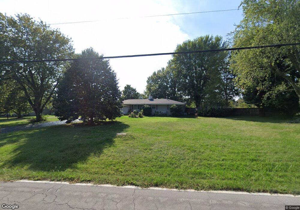
4221 N Farm Road 171 Springfield, MO 65803
Estimated Value: $194,000 - $255,000
3
Beds
2
Baths
1,296
Sq Ft
$177/Sq Ft
Est. Value
About This Home
This home is located at 4221 N Farm Road 171, Springfield, MO 65803 and is currently estimated at $228,832, approximately $176 per square foot. 4221 N Farm Road 171 is a home located in Greene County with nearby schools including Pleasant View Elementary School, Pleasant View K-8 School, and Hillcrest High School.
Ownership History
Date
Name
Owned For
Owner Type
Purchase Details
Closed on
Mar 30, 2018
Sold by
Epps Christopher L and Kean Lisa M
Bought by
Lane Greogory J and Lane Gail A
Current Estimated Value
Purchase Details
Closed on
Nov 16, 2011
Sold by
Epps Leroy
Bought by
Epps Leroy and Revocable Trust Leroy Epps
Purchase Details
Closed on
May 17, 2006
Sold by
Trewatha Janet L
Bought by
Epps Leroy and Epps Darlene F
Home Financials for this Owner
Home Financials are based on the most recent Mortgage that was taken out on this home.
Original Mortgage
$117,300
Interest Rate
6.62%
Mortgage Type
Adjustable Rate Mortgage/ARM
Create a Home Valuation Report for This Property
The Home Valuation Report is an in-depth analysis detailing your home's value as well as a comparison with similar homes in the area
Home Values in the Area
Average Home Value in this Area
Purchase History
| Date | Buyer | Sale Price | Title Company |
|---|---|---|---|
| Lane Greogory J | -- | None Available | |
| Epps Leroy | -- | None Available | |
| Epps Leroy | -- | None Available |
Source: Public Records
Mortgage History
| Date | Status | Borrower | Loan Amount |
|---|---|---|---|
| Previous Owner | Epps Leroy | $117,300 |
Source: Public Records
Tax History Compared to Growth
Tax History
| Year | Tax Paid | Tax Assessment Tax Assessment Total Assessment is a certain percentage of the fair market value that is determined by local assessors to be the total taxable value of land and additions on the property. | Land | Improvement |
|---|---|---|---|---|
| 2025 | $1,345 | $24,530 | $5,700 | $18,830 |
| 2024 | $1,345 | $23,240 | $5,700 | $17,540 |
| 2023 | $1,338 | $23,240 | $5,700 | $17,540 |
| 2022 | $1,330 | $22,630 | $5,700 | $16,930 |
| 2021 | $1,272 | $22,630 | $5,700 | $16,930 |
| 2020 | $1,293 | $21,830 | $5,700 | $16,130 |
| 2019 | $1,256 | $21,830 | $5,700 | $16,130 |
| 2018 | $1,150 | $19,890 | $3,720 | $16,170 |
| 2017 | $1,140 | $19,760 | $3,720 | $16,040 |
| 2016 | $1,130 | $19,760 | $3,720 | $16,040 |
| 2015 | $1,122 | $19,760 | $3,720 | $16,040 |
| 2014 | $1,113 | $19,620 | $3,720 | $15,900 |
Source: Public Records
Map
Nearby Homes
- 4541b N Lanier Ln
- 4541 N Lanier Ln
- 4159 N Farm Road 173
- 3839 N Stewart Ave
- Lot 1 E Stoneridge Dr
- 4697 N Farm Road 175
- 0 N State Highway H Unit 60272431
- 3481 N Marwin Ave
- 1464 E Burntwood St
- 4260 N State Highway H
- 3753 N Pickwick Ave
- 3749 N Pickwick Ave
- 1338 E Burntwood St
- 1270 E Ogorman Ct
- 3957 N Springlawn Ave
- 00 State Highway H N
- 1214 Evington Ct
- 3857 N Sheedy Ave
- 3449 N Rogers Ave
- 1439 E McClernon St
- 4175 N Farm Road 171
- 2040 E Farm Road 94
- 2314 E Farm Road 94
- 2024 E Farm Road 94
- 4120 N Farm Road 171
- 4120 N Farm Road 171
- 4202 N Link Ave
- 2010 E Farm Road 94
- 3909 E Bluegrass Rd
- 4056 N Farm Road 171
- 4279 N Link Ave
- 3980 N Farm Road 171
- 1930 E Farm Road 94
- 1908 E Farm Road 94
- 4157 N Link Ave
- 4167 N Sower Ln
- 2522 E Farm Road 94
- 1862 E Farm Road 94
- 3986 N Bannister Ave
- 3980 N Bannister Ave