Estimated Value: $454,577 - $509,000
4
Beds
2
Baths
2,396
Sq Ft
$199/Sq Ft
Est. Value
About This Home
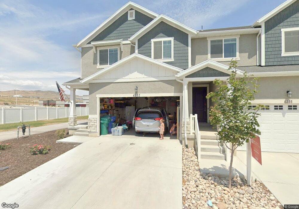
This home is located at 4222 W 1650 N Unit 709, Lehi, UT 84043 and is currently estimated at $476,644, approximately $198 per square foot. 4222 W 1650 N Unit 709 is a home located in Utah County with nearby schools including North Point Elementary School, Willowcreek Middle School, and Lehi High School.
Ownership History
Date
Name
Owned For
Owner Type
Purchase Details
Closed on
Jul 24, 2020
Sold by
Bishop Matthew Cody and Bishop Ashlee P
Bought by
Bishop Ashlee P and Bishop Matthew Cody
Current Estimated Value
Home Financials for this Owner
Home Financials are based on the most recent Mortgage that was taken out on this home.
Original Mortgage
$297,500
Outstanding Balance
$263,803
Interest Rate
3.1%
Mortgage Type
New Conventional
Estimated Equity
$212,841
Purchase Details
Closed on
Sep 27, 2018
Sold by
Edge Homes Utah Llc
Bought by
Bishop Matthew Cody and Bishop Ashlee P
Home Financials for this Owner
Home Financials are based on the most recent Mortgage that was taken out on this home.
Original Mortgage
$297,106
Interest Rate
4.5%
Mortgage Type
New Conventional
Create a Home Valuation Report for This Property
The Home Valuation Report is an in-depth analysis detailing your home's value as well as a comparison with similar homes in the area
Home Values in the Area
Average Home Value in this Area
Purchase History
| Date | Buyer | Sale Price | Title Company |
|---|---|---|---|
| Bishop Ashlee P | -- | Highland Title | |
| Bishop Matthew Cody | -- | Provo Land Title Co |
Source: Public Records
Mortgage History
| Date | Status | Borrower | Loan Amount |
|---|---|---|---|
| Open | Bishop Ashlee P | $297,500 | |
| Closed | Bishop Matthew Cody | $297,106 |
Source: Public Records
Tax History Compared to Growth
Tax History
| Year | Tax Paid | Tax Assessment Tax Assessment Total Assessment is a certain percentage of the fair market value that is determined by local assessors to be the total taxable value of land and additions on the property. | Land | Improvement |
|---|---|---|---|---|
| 2025 | $2,121 | $243,595 | $65,100 | $377,800 |
| 2024 | $2,121 | $248,600 | $0 | $0 |
| 2023 | $1,908 | $242,825 | $0 | $0 |
| 2022 | $2,026 | $249,920 | $0 | $0 |
| 2021 | $1,715 | $319,900 | $48,000 | $271,900 |
| 2020 | $1,693 | $312,200 | $46,800 | $265,400 |
| 2019 | $1,560 | $299,100 | $44,900 | $254,200 |
| 2018 | $0 | $27,500 | $0 | $0 |
Source: Public Records
Map
Nearby Homes
- 1606 N 4230 W
- 1700 N Boston St
- 1552 N Boston St Unit 5B
- 4089 W 1700 N Unit 618
- 4126 W 1530 N Unit DD101
- 4037 W 1730 N
- 4057 W 1760 N
- 4173 W 1850 N
- 4252 W 1850 N Unit J203
- 3972 W 1530 N
- 4155 W 1960 N
- 1941 N 4100 W
- 2538 N Redwood Rd
- 1991 W 1960 N
- 2019 W 1960 N
- 3984 W 1850 N Unit D102
- 4827 N Sage Dr
- 4193 W 2010 N
- 1629 N 3860 W
- 1689 W Canyon Rim Dr N Unit 636
- 4216 W 1650 N Unit 710
- 4216 W 1650 N
- 4210 W 1650 N Unit 711
- 4210 W 1650 N
- 4204 W 1650 N
- 4204 W 1650 N Unit 712
- 4198 W 1650 N Unit 713
- 1630 N 4230 W Unit 736
- 1630 N 4230 W
- 4192 W 1650 N Unit 714
- 4192 W 1650 N
- 1624 N 4230 W Unit 737
- 1618 N 4230 W Unit 738
- 1618 N 4230 W
- 4199 W 1650 N Unit 735
- 4199 W 1650 N Unit 732
- 1612 N 4230 W
- 1612 N 4230 W Unit 739
- 4193 W 1650 N Unit 734
- 4193 W 1650 N Unit 733