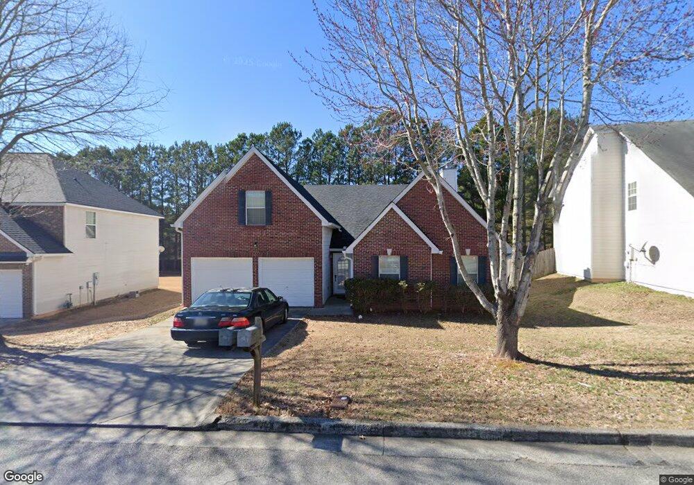
4223 Butternut Place Atlanta, GA 30349
Estimated Value: $298,229 - $343,000
4
Beds
3
Baths
2,198
Sq Ft
$144/Sq Ft
Est. Value
About This Home
This home is located at 4223 Butternut Place, Atlanta, GA 30349 and is currently estimated at $317,557, approximately $144 per square foot. 4223 Butternut Place is a home located in Fulton County with nearby schools including Wolf Creek Elementary, Renaissance Middle School, and Langston Hughes High School.
Ownership History
Date
Name
Owned For
Owner Type
Purchase Details
Closed on
Nov 30, 2023
Sold by
Robotham Lauriston
Bought by
510 Sfr Ga Operations 1 Llc
Current Estimated Value
Purchase Details
Closed on
Oct 24, 2005
Sold by
Legacy Communities Of Cooks La
Bought by
Robotham Lauriston
Home Financials for this Owner
Home Financials are based on the most recent Mortgage that was taken out on this home.
Original Mortgage
$173,280
Interest Rate
5.71%
Mortgage Type
New Conventional
Create a Home Valuation Report for This Property
The Home Valuation Report is an in-depth analysis detailing your home's value as well as a comparison with similar homes in the area
Home Values in the Area
Average Home Value in this Area
Purchase History
| Date | Buyer | Sale Price | Title Company |
|---|---|---|---|
| 510 Sfr Ga Operations 1 Llc | -- | -- | |
| 510 Sfr Ga Operations Llc | $275,500 | -- | |
| Robotham Lauriston | $182,400 | -- |
Source: Public Records
Mortgage History
| Date | Status | Borrower | Loan Amount |
|---|---|---|---|
| Previous Owner | Robotham Lauriston | $173,280 |
Source: Public Records
Tax History Compared to Growth
Tax History
| Year | Tax Paid | Tax Assessment Tax Assessment Total Assessment is a certain percentage of the fair market value that is determined by local assessors to be the total taxable value of land and additions on the property. | Land | Improvement |
|---|---|---|---|---|
| 2025 | $4,650 | $120,720 | $26,400 | $94,320 |
| 2023 | $4,650 | $120,720 | $26,400 | $94,320 |
| 2022 | $3,744 | $95,480 | $18,880 | $76,600 |
| 2021 | $3,111 | $77,720 | $19,000 | $58,720 |
| 2020 | $2,717 | $66,760 | $12,960 | $53,800 |
| 2019 | $2,692 | $68,160 | $15,320 | $52,840 |
| 2018 | $2,261 | $56,800 | $8,520 | $48,280 |
| 2017 | $1,604 | $39,360 | $10,400 | $28,960 |
| 2016 | $1,604 | $39,360 | $10,400 | $28,960 |
| 2015 | $1,609 | $39,360 | $10,400 | $28,960 |
| 2014 | $1,697 | $39,360 | $10,400 | $28,960 |
Source: Public Records
Map
Nearby Homes
- 4224 Butternut Place
- 6639 Overlook Ridge
- 4247 Butternut Place
- 4369 Estate St
- 6640 E Stubbs Rd
- 4270 Holliday Rd
- 4140 Butternut Place
- 6292 Dekeon Dr
- 6476 Snowden Dr
- 4185 Post Oak Grove
- 4189 Post Oak Grove
- 6843 Foxfire Place
- 6474 E Stubbs Rd
- 3985 Demooney Rd
- 3930 Demooney Rd
- 6390 E Stubbs Rd
- 4327 Shamrock Dr
- 6300 E Stubbs Rd
- 0 Jones Rd Unit 10486732
- 4219 Butternut Place
- 4227 Butternut Place
- 4231 Butternut Place
- 4228 Butternut Place
- 4220 Butternut Place
- 4232 Butternut Place
- 1000 Butternut Place
- 6619 Overlook Ridge Unit 115
- 6619 Overlook Ridge
- 4216 Butternut Place
- 6629 Overlook Ridge
- 4236 Butternut Place
- 4212 Butternut Place
- 4240 Butternut Place
- 4413 Estate St
- 6614 Overlook Ridge
- 6614 Overlook Ridge
- 4421 Estate St
- 4417 Estate St
- 4244 Butternut Place