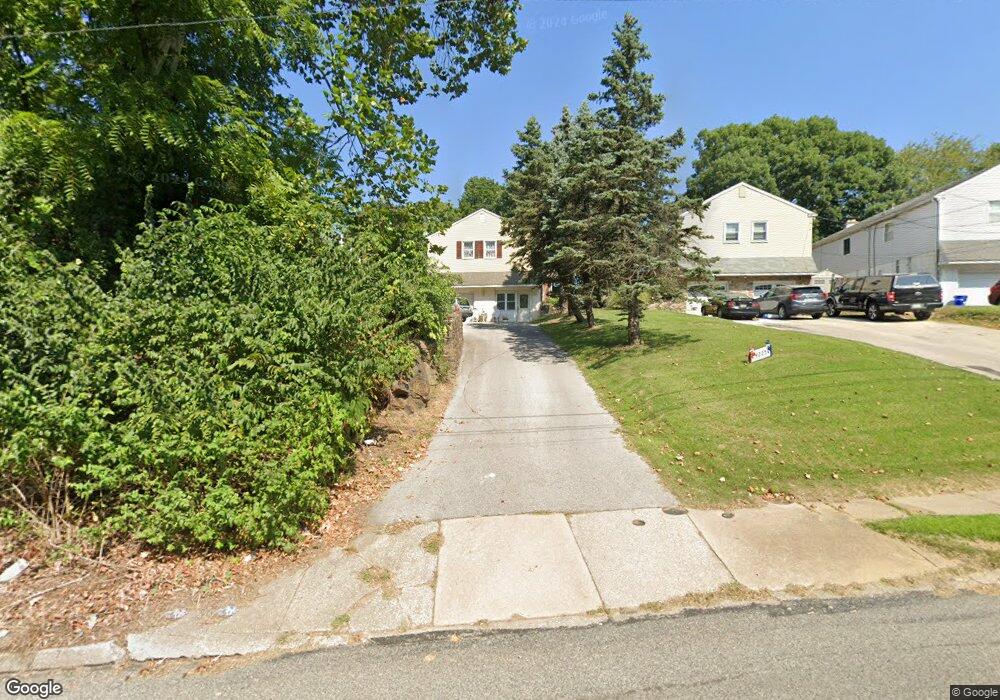
4225 Garrett Rd Drexel Hill, PA 19026
Estimated Value: $321,000 - $409,000
3
Beds
1
Bath
1,748
Sq Ft
$215/Sq Ft
Est. Value
About This Home
This home is located at 4225 Garrett Rd, Drexel Hill, PA 19026 and is currently estimated at $376,391, approximately $215 per square foot. 4225 Garrett Rd is a home located in Delaware County with nearby schools including Garrettford El School, Drexel Hill Middle School, and Upper Darby High School.
Ownership History
Date
Name
Owned For
Owner Type
Purchase Details
Closed on
Apr 6, 2000
Sold by
Cendant Mtg
Bought by
Kaladjian Garnik John and Kaladjian Goar Danielyan
Current Estimated Value
Home Financials for this Owner
Home Financials are based on the most recent Mortgage that was taken out on this home.
Original Mortgage
$101,650
Outstanding Balance
$34,825
Interest Rate
8.23%
Estimated Equity
$341,566
Purchase Details
Closed on
Jan 11, 2000
Sold by
Decaro Richard
Bought by
Cendant Mtg
Purchase Details
Closed on
Jun 16, 1995
Sold by
Gillespie James and Gillespie Adelle A
Bought by
Decaro Richard
Home Financials for this Owner
Home Financials are based on the most recent Mortgage that was taken out on this home.
Original Mortgage
$103,850
Interest Rate
6.87%
Create a Home Valuation Report for This Property
The Home Valuation Report is an in-depth analysis detailing your home's value as well as a comparison with similar homes in the area
Home Values in the Area
Average Home Value in this Area
Purchase History
| Date | Buyer | Sale Price | Title Company |
|---|---|---|---|
| Kaladjian Garnik John | $107,000 | Commonwealth Land Title Ins | |
| Cendant Mtg | -- | -- | |
| Decaro Richard | $138,500 | Commonwealth Land Title Ins |
Source: Public Records
Mortgage History
| Date | Status | Borrower | Loan Amount |
|---|---|---|---|
| Open | Kaladjian Garnik John | $101,650 | |
| Previous Owner | Decaro Richard | $103,850 |
Source: Public Records
Tax History Compared to Growth
Tax History
| Year | Tax Paid | Tax Assessment Tax Assessment Total Assessment is a certain percentage of the fair market value that is determined by local assessors to be the total taxable value of land and additions on the property. | Land | Improvement |
|---|---|---|---|---|
| 2025 | $7,929 | $187,490 | $48,370 | $139,120 |
| 2024 | $7,929 | $187,490 | $48,370 | $139,120 |
| 2023 | $7,854 | $187,490 | $48,370 | $139,120 |
| 2022 | $7,643 | $187,490 | $48,370 | $139,120 |
| 2021 | $10,306 | $187,490 | $48,370 | $139,120 |
| 2020 | $8,387 | $129,650 | $37,420 | $92,230 |
| 2019 | $8,239 | $129,650 | $37,420 | $92,230 |
| 2018 | $8,144 | $129,650 | $0 | $0 |
| 2017 | $7,933 | $129,650 | $0 | $0 |
| 2016 | $712 | $129,650 | $0 | $0 |
| 2015 | $712 | $129,650 | $0 | $0 |
| 2014 | $712 | $129,650 | $0 | $0 |
Source: Public Records
Map
Nearby Homes
- 4130 Rosemont Ave
- 461 Wilde Ave
- 469 Wilde Ave
- 4426 Huey Ave
- 4044 Dayton Rd
- 4014 Rosemont Ave
- 5134 Westley Dr
- 4032 Dayton Rd
- 521 Blythe Ave
- 4400 School Ln
- 523 Bloomfield Ave
- 4410 School Ln
- 5137 Westley Dr
- 543 Bloomfield Ave
- 4009 Redden Rd
- 3811 Berry Ave
- 337 Cheswold Rd
- 3804 Rosemont Ave
- 4123 School Ln
- 3810 Huey Ave