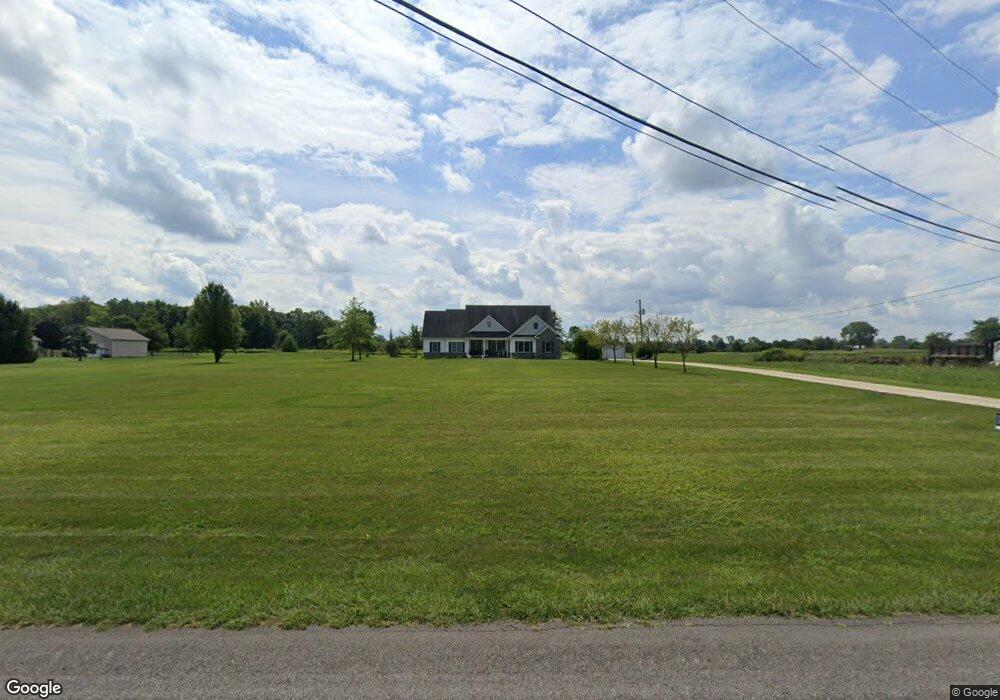
42253 Biggs Rd Lagrange, OH 44050
Estimated Value: $478,000 - $562,000
4
Beds
3
Baths
2,984
Sq Ft
$179/Sq Ft
Est. Value
About This Home
This home is located at 42253 Biggs Rd, Lagrange, OH 44050 and is currently estimated at $535,099, approximately $179 per square foot. 42253 Biggs Rd is a home located in Lorain County with nearby schools including Keystone Elementary School, Keystone Middle School, and Keystone High School.
Ownership History
Date
Name
Owned For
Owner Type
Purchase Details
Closed on
Apr 6, 2010
Sold by
Denham John D and Denham Sandra L
Bought by
Myers John K and Myers Jamie L
Current Estimated Value
Home Financials for this Owner
Home Financials are based on the most recent Mortgage that was taken out on this home.
Original Mortgage
$236,000
Outstanding Balance
$157,961
Interest Rate
5.1%
Mortgage Type
Purchase Money Mortgage
Estimated Equity
$377,138
Purchase Details
Closed on
Apr 21, 2004
Sold by
Tipple James E and Tipple Lynn M
Bought by
Denham John D and Denham Sandra L
Purchase Details
Closed on
Mar 30, 2004
Sold by
Shoulter Steven W and Shoulter Linda D
Bought by
Tipple James E and Tipple Lynn M
Purchase Details
Closed on
Feb 13, 2004
Sold by
Shoulter Steven W and Shoulter Linda D
Bought by
Shoulter Steven W and Shoulter Linda D
Create a Home Valuation Report for This Property
The Home Valuation Report is an in-depth analysis detailing your home's value as well as a comparison with similar homes in the area
Home Values in the Area
Average Home Value in this Area
Purchase History
| Date | Buyer | Sale Price | Title Company |
|---|---|---|---|
| Myers John K | $300,000 | Attorney | |
| Denham John D | $55,000 | -- | |
| Tipple James E | $55,000 | -- | |
| Shoulter Steven W | -- | -- |
Source: Public Records
Mortgage History
| Date | Status | Borrower | Loan Amount |
|---|---|---|---|
| Open | Myers John K | $236,000 |
Source: Public Records
Tax History Compared to Growth
Tax History
| Year | Tax Paid | Tax Assessment Tax Assessment Total Assessment is a certain percentage of the fair market value that is determined by local assessors to be the total taxable value of land and additions on the property. | Land | Improvement |
|---|---|---|---|---|
| 2024 | $6,088 | $148,978 | $32,312 | $116,666 |
| 2023 | $6,692 | $137,207 | $31,028 | $106,180 |
| 2022 | $6,644 | $137,207 | $31,028 | $106,180 |
| 2021 | $6,645 | $137,207 | $31,028 | $106,180 |
| 2020 | $5,875 | $108,120 | $24,450 | $83,670 |
| 2019 | $5,838 | $108,120 | $24,450 | $83,670 |
| 2018 | $5,696 | $108,120 | $24,450 | $83,670 |
| 2017 | $5,488 | $97,550 | $25,400 | $72,150 |
| 2016 | $5,449 | $97,550 | $25,400 | $72,150 |
| 2015 | $5,440 | $97,550 | $25,400 | $72,150 |
| 2014 | $4,488 | $92,030 | $23,970 | $68,060 |
| 2013 | $4,348 | $92,030 | $23,970 | $68,060 |
Source: Public Records
Map
Nearby Homes
- 171 Keywood Blvd
- 128 Harvest Ct
- 756 N Center St
- 433 N Center St
- 41635 Parsons Rd
- 40725 Biggs Rd
- 516 Appomattox Ct
- 548 William St
- 829 Robinson Dr
- 831 Robinson Dr
- 822 Robinson Dr
- 110 Railroad St
- 607 Rundle St
- 808 Buckingham Dr
- 194 Railroad St
- 800 Buckingham Dr
- 630 Rundle St
- 16974 Hawley Rd
- 0 Dill Ct Unit 5072837
- 44867 E Hamilton St
- 39978 Whitney Rd
- 42183 Biggs Rd
- 42637 Biggs Rd
- 42125 Biggs Rd
- 42270 Biggs Rd
- 42099 Biggs Rd
- 42156 Biggs Rd
- 42829 Biggs Rd
- 42820 Biggs Rd
- 42204 Biggs Rd
- 42318 Biggs Rd
- 42108 Biggs Rd
- 42100 Biggs Rd
- 42087 Biggs Rd
- 42843 Biggs Rd
- 42088 Biggs Rd
- 42077 Biggs Rd
- 42078 Biggs Rd
- 42836 Biggs Rd
- 42068 Biggs Rd