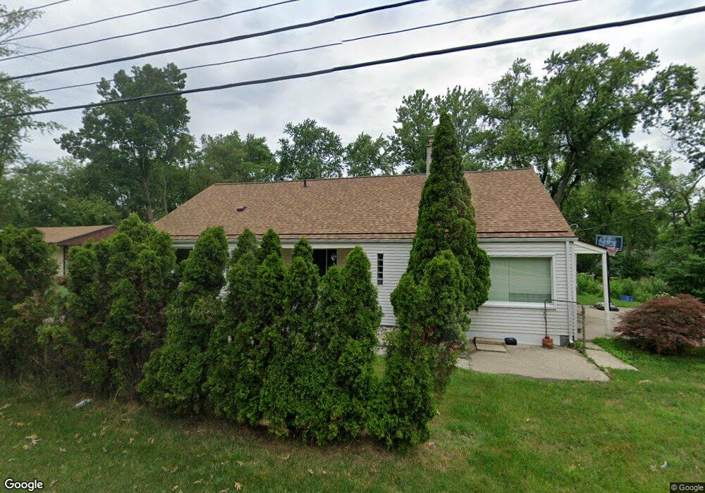
4226 Green Lake Rd Unit Bldg-Unit West Bloomfield, MI 48323
Estimated Value: $314,000 - $342,000
3
Beds
2
Baths
2,070
Sq Ft
$158/Sq Ft
Est. Value
About This Home
This home is located at 4226 Green Lake Rd Unit Bldg-Unit, West Bloomfield, MI 48323 and is currently estimated at $326,567, approximately $157 per square foot. 4226 Green Lake Rd Unit Bldg-Unit is a home located in Oakland County with nearby schools including Clifford H. Smart Middle School, Walled Lake Northern High School, and Our Lady Of Refuge School.
Ownership History
Date
Name
Owned For
Owner Type
Purchase Details
Closed on
May 30, 2019
Sold by
Gonzalez Dijohn
Bought by
Esslinger Matthew and Esslinger Victoria
Current Estimated Value
Purchase Details
Closed on
Sep 3, 2015
Sold by
Wallace Jonathan and Wallace Jennifer
Bought by
Gonzalez Dijohn E
Home Financials for this Owner
Home Financials are based on the most recent Mortgage that was taken out on this home.
Original Mortgage
$148,224
Interest Rate
4.62%
Mortgage Type
FHA
Purchase Details
Closed on
Jun 15, 2010
Sold by
King Gary A and King Lynne K
Bought by
Wallace Jonathan
Create a Home Valuation Report for This Property
The Home Valuation Report is an in-depth analysis detailing your home's value as well as a comparison with similar homes in the area
Home Values in the Area
Average Home Value in this Area
Purchase History
| Date | Buyer | Sale Price | Title Company |
|---|---|---|---|
| Esslinger Matthew | $210,000 | None Available | |
| Gonzalez Dijohn E | $152,000 | Attorney | |
| Wallace Jonathan | $100,000 | Interstate Title Inc |
Source: Public Records
Mortgage History
| Date | Status | Borrower | Loan Amount |
|---|---|---|---|
| Previous Owner | Gonzalez Dijohn E | $148,224 |
Source: Public Records
Tax History Compared to Growth
Tax History
| Year | Tax Paid | Tax Assessment Tax Assessment Total Assessment is a certain percentage of the fair market value that is determined by local assessors to be the total taxable value of land and additions on the property. | Land | Improvement |
|---|---|---|---|---|
| 2024 | $2,261 | $116,260 | $0 | $0 |
| 2022 | $2,138 | $108,530 | $34,340 | $74,190 |
| 2021 | $3,516 | $104,750 | $0 | $0 |
| 2020 | $2,113 | $100,990 | $34,340 | $66,650 |
| 2018 | $3,188 | $90,140 | $34,340 | $55,800 |
| 2015 | -- | $79,920 | $0 | $0 |
| 2014 | -- | $74,900 | $0 | $0 |
| 2011 | -- | $68,180 | $0 | $0 |
Source: Public Records
Map
Nearby Homes
- 6978 Colony Dr
- 4066 Green Lake Rd
- 3991 Fieldview Ave
- 4442 Borland St
- 4335 Crestdale Ave
- 0000 Langtoft
- 4245 Bunker Ave
- 6675 Langtoft St
- 3965 Carrick Ave
- 6903 Dandison Blvd
- 3950 Bradmore Ave
- 4212 Greendale Ave
- 7337 Richardson Rd
- 6980 Hambro St
- 4540 Rolling Pine Ct
- 6768 Buckland Ave
- 7381 Crestmore St
- 3632 Fieldview Ave
- 7359 Woodlore Dr
- 3641 Green Lake Rd
- 4226 Green Lake Rd
- 4168 Welland Dr
- 4258 Green Lake Rd
- 4210 Welland Dr
- 4187 Welland Dr
- 4150 Welland Dr
- 4175 Welland Dr
- 4266 Green Lake Rd
- 4149 Howarth Terrace
- 4269 Green Lake Rd
- 4135 Welland Dr
- 000 Howarth Terrace
- 00000 Howarth Terrace
- 4235 Welland Dr
- 6918 Evershed Terrace
- 6735 Colony Dr
- 6930 Evershed Terrace
- 4125 Howarth Terrace
- 0000 Howarth Terrace
- 4116 Welland Dr