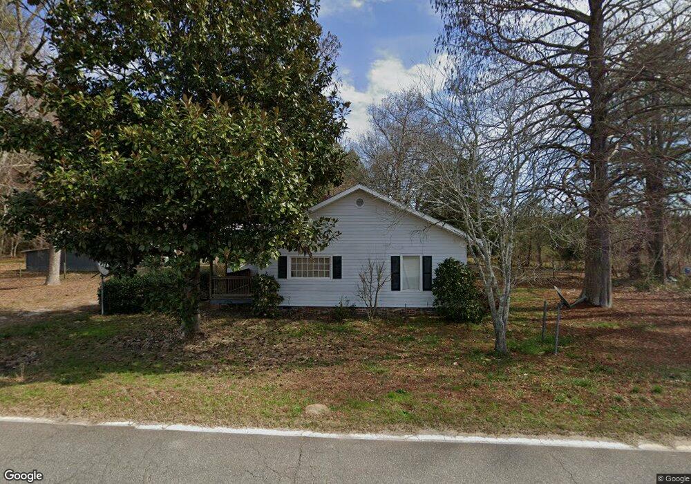
4226 Neals Mill Rd Dearing, GA 30808
Estimated Value: $38,000 - $175,000
2
Beds
1
Bath
1,070
Sq Ft
$110/Sq Ft
Est. Value
About This Home
This home is located at 4226 Neals Mill Rd, Dearing, GA 30808 and is currently estimated at $117,447, approximately $109 per square foot. 4226 Neals Mill Rd is a home located in McDuffie County with nearby schools including Thomson High School.
Ownership History
Date
Name
Owned For
Owner Type
Purchase Details
Closed on
Oct 25, 2002
Sold by
Perry Stanley C
Bought by
Perry Stanley C
Current Estimated Value
Purchase Details
Closed on
Dec 22, 2000
Sold by
Secretary Of Housing
Bought by
Perry Stanley C
Purchase Details
Closed on
Dec 7, 1999
Sold by
Fleet Mortgage Corp
Bought by
Secretary Of Housing
Purchase Details
Closed on
Jun 20, 1995
Sold by
Parr Francis X
Bought by
Vaughn William H
Purchase Details
Closed on
Nov 6, 1989
Bought by
Parr Francis X
Create a Home Valuation Report for This Property
The Home Valuation Report is an in-depth analysis detailing your home's value as well as a comparison with similar homes in the area
Home Values in the Area
Average Home Value in this Area
Purchase History
| Date | Buyer | Sale Price | Title Company |
|---|---|---|---|
| Perry Stanley C | -- | -- | |
| Perry Stanley C | $41,700 | -- | |
| Secretary Of Housing | $56,400 | -- | |
| Fleet Mortgage Corp | $56,400 | -- | |
| Vaughn William H | $51,000 | -- | |
| Parr Francis X | $42,000 | -- |
Source: Public Records
Tax History Compared to Growth
Tax History
| Year | Tax Paid | Tax Assessment Tax Assessment Total Assessment is a certain percentage of the fair market value that is determined by local assessors to be the total taxable value of land and additions on the property. | Land | Improvement |
|---|---|---|---|---|
| 2024 | $108 | $35,715 | $4,045 | $31,670 |
| 2023 | $890 | $33,185 | $4,045 | $29,140 |
| 2022 | $866 | $31,641 | $4,045 | $27,596 |
| 2021 | $618 | $25,949 | $3,927 | $22,022 |
| 2020 | $509 | $22,052 | $2,500 | $19,552 |
| 2019 | $514 | $22,052 | $2,500 | $19,552 |
| 2018 | $794 | $31,857 | $2,500 | $29,357 |
| 2017 | $766 | $31,857 | $2,500 | $29,357 |
| 2016 | $766 | $31,857 | $2,500 | $29,357 |
| 2015 | $727 | $33,043 | $3,687 | $29,357 |
| 2014 | $729 | $33,044 | $3,687 | $29,357 |
| 2013 | -- | $33,043 | $3,686 | $29,356 |
Source: Public Records
Map
Nearby Homes
- 0 Whitaker Rd Unit 540660
- 2786 Tudor Rd
- 4062 Horsham Trail
- 290 Neals Mill Rd
- 4327 Iron Hill Rd
- 259 S Main St
- 122 First St
- 0 Adams-Reeves Rd Unit 523648
- 0 Adams Chapel Rd
- 3946 Radford Gay Rd
- 3191 Old Augusta Rd
- 3171 Old Augusta Rd
- 4099 Randall Hunt Rd
- 833 Sweet Grass Cir
- 832 Sweet Grass Cir
- 854 Sweet Grass Cir
- 830 Sweet Grass Cir
- 864 Sweet Grass Cir
- 227 Pebble Ln
- 818 Sweet Grass Cir
- 4212 Neals Mill Rd
- 4254 Neals Mill Rd
- 4275 Neals Mill Rd
- 4303 Neals Mill Rd
- 4223 Neals Mill Rd
- 4316 Neals Mill Rd
- 4331 Neals Mill Rd
- 4150 Neals Mill Rd
- 4249 Neals Mill Rd
- 4152 Neals Mill Rd
- 4352 Neals Mill Rd
- 4324 Neals Mill Rd
- 4076 Neals Mill Rd
- 4394 Neals Mill Rd
- 4326 Neals Mill Rd
- 4453 Neals Mill Rd
- 4343 Neals Mill Rd
- 3987 Neals Mill Rd
- 4490 Neals Mill Rd
- 4524 Neals Mill Rd