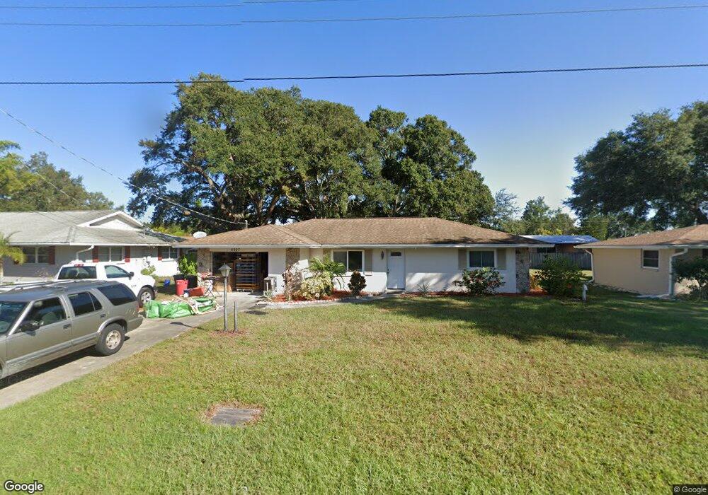
4227 Baird St Sarasota, FL 34232
Estimated Value: $334,595 - $380,000
3
Beds
2
Baths
1,328
Sq Ft
$268/Sq Ft
Est. Value
About This Home
This home is located at 4227 Baird St, Sarasota, FL 34232 and is currently estimated at $356,149, approximately $268 per square foot. 4227 Baird St is a home located in Sarasota County with nearby schools including Brentwood Elementary School, McIntosh Middle School, and Sarasota High School.
Ownership History
Date
Name
Owned For
Owner Type
Purchase Details
Closed on
Aug 26, 2025
Sold by
Macgregor William Robert
Bought by
Macgregor William Robert and William R Macgregor Trust
Current Estimated Value
Purchase Details
Closed on
Feb 24, 1997
Sold by
Desrosier Omer A and Desrosier Vivian R
Bought by
Macgregor William Robert
Home Financials for this Owner
Home Financials are based on the most recent Mortgage that was taken out on this home.
Original Mortgage
$60,000
Interest Rate
7.88%
Create a Home Valuation Report for This Property
The Home Valuation Report is an in-depth analysis detailing your home's value as well as a comparison with similar homes in the area
Home Values in the Area
Average Home Value in this Area
Purchase History
| Date | Buyer | Sale Price | Title Company |
|---|---|---|---|
| Macgregor William Robert | $100 | None Listed On Document | |
| Macgregor William Robert | $84,000 | -- |
Source: Public Records
Mortgage History
| Date | Status | Borrower | Loan Amount |
|---|---|---|---|
| Previous Owner | Macgregor William Robert | $60,000 |
Source: Public Records
Tax History Compared to Growth
Tax History
| Year | Tax Paid | Tax Assessment Tax Assessment Total Assessment is a certain percentage of the fair market value that is determined by local assessors to be the total taxable value of land and additions on the property. | Land | Improvement |
|---|---|---|---|---|
| 2024 | $1,354 | $99,966 | -- | -- |
| 2023 | $1,354 | $97,054 | $0 | $0 |
| 2022 | $1,286 | $94,227 | $0 | $0 |
| 2021 | $1,282 | $91,483 | $0 | $0 |
| 2020 | $1,266 | $90,220 | $0 | $0 |
| 2019 | $1,205 | $88,192 | $0 | $0 |
| 2018 | $1,158 | $86,548 | $0 | $0 |
| 2017 | $1,149 | $84,768 | $0 | $0 |
| 2016 | $1,139 | $129,700 | $37,800 | $91,900 |
| 2015 | $1,152 | $116,200 | $34,200 | $82,000 |
| 2014 | $1,065 | $74,648 | $0 | $0 |
Source: Public Records
Map
Nearby Homes
- 4220 Larkin St
- 4209 Larkin St
- 3613 Belmont Blvd
- 3525 Mcintosh Rd
- 3338 Cambridge Dr
- 4442 Beacon Dr
- 4015 Asbury Place
- 4519 Brooksdale Dr
- 4547 Busti Dr
- 4429 Hicks St
- 4549 Mcintosh Ln
- 4037 Tern St
- 2920 Mcintosh Rd
- 3616 Stardust Place
- 2902 Teal Ave
- 0 Stardust Place
- 4431 Spahn St
- 4058 Oakhurst Dr Unit 3174
- 4018 Oakhurst Dr Unit 3181
- 3925 Oakhurst Blvd Unit 3010