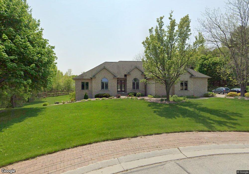
4227 Westbrook Ct Oneida, WI 54155
Estimated Value: $698,962 - $906,000
Studio
--
Bath
--
Sq Ft
65,122
Sq Ft Lot
About This Home
This home is located at 4227 Westbrook Ct, Oneida, WI 54155 and is currently estimated at $776,991. 4227 Westbrook Ct is a home located in Brown County with nearby schools including Hillcrest Elementary School, Pulaski Community Middle School, and Pulaski High School.
Ownership History
Date
Name
Owned For
Owner Type
Purchase Details
Closed on
Apr 23, 2007
Sold by
Anderson David A and Anderson Roxie L
Bought by
Svetlichnyy Sergey and Svetlichnyy Lyudmila
Current Estimated Value
Home Financials for this Owner
Home Financials are based on the most recent Mortgage that was taken out on this home.
Original Mortgage
$405,000
Outstanding Balance
$239,424
Interest Rate
6.2%
Mortgage Type
Purchase Money Mortgage
Estimated Equity
$537,567
Create a Home Valuation Report for This Property
The Home Valuation Report is an in-depth analysis detailing your home's value as well as a comparison with similar homes in the area
Home Values in the Area
Average Home Value in this Area
Purchase History
| Date | Buyer | Sale Price | Title Company |
|---|---|---|---|
| Svetlichnyy Sergey | $405,000 | Bay Title & Abstract |
Source: Public Records
Mortgage History
| Date | Status | Borrower | Loan Amount |
|---|---|---|---|
| Open | Svetlichnyy Sergey | $405,000 |
Source: Public Records
Tax History
| Year | Tax Paid | Tax Assessment Tax Assessment Total Assessment is a certain percentage of the fair market value that is determined by local assessors to be the total taxable value of land and additions on the property. | Land | Improvement |
|---|---|---|---|---|
| 2025 | $7,199 | $451,800 | $110,000 | $341,800 |
| 2024 | $7,398 | $451,800 | $110,000 | $341,800 |
| 2023 | $7,507 | $451,800 | $110,000 | $341,800 |
| 2022 | $6,403 | $451,800 | $110,000 | $341,800 |
| 2021 | $6,069 | $451,800 | $110,000 | $341,800 |
| 2020 | $6,601 | $370,500 | $93,300 | $277,200 |
| 2019 | $6,724 | $370,500 | $93,300 | $277,200 |
| 2018 | $6,708 | $370,500 | $93,300 | $277,200 |
| 2017 | $6,530 | $370,500 | $93,300 | $277,200 |
| 2016 | $6,625 | $370,500 | $93,300 | $277,200 |
| 2015 | $6,682 | $370,500 | $93,300 | $277,200 |
| 2014 | $6,970 | $370,500 | $93,300 | $277,200 |
| 2013 | $6,970 | $370,500 | $93,300 | $277,200 |
Source: Public Records
Map
Nearby Homes
- 910 Kings Point Ct
- 966 Thornberry Creek Dr
- 4354 Hilton Head Dr
- 772 Brookwood Cir
- 1102 Heyerdahl Heights
- 1064 Coronado Ct
- 4336 Hilton Head Dr
- 692 Blackberry Ct
- 4327 Hilton Head Dr
- 4131 Blackberry Ridge Ct
- 4141 Blackberry Ridge Ct
- 1336 S Sedona Cir
- 1124 Heyerdahl Heights Unit 174
- 1071 Hill Dr
- 1274 S Sedona Cir
- 4179 Hillcrest Dr
- 3820 National St
- 598 Cross Country Ct
- 1250 Thayer Trail
- 1232 Thayer Trail
- 4233 Westbrook Ct
- 4207 N Pine Tree Rd
- 4204 Westbrook Ct
- 4200 N Pine Tree Rd Unit BLOCK
- 880 Kendale Ct
- 4215 N Pine Tree Rd
- 909 Kings Point Ct
- 900 Pine Hill Dr
- 4242 Westbrook Ct
- 915 Kings Point Ct
- 899 Pine Hill Dr
- 916 Kings Point Ct
- 4160 Crooked Stick Ct
- 4156 Crooked Stick Ct
- 893 Kendale Ct
- 4229 N Pine Tree Rd
- 4248 Westbrook Ct
- 888 Pine Hill Dr
- 4140 Crooked Stick Ct
- 884 Kendale Ct
Your Personal Tour Guide
Ask me questions while you tour the home.