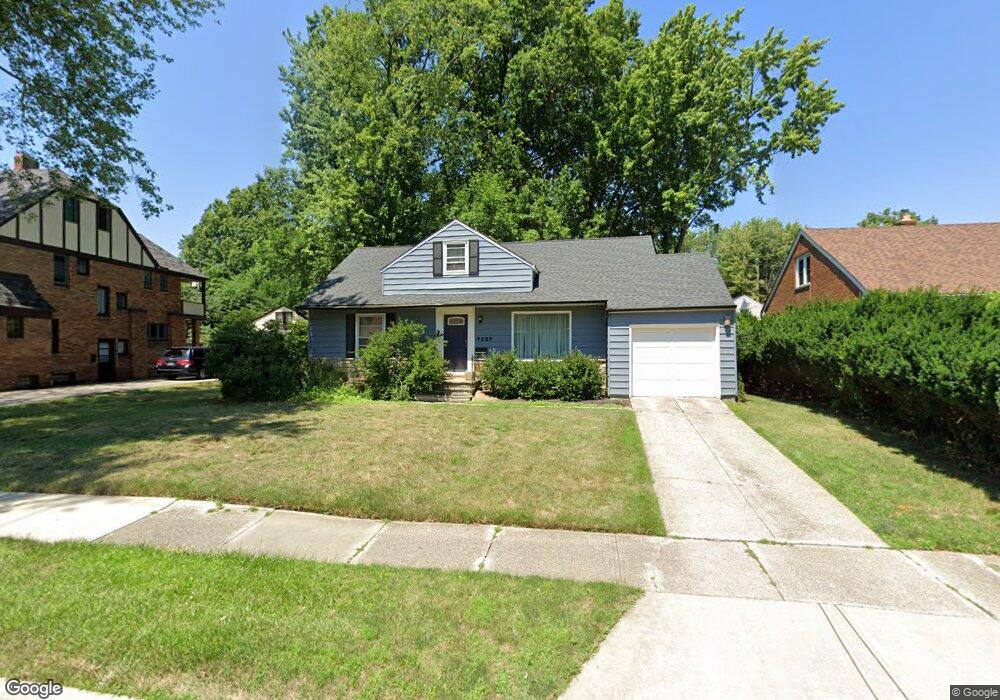
4229 Plymouth Dr South Euclid, OH 44121
Estimated Value: $180,000 - $193,000
3
Beds
2
Baths
1,708
Sq Ft
$110/Sq Ft
Est. Value
About This Home
This home is located at 4229 Plymouth Dr, South Euclid, OH 44121 and is currently estimated at $187,258, approximately $109 per square foot. 4229 Plymouth Dr is a home located in Cuyahoga County with nearby schools including Adrian Elementary School, Greenview Upper Elementary School, and Memorial Junior High School.
Ownership History
Date
Name
Owned For
Owner Type
Purchase Details
Closed on
Jan 21, 2004
Sold by
Clair John F
Bought by
Didion Jamie A
Current Estimated Value
Home Financials for this Owner
Home Financials are based on the most recent Mortgage that was taken out on this home.
Original Mortgage
$64,000
Outstanding Balance
$29,951
Interest Rate
5.91%
Mortgage Type
Purchase Money Mortgage
Estimated Equity
$157,307
Purchase Details
Closed on
Oct 23, 2001
Sold by
Rini Martha M
Bought by
Clair John F
Home Financials for this Owner
Home Financials are based on the most recent Mortgage that was taken out on this home.
Original Mortgage
$101,000
Interest Rate
6.88%
Purchase Details
Closed on
Jan 1, 1975
Bought by
Rini Martha M
Create a Home Valuation Report for This Property
The Home Valuation Report is an in-depth analysis detailing your home's value as well as a comparison with similar homes in the area
Home Values in the Area
Average Home Value in this Area
Purchase History
| Date | Buyer | Sale Price | Title Company |
|---|---|---|---|
| Didion Jamie A | $119,000 | Midland Title Agency | |
| Clair John F | $109,000 | Midland Title Security Inc | |
| Rini Martha M | -- | -- |
Source: Public Records
Mortgage History
| Date | Status | Borrower | Loan Amount |
|---|---|---|---|
| Open | Didion Jamie A | $64,000 | |
| Previous Owner | Clair John F | $101,000 |
Source: Public Records
Tax History Compared to Growth
Tax History
| Year | Tax Paid | Tax Assessment Tax Assessment Total Assessment is a certain percentage of the fair market value that is determined by local assessors to be the total taxable value of land and additions on the property. | Land | Improvement |
|---|---|---|---|---|
| 2024 | $4,427 | $57,785 | $9,975 | $47,810 |
| 2023 | $3,673 | $38,370 | $8,020 | $30,350 |
| 2022 | $3,654 | $38,360 | $8,015 | $30,345 |
| 2021 | $3,626 | $38,360 | $8,020 | $30,350 |
| 2020 | $3,392 | $31,190 | $6,510 | $24,680 |
| 2019 | $3,101 | $89,100 | $18,600 | $70,500 |
| 2018 | $3,030 | $31,190 | $6,510 | $24,680 |
| 2017 | $3,065 | $28,390 | $6,410 | $21,980 |
| 2016 | $3,046 | $28,390 | $6,410 | $21,980 |
| 2015 | $3,098 | $28,390 | $6,410 | $21,980 |
| 2014 | $3,098 | $29,900 | $6,760 | $23,140 |
Source: Public Records
Map
Nearby Homes
- 4258 Bluestone Rd
- 963 Chelston Rd
- 1089 Argonne Rd
- 1114 Piermont Rd
- 4289 Swaffield Dr
- 1129 Homestead Rd
- 1105 Winston Rd
- 1129 Avondale Rd
- 1164 S Belvoir Blvd
- 1166 Argonne Rd
- 857 Quarry Dr
- 925 Keystone Dr
- 1117 Allston Rd
- 4400 Angela Dr
- 854 Keystone Dr
- 1157 Sylvania Rd
- 868 Haywood Dr
- 1148 Sylvania Rd
- 1231 Winston Rd
- 4090 Princeton Blvd
- 4241 Plymouth Dr
- 4225 Plymouth Dr
- 960 Murray Rd
- 4221 Plymouth Dr
- 956 Murray Rd
- 4230 Plymouth Dr
- 4249 Plymouth Dr
- 4238 Plymouth Dr
- 4226 Plymouth Dr
- 4217 Plymouth Dr
- 4216 Bluestone Rd
- 4242 Plymouth Dr
- 4222 Plymouth Dr
- 4253 Plymouth Dr
- 4246 Plymouth Dr
- 4218 Plymouth Dr
- 959 Murray Rd
- 971 S Belvoir Blvd
- 4212 Bluestone Rd
- 951 Murray Rd