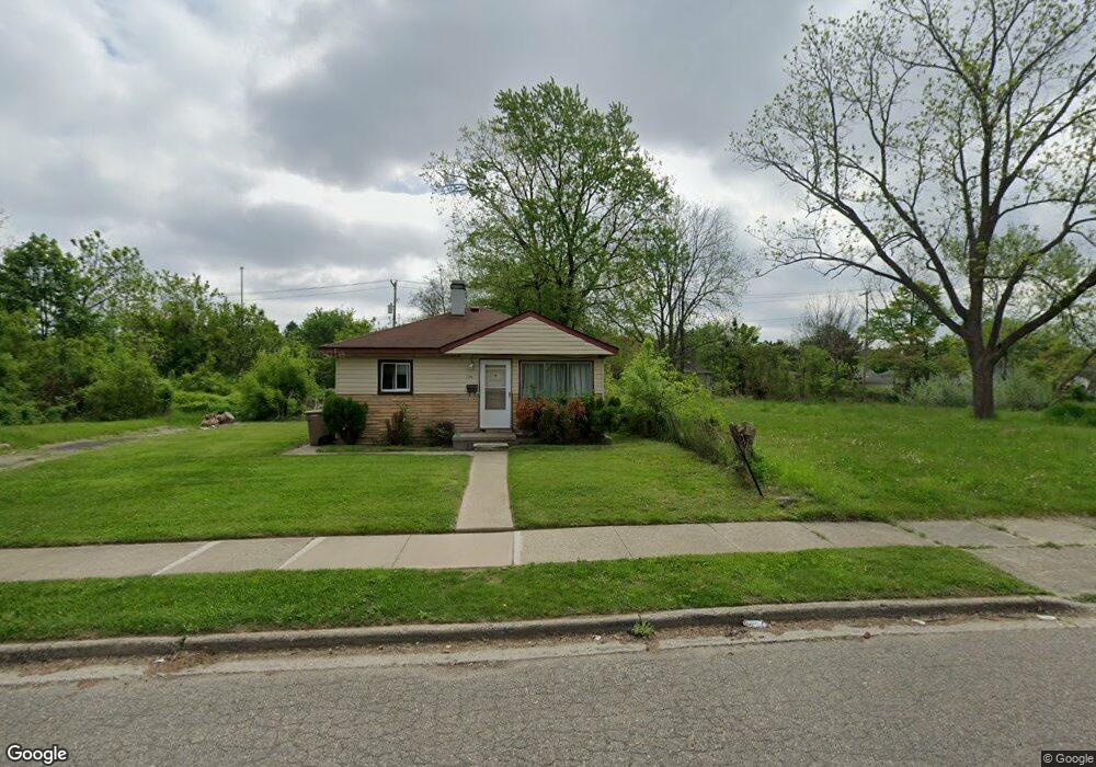
423 Bloomfield Ave Pontiac, MI 48341
Estimated Value: $90,591 - $140,000
3
Beds
1
Bath
1,014
Sq Ft
$116/Sq Ft
Est. Value
About This Home
This home is located at 423 Bloomfield Ave, Pontiac, MI 48341 and is currently estimated at $117,898, approximately $116 per square foot. 423 Bloomfield Ave is a home located in Oakland County with nearby schools including Walt Whitman Elementary School, Pontiac Middle School, and Pontiac High School.
Ownership History
Date
Name
Owned For
Owner Type
Purchase Details
Closed on
Feb 18, 2009
Sold by
Secretary Of Housing & Urban Development
Bought by
Perry Annie
Current Estimated Value
Purchase Details
Closed on
May 8, 2007
Sold by
West Diane and Craft Willie Mary
Bought by
Wells Fargo Bank Na
Purchase Details
Closed on
May 7, 2007
Sold by
Wells Fargo Bank Na
Bought by
Hud
Purchase Details
Closed on
Dec 18, 1998
Sold by
Campbell Edward E
Bought by
West Diane M
Home Financials for this Owner
Home Financials are based on the most recent Mortgage that was taken out on this home.
Original Mortgage
$56,550
Interest Rate
6.79%
Create a Home Valuation Report for This Property
The Home Valuation Report is an in-depth analysis detailing your home's value as well as a comparison with similar homes in the area
Home Values in the Area
Average Home Value in this Area
Purchase History
| Date | Buyer | Sale Price | Title Company |
|---|---|---|---|
| Perry Annie | $3,000 | None Available | |
| Wells Fargo Bank Na | $65,692 | None Available | |
| Hud | -- | None Available | |
| West Diane M | $57,000 | -- |
Source: Public Records
Mortgage History
| Date | Status | Borrower | Loan Amount |
|---|---|---|---|
| Previous Owner | West Diane M | $56,550 |
Source: Public Records
Tax History Compared to Growth
Tax History
| Year | Tax Paid | Tax Assessment Tax Assessment Total Assessment is a certain percentage of the fair market value that is determined by local assessors to be the total taxable value of land and additions on the property. | Land | Improvement |
|---|---|---|---|---|
| 2024 | $622 | $24,840 | $0 | $0 |
| 2023 | $593 | $22,640 | $0 | $0 |
| 2022 | $1,748 | $19,580 | $0 | $0 |
| 2021 | $1,872 | $17,490 | $0 | $0 |
| 2020 | $540 | $15,780 | $0 | $0 |
| 2019 | $588 | $13,710 | $0 | $0 |
| 2018 | $831 | $11,790 | $0 | $0 |
| 2017 | $538 | $11,620 | $0 | $0 |
| 2016 | $2,006 | $11,180 | $0 | $0 |
| 2015 | -- | $10,230 | $0 | $0 |
| 2014 | -- | $9,000 | $0 | $0 |
| 2011 | -- | $16,310 | $0 | $0 |
Source: Public Records
Map
Nearby Homes
- 371 Nebraska Ave
- 499 Bloomfield Ave
- 151 South Blvd W
- 567 Highland Ave
- 472 Wyoming Ave
- 466 Colorado Ave
- 200 Cedardale Ave
- 587 California Ave
- 485 Colorado Ave
- 200 Crystal Lake Dr
- 305 South Blvd W
- 598 Montana Ave
- 534 Nevada Ave
- 228 Hughes Ave
- 232 Hughes Ave
- 240 Hughes Ave
- 215 Hughes Ave
- 185 Hughes Ave
- 248 Hughes Ave
- 533 California Ave
- 429 Bloomfield Ave
- 409 Bloomfield Ave
- 418 Howland Ave
- 432 Howland Ave
- 412 Howland Ave
- 428 Bloomfield Ave
- 428 Howland Ave
- 422 Bloomfield Ave
- 443 Bloomfield Ave
- 432 Bloomfield Ave
- 438 Howland Ave
- 408 Howland Ave
- 442 Bloomfield Ave
- 398 Howland Ave
- 398 Bloomfield Ave
- 453 Bloomfield Ave
- 452 Howland Ave
- 423 Highland Ave
- 452 Bloomfield Ave
- 407 Highland Ave