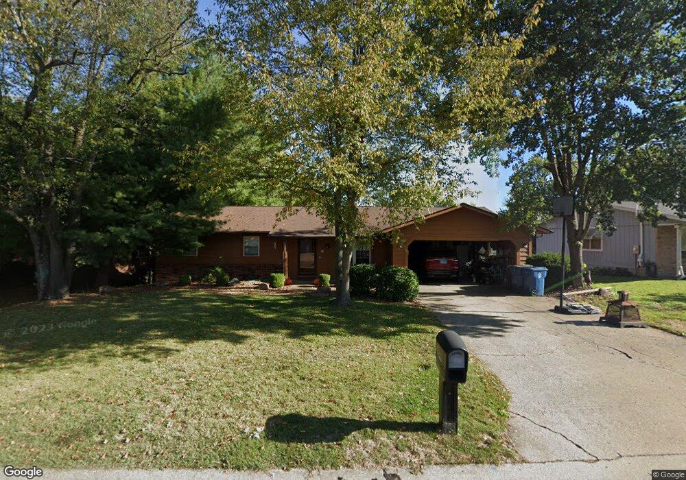
423 Chapel Dr Collinsville, IL 62234
Estimated Value: $248,525 - $283,000
4
Beds
2
Baths
1,344
Sq Ft
$195/Sq Ft
Est. Value
About This Home
This home is located at 423 Chapel Dr, Collinsville, IL 62234 and is currently estimated at $262,381, approximately $195 per square foot. 423 Chapel Dr is a home located in Madison County with nearby schools including John A Renfro Elementary School, Dorris Intermediate School, and Collinsville Middle School.
Ownership History
Date
Name
Owned For
Owner Type
Purchase Details
Closed on
May 14, 2004
Sold by
Palumbo Peter C and Palumbo Mary Ann
Bought by
Cates Matthew J and Cates Kimberly A
Current Estimated Value
Home Financials for this Owner
Home Financials are based on the most recent Mortgage that was taken out on this home.
Original Mortgage
$141,300
Outstanding Balance
$67,877
Interest Rate
5.85%
Mortgage Type
Purchase Money Mortgage
Estimated Equity
$194,504
Create a Home Valuation Report for This Property
The Home Valuation Report is an in-depth analysis detailing your home's value as well as a comparison with similar homes in the area
Home Values in the Area
Average Home Value in this Area
Purchase History
| Date | Buyer | Sale Price | Title Company |
|---|---|---|---|
| Cates Matthew J | $157,000 | Abstracts & Titles Inc |
Source: Public Records
Mortgage History
| Date | Status | Borrower | Loan Amount |
|---|---|---|---|
| Open | Cates Matthew J | $141,300 |
Source: Public Records
Tax History Compared to Growth
Tax History
| Year | Tax Paid | Tax Assessment Tax Assessment Total Assessment is a certain percentage of the fair market value that is determined by local assessors to be the total taxable value of land and additions on the property. | Land | Improvement |
|---|---|---|---|---|
| 2024 | $4,193 | $71,590 | $14,650 | $56,940 |
| 2023 | $4,193 | $65,360 | $13,330 | $52,030 |
| 2022 | $3,907 | $60,440 | $12,330 | $48,110 |
| 2021 | $3,508 | $56,780 | $11,580 | $45,200 |
| 2020 | $3,363 | $54,180 | $11,050 | $43,130 |
| 2019 | $3,008 | $48,760 | $10,310 | $38,450 |
| 2018 | $2,928 | $46,190 | $9,770 | $36,420 |
| 2017 | $2,923 | $45,280 | $9,580 | $35,700 |
| 2016 | $3,070 | $45,280 | $9,580 | $35,700 |
| 2015 | $3,294 | $44,100 | $9,330 | $34,770 |
| 2014 | $3,294 | $44,100 | $9,330 | $34,770 |
| 2013 | $3,294 | $44,100 | $9,330 | $34,770 |
Source: Public Records
Map
Nearby Homes
- 414 Bunker Hill Dr
- 22 Brookwood Dr
- 5 Brookwood Dr
- 10 White Lily Dr
- 1224 Cedar Ridge Ct
- 0 N Keebler Ave
- 2007 Belt Line Rd
- 203 Greenfield Dr
- 1121 Carraway Ct
- 1120 Williams St
- 308 Brown Ave
- 123 Elliot St
- 1059 Lafayette Ct Unit A
- 1035 Lafayette Ct Unit B
- 1051 Lafayette Ct Unit A
- 1210 Constance St
- 0 Strong Ave
- 617 N Morrison Ave
- 123 W Wickliffe Ave
- 580 N Guernsey St