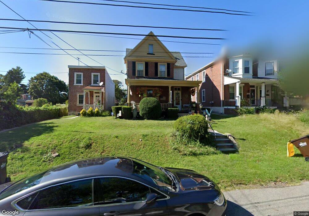
423 Forrest Ave Norristown, PA 19401
West Norriton Township NeighborhoodEstimated Value: $278,000 - $355,361
3
Beds
1
Bath
1,536
Sq Ft
$199/Sq Ft
Est. Value
About This Home
This home is located at 423 Forrest Ave, Norristown, PA 19401 and is currently estimated at $306,340, approximately $199 per square foot. 423 Forrest Ave is a home located in Montgomery County with nearby schools including Charles Blockson Middle School, Marshall Street Elementary School, and East Norriton Middle School.
Ownership History
Date
Name
Owned For
Owner Type
Purchase Details
Closed on
Oct 29, 2025
Sold by
Davenport Daymond E and Davenport Paula
Bought by
Wilsman Re 5 Llc
Current Estimated Value
Purchase Details
Closed on
Jul 10, 1998
Sold by
Boyd George Rae and Boyd Dorothy K
Bought by
Davenport Daymond E and Davenport Paula
Purchase Details
Closed on
Dec 16, 1996
Sold by
Boyd George Rae
Bought by
Boyd George Rae and Boyd Dorothy K
Create a Home Valuation Report for This Property
The Home Valuation Report is an in-depth analysis detailing your home's value as well as a comparison with similar homes in the area
Home Values in the Area
Average Home Value in this Area
Purchase History
| Date | Buyer | Sale Price | Title Company |
|---|---|---|---|
| Wilsman Re 5 Llc | $255,000 | Brendan Abstract | |
| Davenport Daymond E | $96,000 | -- | |
| Boyd George Rae | -- | -- |
Source: Public Records
Tax History Compared to Growth
Tax History
| Year | Tax Paid | Tax Assessment Tax Assessment Total Assessment is a certain percentage of the fair market value that is determined by local assessors to be the total taxable value of land and additions on the property. | Land | Improvement |
|---|---|---|---|---|
| 2025 | $5,274 | $107,960 | $35,780 | $72,180 |
| 2024 | $5,274 | $107,960 | $35,780 | $72,180 |
| 2023 | $5,214 | $107,960 | $35,780 | $72,180 |
| 2022 | $5,181 | $107,960 | $35,780 | $72,180 |
| 2021 | $5,150 | $107,960 | $35,780 | $72,180 |
| 2020 | $4,996 | $107,960 | $35,780 | $72,180 |
| 2019 | $4,884 | $107,960 | $35,780 | $72,180 |
| 2018 | $3,739 | $107,960 | $35,780 | $72,180 |
| 2017 | $4,611 | $107,960 | $35,780 | $72,180 |
| 2016 | $4,569 | $107,960 | $35,780 | $72,180 |
| 2015 | $4,232 | $107,960 | $35,780 | $72,180 |
| 2014 | $4,232 | $107,960 | $35,780 | $72,180 |
Source: Public Records
Map
Nearby Homes
- 41 Centre Ave
- 89 Centre Ave
- 0 Centre Unit 430 PAMC2099854
- 621 N Forrest
- 627 Forrest Ave
- 134 W Main St
- 150 Forrest Ave
- 16 Forrest Ave
- 1635 W Marshall W Marshall St
- 1009 W Main St
- 243 Buttonwood St
- 1633 Williams Way
- 907 W Airy St
- 612 Glen Ln Unit 56A
- 905 W Marshall St
- 725 Noble St
- 208 Stanbridge St Unit 35
- 721 Stanbridge St
- 214 Oxford Cir
- 827 Buttonwood St
- 425 Forrest Ave
- 421 Forrest Ave
- 427 Forrest Ave
- 431 Forrest Ave
- 415 Forrest Ave
- 435 Forrest Ave
- 413 N Forrest Ave
- 413 Forrest Ave
- 439 Forrest Ave
- 437 Forrest Ave
- 409 Forrest Ave
- 54 Centre Ave Unit 70
- 52 Centre Ave
- 64 Centre Ave
- 441 Forrest Ave
- 46 Centre Ave
- 443 Forrest Ave
- 445 N Forrest Ave
- 445 Forrest Ave
- 40 Centre Ave