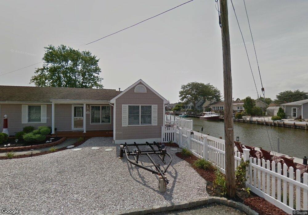
423 Middle Branch Dr Forked River, NJ 08731
Estimated Value: $579,000 - $659,000
4
Beds
2
Baths
1,694
Sq Ft
$368/Sq Ft
Est. Value
About This Home
This home is located at 423 Middle Branch Dr, Forked River, NJ 08731 and is currently estimated at $623,001, approximately $367 per square foot. 423 Middle Branch Dr is a home located in Ocean County with nearby schools including Lacey Township High School.
Ownership History
Date
Name
Owned For
Owner Type
Purchase Details
Closed on
Mar 22, 2004
Sold by
Reavis Paul B and Reavis Marie M
Bought by
Silvestri Albert
Current Estimated Value
Home Financials for this Owner
Home Financials are based on the most recent Mortgage that was taken out on this home.
Original Mortgage
$37,500
Outstanding Balance
$17,524
Interest Rate
5.56%
Mortgage Type
Stand Alone Second
Estimated Equity
$605,477
Purchase Details
Closed on
Mar 6, 1998
Sold by
Reavis Marie and Stein Marie
Bought by
Reavis Paul B and Reavis Marie M
Home Financials for this Owner
Home Financials are based on the most recent Mortgage that was taken out on this home.
Original Mortgage
$35,000
Interest Rate
6.98%
Create a Home Valuation Report for This Property
The Home Valuation Report is an in-depth analysis detailing your home's value as well as a comparison with similar homes in the area
Home Values in the Area
Average Home Value in this Area
Purchase History
| Date | Buyer | Sale Price | Title Company |
|---|---|---|---|
| Silvestri Albert | $375,000 | New Jersey Title Ins Co | |
| Reavis Paul B | -- | -- |
Source: Public Records
Mortgage History
| Date | Status | Borrower | Loan Amount |
|---|---|---|---|
| Open | Silvestri Albert | $37,500 | |
| Open | Silvestri Albert | $300,000 | |
| Previous Owner | Reavis Paul B | $35,000 |
Source: Public Records
Tax History
| Year | Tax Paid | Tax Assessment Tax Assessment Total Assessment is a certain percentage of the fair market value that is determined by local assessors to be the total taxable value of land and additions on the property. | Land | Improvement |
|---|---|---|---|---|
| 2025 | $8,020 | $316,500 | $171,800 | $144,700 |
| 2024 | $7,498 | $316,500 | $171,800 | $144,700 |
| 2023 | $7,162 | $316,500 | $171,800 | $144,700 |
| 2022 | $7,162 | $316,500 | $171,800 | $144,700 |
| 2021 | $7,042 | $316,500 | $171,800 | $144,700 |
| 2020 | $6,817 | $316,500 | $171,800 | $144,700 |
| 2019 | $6,697 | $316,500 | $171,800 | $144,700 |
| 2018 | $6,618 | $316,500 | $171,800 | $144,700 |
| 2017 | $6,466 | $316,500 | $171,800 | $144,700 |
| 2016 | $6,441 | $316,500 | $171,800 | $144,700 |
| 2015 | $6,153 | $316,500 | $171,800 | $144,700 |
| 2014 | $7,040 | $409,300 | $271,800 | $137,500 |
Source: Public Records
Map
Nearby Homes
- 10 Dolphin Ct
- 404 Beach Blvd
- 69 Saltspray Dr
- 75 Saltspray Dr
- 79 Saltspray Dr
- 463 Ensign Rd
- 72 Saltspray Dr
- 615 Beach Blvd
- 123 Oakwood Place
- 217 Nantucket Rd
- 417 Riverview Rd
- 9 Hollywood Blvd S
- 635 Oakwood Dr
- 634 Fairview Ln
- 22 Saltspray Dr
- 102 Maria Loretta Ln
- 703 Chesapeake Dr
- 126 Bay Ave
- 117 E Lacey Rd
- 1 Thropp Rd
- 422 Middle Branch Dr
- 421 Middle Branch Dr
- 424 Middle Branch Dr
- 425 Middle Branch Dr
- 312 Richard Rd
- 412 Whyatt Ct
- 313 Richard Rd
- 426 Middle Branch Dr
- 414 Whyatt Ct
- 420 Middle Branch Dr
- 416 Whyatt Ct
- 427 Middle Branch Dr
- 314 Richard Rd
- 410 Whyatt Ct
- 0 Middle Branch Dr Unit NJOC217938
- 311 Richard Rd
- 428 Middle Branch Dr
- 310 Richard Rd
- 408 Whyatt Ct
- 316 Richard Rd
Your Personal Tour Guide
Ask me questions while you tour the home.