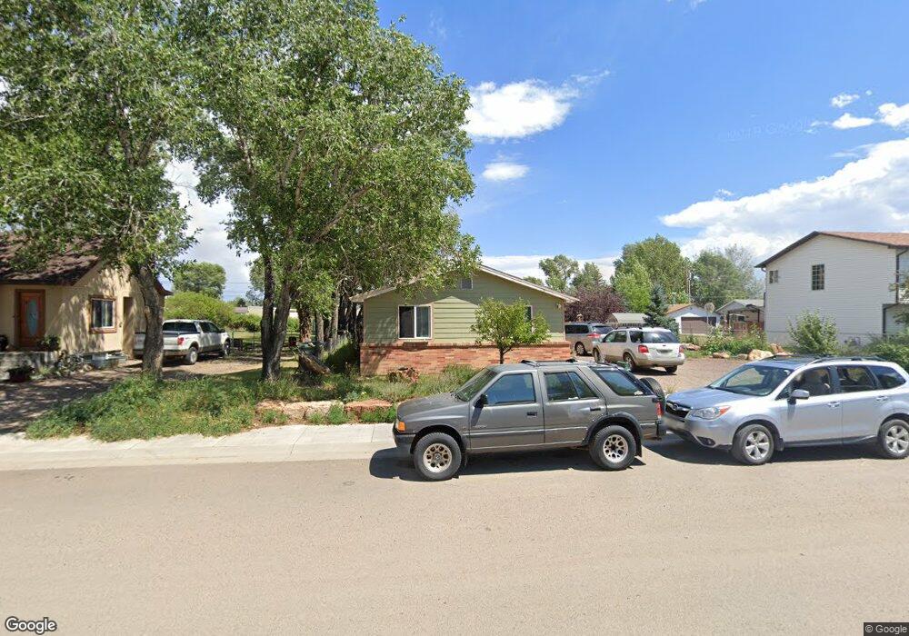
423 S Grant St Laramie, WY 82070
Estimated Value: $195,000 - $291,000
3
Beds
1
Bath
936
Sq Ft
$250/Sq Ft
Est. Value
About This Home
This home is located at 423 S Grant St, Laramie, WY 82070 and is currently estimated at $233,616, approximately $249 per square foot. 423 S Grant St is a home located in Albany County with nearby schools including Velma Linford Elementary School, Laramie Middle School, and Laramie High School.
Ownership History
Date
Name
Owned For
Owner Type
Purchase Details
Closed on
Dec 16, 2005
Sold by
Anderson Gregory John and Anderson Tamara Louise
Bought by
Deberard Jennifer Lee Malmskog and Deberard Stephen Josh
Current Estimated Value
Home Financials for this Owner
Home Financials are based on the most recent Mortgage that was taken out on this home.
Original Mortgage
$22,600
Interest Rate
6.3%
Mortgage Type
Future Advance Clause Open End Mortgage
Create a Home Valuation Report for This Property
The Home Valuation Report is an in-depth analysis detailing your home's value as well as a comparison with similar homes in the area
Home Values in the Area
Average Home Value in this Area
Purchase History
| Date | Buyer | Sale Price | Title Company |
|---|---|---|---|
| Deberard Jennifer Lee Malmskog | -- | -- |
Source: Public Records
Mortgage History
| Date | Status | Borrower | Loan Amount |
|---|---|---|---|
| Closed | Deberard Jennifer Lee Malmskog | $22,600 |
Source: Public Records
Tax History Compared to Growth
Tax History
| Year | Tax Paid | Tax Assessment Tax Assessment Total Assessment is a certain percentage of the fair market value that is determined by local assessors to be the total taxable value of land and additions on the property. | Land | Improvement |
|---|---|---|---|---|
| 2025 | $1,140 | $12,186 | $3,687 | $8,499 |
| 2024 | $1,140 | $15,622 | $4,726 | $10,896 |
| 2023 | $1,125 | $15,408 | $4,726 | $10,682 |
| 2022 | $998 | $13,677 | $4,726 | $8,951 |
| 2021 | $915 | $12,536 | $4,726 | $7,810 |
| 2020 | $867 | $11,875 | $4,294 | $7,581 |
| 2019 | $804 | $11,014 | $4,294 | $6,720 |
| 2018 | $728 | $9,979 | $3,642 | $6,337 |
| 2017 | $731 | $10,018 | $3,642 | $6,376 |
| 2016 | $707 | $9,679 | $3,500 | $6,179 |
| 2015 | $749 | $10,254 | $4,787 | $5,467 |
| 2014 | $741 | $10,149 | $0 | $0 |
Source: Public Records
Map
Nearby Homes
- 541 S Johnson St
- 1012 A-B S Colorado Ave
- 627 S Colorado Ave
- 416 Arthur St
- 370 S Buchanan St
- 2075 Jefferson St
- 2166 W Wyoming Ave Unit 29
- 2166 W Wyoming Ave Unit 25
- 1990 Truman St
- 2260 Franklin St Unit 27
- 2260 Franklin St Unit 38
- 1416 S Colorado Ave
- 1414 S Colorado Ave
- 1412 S Colorado Ave
- 1410 S Colorado Ave
- 427 S Pierce St
- 529 S Pierce St
- 1866 Truman St
- 174 N Colorado Ave
- 8 Star Struck Ln
- 419 S Grant St
- 431 S Grant St
- 2269 Harrison St
- 2265 Harrison St
- 2261 Harrison St
- 434 S Grant St
- 430 S Johnson St
- 2278 Snowy Range Rd
- 424 S Grant St
- 2361 Harrison St
- 436 S Johnson St
- 408 S Johnson St
- 505 S Grant St
- 2262 Harrison St
- 2364 Snowy Range Rd
- 507 S Grant St
- 504 S Grant St
- 2371 W Harrison St
- 2372 Snowy Range Rd
- 515 S Grant St