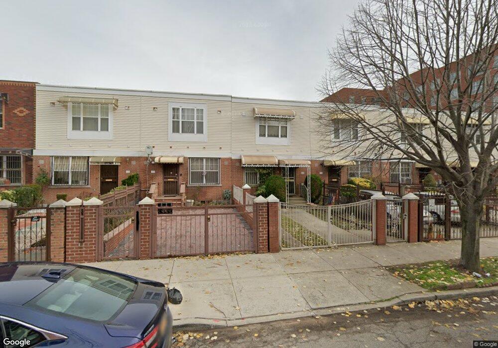
423 Snediker Ave Brooklyn, NY 11207
Brownsville NeighborhoodEstimated Value: $535,348 - $703,000
--
Bed
--
Bath
1,332
Sq Ft
$477/Sq Ft
Est. Value
About This Home
This home is located at 423 Snediker Ave, Brooklyn, NY 11207 and is currently estimated at $634,837, approximately $476 per square foot. 423 Snediker Ave is a home located in Kings County with nearby schools including Brooklyn Gardens Elementary School, J.H.S 292 Margaret S. Douglas, and Hyde Leadership Charter School-Brooklyn.
Ownership History
Date
Name
Owned For
Owner Type
Purchase Details
Closed on
Dec 11, 1997
Sold by
Nehemiah Housing Development Fund Co Inc
Bought by
Simpson Millicent M
Current Estimated Value
Home Financials for this Owner
Home Financials are based on the most recent Mortgage that was taken out on this home.
Original Mortgage
$65,000
Interest Rate
7.11%
Create a Home Valuation Report for This Property
The Home Valuation Report is an in-depth analysis detailing your home's value as well as a comparison with similar homes in the area
Home Values in the Area
Average Home Value in this Area
Purchase History
| Date | Buyer | Sale Price | Title Company |
|---|---|---|---|
| Simpson Millicent M | $93,000 | -- |
Source: Public Records
Mortgage History
| Date | Status | Borrower | Loan Amount |
|---|---|---|---|
| Previous Owner | Simpson Millicent M | $65,000 | |
| Closed | Simpson Millicent M | $20,000 |
Source: Public Records
Tax History Compared to Growth
Tax History
| Year | Tax Paid | Tax Assessment Tax Assessment Total Assessment is a certain percentage of the fair market value that is determined by local assessors to be the total taxable value of land and additions on the property. | Land | Improvement |
|---|---|---|---|---|
| 2025 | $4,717 | $34,560 | $10,380 | $24,180 |
| 2024 | $4,717 | $39,780 | $10,380 | $29,400 |
| 2023 | $4,580 | $36,360 | $10,380 | $25,980 |
| 2022 | $4,471 | $32,040 | $10,380 | $21,660 |
| 2021 | $4,551 | $29,520 | $10,380 | $19,140 |
| 2020 | $3,413 | $24,960 | $10,380 | $14,580 |
| 2019 | $4,045 | $24,960 | $10,380 | $14,580 |
| 2018 | $3,772 | $19,962 | $10,068 | $9,894 |
| 2017 | $3,502 | $19,860 | $7,758 | $12,102 |
| 2016 | $3,043 | $19,192 | $7,090 | $12,102 |
| 2015 | $1,060 | $18,109 | $6,007 | $12,102 |
| 2014 | $1,060 | $17,280 | $5,178 | $12,102 |
Source: Public Records
Map
Nearby Homes
- 406 Hinsdale St
- 533 Snediker Ave
- 440 Blake Ave
- 297 Hinsdale St
- 541 Hinsdale St
- 576 Williams Ave
- 578 Williams Ave
- 582 Williams Ave
- 442 Newport St
- 606 Alabama Ave
- 637 Blake Ave
- 584 Hinsdale St
- 610 Alabama Ave
- 546 Powell St
- 589 Hinsdale St
- 563 Powell St
- 699 Sackman St
- 353 Pennsylvania Ave
- 444 New Jersey Ave
- 650 Williams Ave
- 425 Snediker Ave
- 427 Snediker Ave
- 429 Snediker Ave
- 421 Snediker Ave
- 419 Snediker Ave
- 431 Snediker Ave
- 417 Snediker Ave
- 433 Snediker Ave
- 415 Snediker Ave
- 426 Hinsdale St
- 422 Hinsdale St
- 413 Snediker Ave
- 428 Hinsdale St
- 420 Hinsdale St
- 430 Hinsdale St
- 418 Hinsdale St
- 416 Hinsdale St
- 411 Snediker Ave
- 432 Hinsdale St
- 414 Hinsdale St