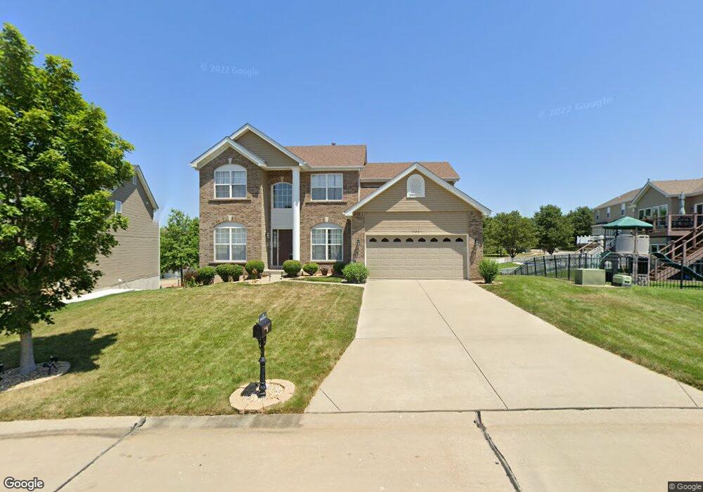
423 Wynding Gate Dr Lake Saint Louis, MO 63367
Estimated Value: $521,483 - $575,000
4
Beds
3
Baths
2,808
Sq Ft
$195/Sq Ft
Est. Value
About This Home
This home is located at 423 Wynding Gate Dr, Lake Saint Louis, MO 63367 and is currently estimated at $546,621, approximately $194 per square foot. 423 Wynding Gate Dr is a home with nearby schools including Duello Elementary School, Frontier Middle School, and Liberty High School.
Ownership History
Date
Name
Owned For
Owner Type
Purchase Details
Closed on
Jul 25, 2012
Sold by
Mcbride Wyndgate Llc
Bought by
Carroll Shelia D
Current Estimated Value
Home Financials for this Owner
Home Financials are based on the most recent Mortgage that was taken out on this home.
Original Mortgage
$268,766
Outstanding Balance
$184,026
Interest Rate
3.5%
Mortgage Type
FHA
Estimated Equity
$362,595
Purchase Details
Closed on
Oct 21, 2010
Sold by
Regions Bank
Bought by
Mcbride Wyndgate Llc
Create a Home Valuation Report for This Property
The Home Valuation Report is an in-depth analysis detailing your home's value as well as a comparison with similar homes in the area
Home Values in the Area
Average Home Value in this Area
Purchase History
| Date | Buyer | Sale Price | Title Company |
|---|---|---|---|
| Carroll Shelia D | $275,757 | Dependable Title Llc | |
| Mcbride Wyndgate Llc | -- | Benchmark Title Llc |
Source: Public Records
Mortgage History
| Date | Status | Borrower | Loan Amount |
|---|---|---|---|
| Open | Carroll Shelia D | $268,766 | |
| Closed | Mcbride Wyndgate Llc | $0 |
Source: Public Records
Tax History Compared to Growth
Tax History
| Year | Tax Paid | Tax Assessment Tax Assessment Total Assessment is a certain percentage of the fair market value that is determined by local assessors to be the total taxable value of land and additions on the property. | Land | Improvement |
|---|---|---|---|---|
| 2025 | $5,713 | $87,130 | -- | -- |
| 2023 | $5,718 | $83,652 | $0 | $0 |
| 2022 | $4,781 | $65,155 | $0 | $0 |
| 2021 | $4,792 | $65,155 | $0 | $0 |
| 2020 | $4,562 | $59,595 | $0 | $0 |
| 2019 | $4,282 | $59,595 | $0 | $0 |
| 2018 | $4,277 | $56,644 | $0 | $0 |
| 2017 | $4,251 | $56,644 | $0 | $0 |
| 2016 | $4,099 | $52,395 | $0 | $0 |
| 2015 | $4,038 | $52,395 | $0 | $0 |
| 2014 | $3,690 | $51,346 | $0 | $0 |
Source: Public Records
Map
Nearby Homes
- 522 Long Creek Dr
- 497 Parkgate Dr
- 31 Briscoe Glen Ct
- 125 Far Meadow Dr
- 113 Wyndcrest Ct
- 126 Far Meadow Dr
- 422 Parkgate Dr
- 104 Long Pass Ct
- 427 Parkgate Dr
- 821 Topsfield Dr
- 396 Haycastle Dr
- 2001 Paul Renaud Blvd
- 1733 Briarmanor Dr
- 209 Wyndemere Ln
- 1832 English Oak Dr
- 8085 Glen Arbor Dr
- 339 Wyndemere Dr
- 0 Unknown Unit MIS25067021
- 0 Unknown Unit MIS25067020
- 0 Unknown Unit MIS25067019
- 421 Wynding Gate Dr
- 1053 Wyndgate Ridge Dr
- 1051 Wyndgate Ridge Dr
- 419 Wynding Gate Dr
- 419 Wynding Gate Dr Unit 524
- 306 Graywynd Ct
- 308 Graywynd *Lot 207 Ct
- 420 Wynding Gate Dr
- 308 Graywynd Ct
- 1055 Wyndgate Ridge Dr
- 1055 Wyndgate Ridge Dr Unit 623
- 308*Lot 207 Graywynd Ct
- 1003 Wyndgate Ridge Dr
- 417 Wynding Gate Dr
- 310 Graywynd Ct
- 304 Graywynd Ct
- 1054 Wyndgate Ridge Dr
- 1057 Wyndgate Ridge Dr
- 1057 Wyndgate Ridge Dr Unit 622
- 1056 Wyndgate Ridge Dr