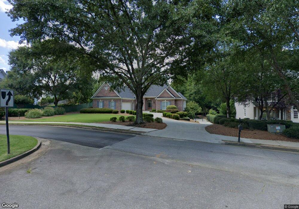
4231 Frank Neely Rd Unit 11 Norcross, GA 30092
Estimated Value: $812,173 - $1,030,000
3
Beds
3
Baths
2,959
Sq Ft
$323/Sq Ft
Est. Value
About This Home
This home is located at 4231 Frank Neely Rd Unit 11, Norcross, GA 30092 and is currently estimated at $955,293, approximately $322 per square foot. 4231 Frank Neely Rd Unit 11 is a home located in Gwinnett County with nearby schools including Simpson Elementary School, Pinckneyville Middle School, and Norcross High School.
Ownership History
Date
Name
Owned For
Owner Type
Purchase Details
Closed on
Jan 28, 2005
Sold by
Hinson James R and Hinson Anne
Bought by
Monthie David
Current Estimated Value
Purchase Details
Closed on
May 11, 1994
Sold by
Dexter Williams Props Inc
Bought by
Hinson James R Anne M
Home Financials for this Owner
Home Financials are based on the most recent Mortgage that was taken out on this home.
Original Mortgage
$212,000
Interest Rate
8.48%
Create a Home Valuation Report for This Property
The Home Valuation Report is an in-depth analysis detailing your home's value as well as a comparison with similar homes in the area
Home Values in the Area
Average Home Value in this Area
Purchase History
| Date | Buyer | Sale Price | Title Company |
|---|---|---|---|
| Monthie David | $459,900 | -- | |
| Hinson James R Anne M | $266,700 | -- |
Source: Public Records
Mortgage History
| Date | Status | Borrower | Loan Amount |
|---|---|---|---|
| Previous Owner | Hinson James R Anne M | $212,000 |
Source: Public Records
Tax History Compared to Growth
Tax History
| Year | Tax Paid | Tax Assessment Tax Assessment Total Assessment is a certain percentage of the fair market value that is determined by local assessors to be the total taxable value of land and additions on the property. | Land | Improvement |
|---|---|---|---|---|
| 2025 | $2,061 | $299,200 | $64,000 | $235,200 |
| 2024 | $2,035 | $299,200 | $64,000 | $235,200 |
| 2023 | $2,035 | $308,520 | $64,000 | $244,520 |
| 2022 | $2,024 | $270,320 | $52,000 | $218,320 |
| 2021 | $2,019 | $255,160 | $49,840 | $205,320 |
| 2020 | $2,014 | $255,160 | $49,840 | $205,320 |
| 2019 | $1,852 | $191,120 | $36,000 | $155,120 |
| 2018 | $1,847 | $191,120 | $36,000 | $155,120 |
| 2016 | $5,301 | $163,200 | $36,000 | $127,200 |
| 2015 | $5,355 | $163,200 | $36,000 | $127,200 |
| 2014 | $5,115 | $157,320 | $34,240 | $123,080 |
Source: Public Records
Map
Nearby Homes
- 4291 River Bottom Dr
- 4405 River Trail Dr
- 6169 Poplar Bluff Cir
- 4410 River Trail Dr Unit 383
- 6040 Neely Farm Dr Unit 3
- 5970 Rachel Ridge Unit 2
- 0 Hawk Run Unit 7571401
- 0 Hawk Run
- 4575 Dairy Way
- 5961 Ranger Ct
- 3922 Glen Meadow Dr
- 4053 Spalding Hollow NW
- 5885 Match Point
- 3910 Spalding Bluff Dr
- 6425 Deerings Ln Unit 6425
- 6433 Deerings Ln
- 6501 Deerings Ln Unit 6501
- 3710 Wedgewood Chase Unit 22
- 4241 Frank Neely Rd
- 6211 Indian River Dr
- 6201 Indian River Dr Unit 6
- 6231 Indian River Dr
- 6191 Dove Field Ct Unit 1
- 6191 Dove Field Ct
- 6241 Indian River Dr
- 4251 Frank Neely Rd
- 4250 Frank Neely Rd Unit 11
- 4250 Frank Neely Rd
- 6210 Blackberry Hill
- 6181 Dove Field Ct
- 6220 Indian River Dr
- 6240 Indian River Dr
- 0 Dove Field Ct Unit 7061503
- 0 Dove Field Ct Unit 8765270
- 0 Dove Field Ct Unit 7550068
- 0 Dove Field Ct Unit 3230457
- 6220 Blackberry Hill Unit 6
- 6190 Dove Field Ct Unit 1