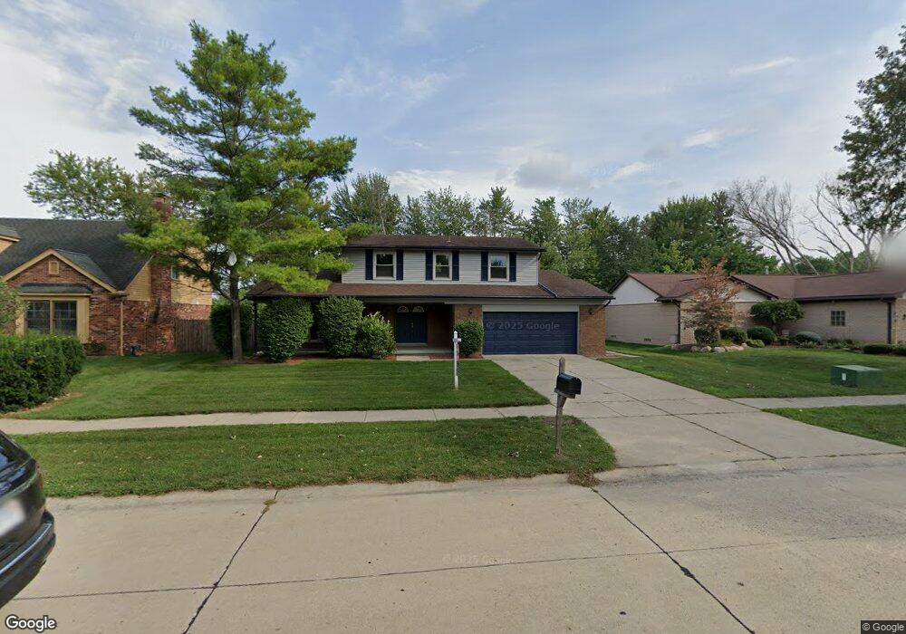
42325 Mayhew Dr Unit Bldg-Unit Sterling Heights, MI 48314
Estimated Value: $370,136 - $406,000
--
Bed
3
Baths
2,180
Sq Ft
$175/Sq Ft
Est. Value
About This Home
This home is located at 42325 Mayhew Dr Unit Bldg-Unit, Sterling Heights, MI 48314 and is currently estimated at $382,284, approximately $175 per square foot. 42325 Mayhew Dr Unit Bldg-Unit is a home located in Macomb County with nearby schools including Dresden Elementary School, Bemis Junior High School, and Henry Ford II High School.
Ownership History
Date
Name
Owned For
Owner Type
Purchase Details
Closed on
Jul 25, 2023
Sold by
Thomas Marlon and Thomas Komeca
Bought by
Al-Saraf Simon and Al-Saraf Fareed
Current Estimated Value
Purchase Details
Closed on
Feb 15, 2019
Sold by
Vlassopoulos Nickolaos
Bought by
Thomas Marlon and Thomas Komeca
Home Financials for this Owner
Home Financials are based on the most recent Mortgage that was taken out on this home.
Original Mortgage
$270,019
Interest Rate
4.4%
Mortgage Type
FHA
Purchase Details
Closed on
Jun 22, 2017
Sold by
Secreatary Of Veterans Affairs
Bought by
Vlassopoulos Nickolas
Purchase Details
Closed on
Aug 22, 2016
Sold by
Carrington Mortgage Services Llc
Bought by
Secretary Of Veterans Affairs
Purchase Details
Closed on
Jul 1, 2016
Sold by
Carrington Mortgage Service Llc
Bought by
Wright Kenneth C and Wright Angela M
Create a Home Valuation Report for This Property
The Home Valuation Report is an in-depth analysis detailing your home's value as well as a comparison with similar homes in the area
Home Values in the Area
Average Home Value in this Area
Purchase History
| Date | Buyer | Sale Price | Title Company |
|---|---|---|---|
| Al-Saraf Simon | $365,000 | Allegiance Title | |
| Thomas Marlon | $275,000 | First American Mortgage Sln | |
| Vlassopoulos Nickolas | -- | None Available | |
| Secretary Of Veterans Affairs | -- | None Available | |
| Secretary Of Veterans Affairs | -- | None Available | |
| Wright Kenneth C | $189,113 | None Available |
Source: Public Records
Mortgage History
| Date | Status | Borrower | Loan Amount |
|---|---|---|---|
| Previous Owner | Thomas Marlon | $270,019 |
Source: Public Records
Tax History Compared to Growth
Tax History
| Year | Tax Paid | Tax Assessment Tax Assessment Total Assessment is a certain percentage of the fair market value that is determined by local assessors to be the total taxable value of land and additions on the property. | Land | Improvement |
|---|---|---|---|---|
| 2025 | $5,695 | $152,700 | $0 | $0 |
| 2024 | $5,208 | $148,200 | $0 | $0 |
| 2023 | $4,310 | $132,500 | $0 | $0 |
| 2022 | $4,493 | $119,600 | $0 | $0 |
| 2021 | $4,400 | $118,200 | $0 | $0 |
| 2020 | $3,925 | $112,500 | $0 | $0 |
| 2019 | $3,658 | $108,000 | $0 | $0 |
| 2018 | $3,846 | $99,700 | $0 | $0 |
| 2017 | $3,668 | $93,800 | $17,500 | $76,300 |
| 2016 | $3,658 | $93,800 | $0 | $0 |
| 2015 | -- | $89,800 | $0 | $0 |
| 2014 | -- | $76,800 | $0 | $0 |
Source: Public Records
Map
Nearby Homes
- 11401 19 Mile Rd
- 11716 Clinton River Rd
- 42049 Farm Lane Ct
- 11898 Lewlund Dr
- 11423 Delvin Dr
- 42790 Utica Rd
- 8125 Ogden Dr
- 41515 Hamilton Dr
- 41371 Hamilton Dr
- 11503 Silver Dr
- 11479 Silver Dr
- 12133 Chattman Dr
- 42222 Mac Rae Dr
- 42153 Mac Rae Dr
- 43629 Vivian Dr
- 41744 Mae Wood Dr
- 8843 Headley Dr
- 8958 Shannon Dr
- 41309 Memphis Dr
- 8628 Strom Dr
- 42325 Mayhew Dr
- 42313 Mayhew Dr
- 42337 Mayhew Dr
- 42349 Mayhew Dr
- 42301 Mayhew Dr
- 42326 Mayhew Dr
- 42314 Mayhew Dr
- 42338 Mayhew Dr
- 42361 Mayhew Dr
- 42283 Mayhew Dr
- 42350 Mayhew Dr
- 42271 Mayhew Dr
- 42373 Mayhew Dr
- 42259 Mayhew Dr
- 42258 Mayhew Dr
- 42385 Mayhew Dr
- 42516 Mayhew Dr
- 42246 Mayhew Dr
- 42397 Mayhew Dr
- 42247 Mayhew Dr