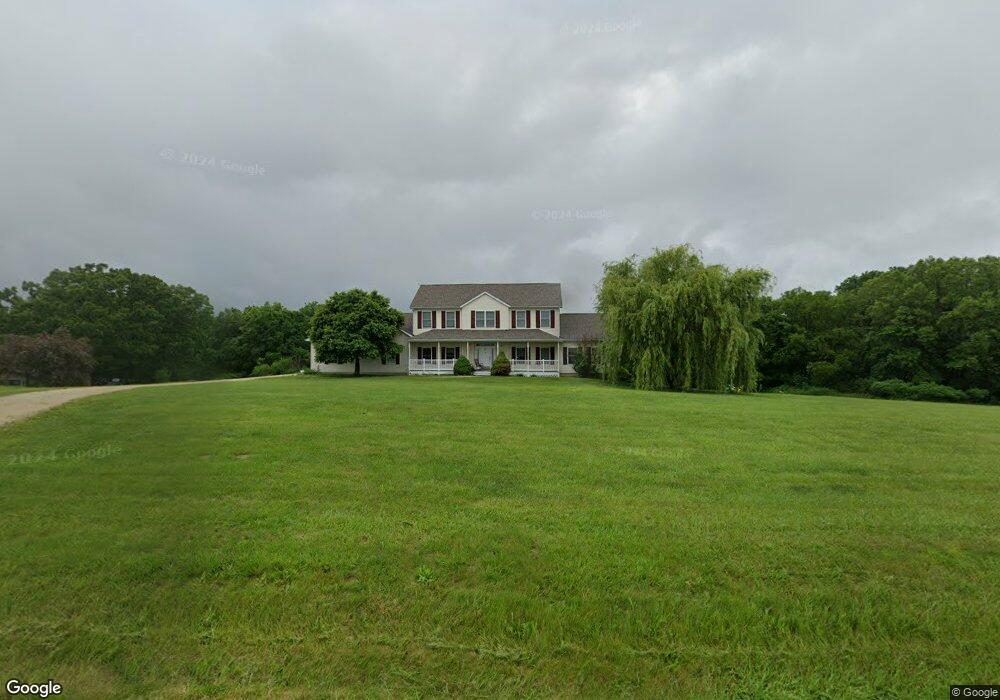
4233 Highway 185 New Haven, MO 63068
Estimated Value: $514,217 - $576,000
4
Beds
2
Baths
3,248
Sq Ft
$165/Sq Ft
Est. Value
About This Home
This home is located at 4233 Highway 185, New Haven, MO 63068 and is currently estimated at $534,554, approximately $164 per square foot. 4233 Highway 185 is a home with nearby schools including Washington High School.
Ownership History
Date
Name
Owned For
Owner Type
Purchase Details
Closed on
Dec 10, 2020
Sold by
Voss David E and Voss Lori L
Bought by
Baker Daniel
Current Estimated Value
Home Financials for this Owner
Home Financials are based on the most recent Mortgage that was taken out on this home.
Original Mortgage
$288,990
Outstanding Balance
$257,746
Interest Rate
2.8%
Mortgage Type
VA
Estimated Equity
$276,808
Purchase Details
Closed on
Feb 3, 2006
Sold by
Hoemann Kevin J and Hoemann Susan L
Bought by
Voss David E and Voss Lori L
Create a Home Valuation Report for This Property
The Home Valuation Report is an in-depth analysis detailing your home's value as well as a comparison with similar homes in the area
Home Values in the Area
Average Home Value in this Area
Purchase History
| Date | Buyer | Sale Price | Title Company |
|---|---|---|---|
| Baker Daniel | -- | None Available | |
| Voss David E | -- | None Available | |
| Hoemann Devin J | -- | None Available |
Source: Public Records
Mortgage History
| Date | Status | Borrower | Loan Amount |
|---|---|---|---|
| Open | Baker Daniel | $288,990 |
Source: Public Records
Tax History Compared to Growth
Tax History
| Year | Tax Paid | Tax Assessment Tax Assessment Total Assessment is a certain percentage of the fair market value that is determined by local assessors to be the total taxable value of land and additions on the property. | Land | Improvement |
|---|---|---|---|---|
| 2024 | $3,050 | $52,638 | $0 | $0 |
| 2023 | $3,050 | $52,638 | $0 | $0 |
| 2022 | $3,156 | $56,833 | $0 | $0 |
| 2021 | $3,145 | $56,833 | $0 | $0 |
| 2020 | $2,945 | $51,327 | $0 | $0 |
| 2019 | $2,940 | $51,327 | $0 | $0 |
| 2018 | $2,711 | $46,951 | $0 | $0 |
| 2017 | $2,710 | $46,951 | $0 | $0 |
| 2016 | $2,443 | $43,274 | $0 | $0 |
| 2015 | $2,451 | $43,274 | $0 | $0 |
| 2014 | $2,470 | $43,647 | $0 | $0 |
Source: Public Records
Map
Nearby Homes
- 00 Hereford Park
- 136 Samson Ln
- 0 Walnut Woods Rd
- 5140 Saint Anns Rd
- 850 Aj Farm Ln
- 3937 Lakeshore Dr
- 526 Saint Joseph Dr
- 5088 Highway Kk
- 3932 Boeuf Lutheran Rd
- 3739 Kopp Ln
- 0 Marlie Rd Unit MIS25036024
- 0 Marlie Rd Unit 23668855
- 0 Marlie Rd Unit MIS25035311
- 0 Highway 185
- 130 Alferman Lake Rd
- 1891 4 Mile Rd
- 000 Highway Aj
- Hwy Aj
- 859 Scenic Ridge Dr
- 11111 Lakeside Dr
- 4233 Missouri 185
- 4253 Highway 185
- 4251 Highway 185
- 4250 Highway 185
- 188 Jamie Valley Dr
- 0Lot 3 Jamie Valley Dr
- 189 Jamie Valley Dr
- 172 Jamie Valley Dr
- 4136 Highway 185
- 171 Jamie Valley Dr
- 4037 Orchard Rd
- 4306 Highway 185
- 0 Hwy Kk Unit 90014957
- 0 Hwy Kk Unit 90048639
- 10 Highway Kk Acs
- 0 Hwy Kk Unit 10059982
- 0 10 Ac Hwy Kk Unit 13023466
- 0 Hwy Kk Unit 19081511
- 0 Hwy Kk Unit 18094730
- 9 State Highway Kk