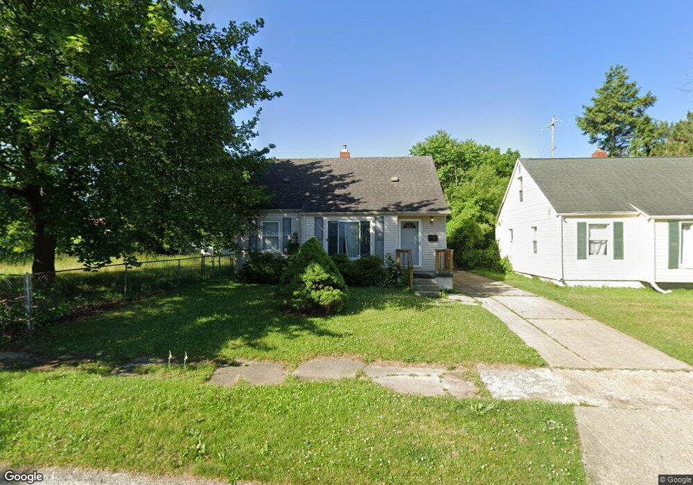
4234 Custer Ave Flint, MI 48507
Circle Drive NeighborhoodEstimated Value: $70,865 - $81,000
3
Beds
1
Bath
954
Sq Ft
$81/Sq Ft
Est. Value
About This Home
This home is located at 4234 Custer Ave, Flint, MI 48507 and is currently estimated at $77,716, approximately $81 per square foot. 4234 Custer Ave is a home located in Genesee County with nearby schools including Freeman Elementary School, Flint Southwestern Classical Academy, and International Academy of Flint (K-12).
Ownership History
Date
Name
Owned For
Owner Type
Purchase Details
Closed on
Dec 28, 2010
Sold by
Alia Antoine
Bought by
Elma Llc
Current Estimated Value
Purchase Details
Closed on
Dec 17, 2008
Sold by
Porteous Russel and Porteous Angela
Bought by
Citimortgage Inc
Purchase Details
Closed on
May 20, 2004
Sold by
Porteous Russel and Porteous Angela
Bought by
Porteous Russell and Porteous Angela
Home Financials for this Owner
Home Financials are based on the most recent Mortgage that was taken out on this home.
Original Mortgage
$85,000
Interest Rate
7.69%
Mortgage Type
New Conventional
Create a Home Valuation Report for This Property
The Home Valuation Report is an in-depth analysis detailing your home's value as well as a comparison with similar homes in the area
Home Values in the Area
Average Home Value in this Area
Purchase History
| Date | Buyer | Sale Price | Title Company |
|---|---|---|---|
| Elma Llc | -- | None Available | |
| Citimortgage Inc | $28,607 | None Available | |
| Porteous Russell | -- | Alpha Title Agency Inc |
Source: Public Records
Mortgage History
| Date | Status | Borrower | Loan Amount |
|---|---|---|---|
| Previous Owner | Porteous Russell | $85,000 |
Source: Public Records
Tax History
| Year | Tax Paid | Tax Assessment Tax Assessment Total Assessment is a certain percentage of the fair market value that is determined by local assessors to be the total taxable value of land and additions on the property. | Land | Improvement |
|---|---|---|---|---|
| 2025 | $1,298 | $34,900 | $0 | $0 |
| 2024 | $1,199 | $31,300 | $0 | $0 |
| 2023 | $1,169 | $27,400 | $0 | $0 |
| 2022 | $0 | $22,400 | $0 | $0 |
| 2021 | $1,187 | $21,400 | $0 | $0 |
| 2020 | $1,088 | $17,000 | $0 | $0 |
| 2019 | $1,061 | $13,200 | $0 | $0 |
| 2018 | $1,059 | $12,000 | $0 | $0 |
| 2017 | $1,048 | $0 | $0 | $0 |
| 2016 | $1,041 | $0 | $0 | $0 |
| 2015 | -- | $0 | $0 | $0 |
| 2014 | -- | $0 | $0 | $0 |
| 2012 | -- | $16,100 | $16,100 | $0 |
Source: Public Records
Map
Nearby Homes
- 4126 Circle Dr
- 4133 Custer Ave
- 4127 Custer Ave
- 530 McKeighan Ave
- 416 Burroughs Ave
- 617 McKeighan Ave
- 338 Browning Ave
- 326 Burroughs Ave
- 621 Burroughs Ave
- 352 Buckingham Ave
- 630 Buckingham Ave
- 361 Buckingham Ave
- 802 McKeighan Ave
- 818 Dell Ave
- 4526 Milton Dr
- 1111 Lochhead Ave
- 4424 Cheyenne Ave
- 3442 Griffith Ct
- 3505 Comanche Ave
- 1483 Carman St
- 4230 Custer Ave
- 4222 Custer Ave
- 4317 Red Arrow Rd
- 4313 Red Arrow Rd
- 4329 Red Arrow Rd
- 4325 Red Arrow Rd
- 4218 Custer Ave
- 401 Dell Ave
- 4310 Custer Ave
- 407 Dell Ave
- 4229 Custer Ave
- 4309 Red Arrow Rd
- 4217 Custer Ave
- 4301 Custer Ave
- 4221 Custer Ave
- 4213 Custer Ave
- 4305 Red Arrow Rd
- 4305 Custer Ave
- 417 Dell Ave
- 4309 Custer Ave
Your Personal Tour Guide
Ask me questions while you tour the home.