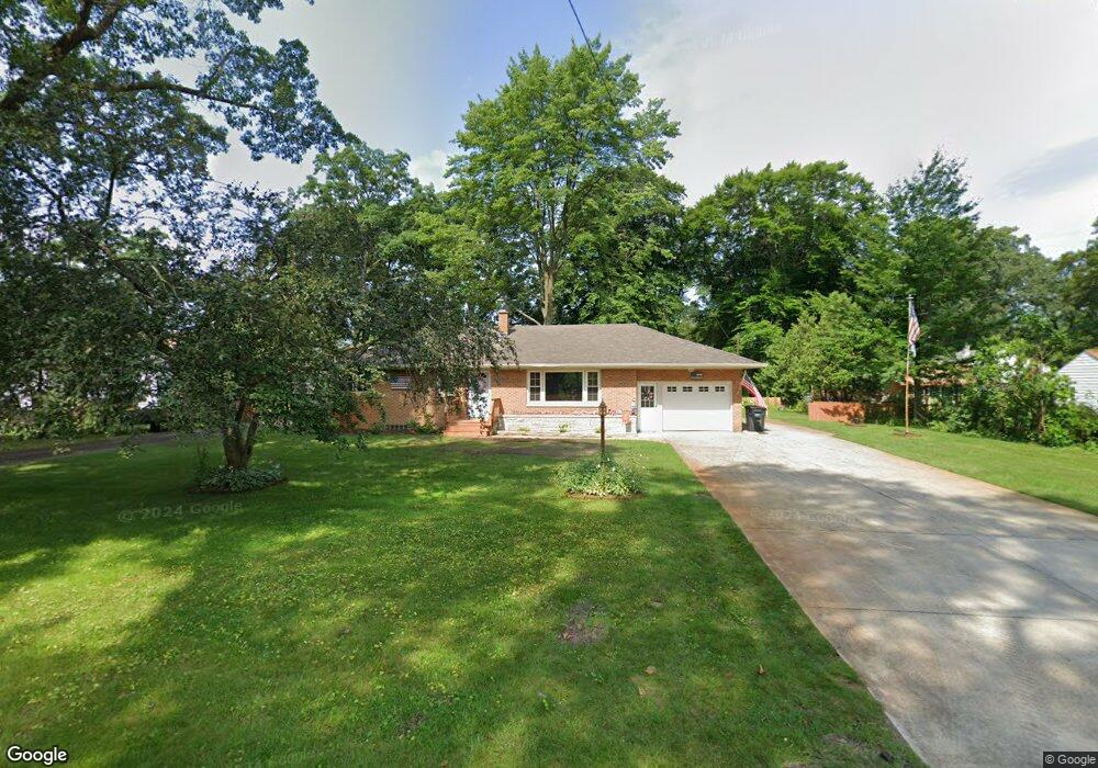
4235 Eastlake Rd Norton Shores, MI 49444
Estimated Value: $249,207 - $277,000
3
Beds
1
Bath
1,188
Sq Ft
$218/Sq Ft
Est. Value
About This Home
This home is located at 4235 Eastlake Rd, Norton Shores, MI 49444 and is currently estimated at $259,552, approximately $218 per square foot. 4235 Eastlake Rd is a home located in Muskegon County with nearby schools including Mona Shores High School, Edgewood Elementary Academy, and Dr. Martin Luther King Academy.
Ownership History
Date
Name
Owned For
Owner Type
Purchase Details
Closed on
Mar 17, 2017
Sold by
Westover William
Bought by
Westover William and Westover Kristine
Current Estimated Value
Home Financials for this Owner
Home Financials are based on the most recent Mortgage that was taken out on this home.
Original Mortgage
$119,352
Outstanding Balance
$99,867
Interest Rate
4.5%
Mortgage Type
FHA
Estimated Equity
$159,685
Purchase Details
Closed on
Sep 25, 2009
Sold by
Katt Dennis Lee and Bialik Janice M
Bought by
Westover William
Home Financials for this Owner
Home Financials are based on the most recent Mortgage that was taken out on this home.
Original Mortgage
$81,400
Interest Rate
5.19%
Mortgage Type
FHA
Create a Home Valuation Report for This Property
The Home Valuation Report is an in-depth analysis detailing your home's value as well as a comparison with similar homes in the area
Home Values in the Area
Average Home Value in this Area
Purchase History
| Date | Buyer | Sale Price | Title Company |
|---|---|---|---|
| Westover William | -- | Attorney | |
| Westover William | $114,700 | None Available |
Source: Public Records
Mortgage History
| Date | Status | Borrower | Loan Amount |
|---|---|---|---|
| Open | Westover William | $119,352 | |
| Closed | Westover William | $81,400 |
Source: Public Records
Tax History Compared to Growth
Tax History
| Year | Tax Paid | Tax Assessment Tax Assessment Total Assessment is a certain percentage of the fair market value that is determined by local assessors to be the total taxable value of land and additions on the property. | Land | Improvement |
|---|---|---|---|---|
| 2025 | $2,605 | $115,600 | $0 | $0 |
| 2024 | $2,042 | $106,100 | $0 | $0 |
| 2023 | $1,951 | $94,600 | $0 | $0 |
| 2022 | $2,378 | $79,900 | $0 | $0 |
| 2021 | $2,310 | $72,800 | $0 | $0 |
| 2020 | $2,284 | $68,200 | $0 | $0 |
| 2019 | $2,242 | $63,300 | $0 | $0 |
| 2018 | $2,190 | $61,600 | $0 | $0 |
| 2017 | $2,139 | $61,400 | $0 | $0 |
| 2016 | $1,656 | $57,400 | $0 | $0 |
| 2015 | -- | $53,900 | $0 | $0 |
| 2014 | $1,987 | $54,200 | $0 | $0 |
| 2013 | -- | $52,800 | $0 | $0 |
Source: Public Records
Map
Nearby Homes
- 1454 Airport Rd
- 4060 Buck St
- V/L 4535 Thompson Rd
- 4677 Harvey St
- 4535 Thompson Rd
- 1130 Englewood Ave
- 1201 Shettler Rd
- 3835 Molly Blvd
- 4468 Spruce Ct
- 4476 Cedar Ln Unit 54
- 1068 Englewood Ave
- 3835 Ellen St
- 4769 Harvey St
- 1067 Aspen Dr
- 1065 Wilson Ct
- 4563 Keener St
- 1404 E Ellis Rd
- 945 Petrie Ave
- 4638 Lauren Dr
- 2171 Monte Ave
- 1519 Airport Rd
- 4274 Orchard Rd
- 1509 Airport Rd
- 4268 Orchard Rd
- 1489 Airport Rd
- 4261 Eastlake Rd
- 4240 Eastlake Rd
- 4230 Orchard Rd
- 1553 Airport Rd
- 4260 Eastlake Rd
- 1477 Airport Rd
- 1504 Airport Rd
- 1520 Airport Rd
- 4270 Eastlake Rd
- 4271 Orchard Rd
- 1555 Airport Rd
- 4269 Orchard Rd
- 4242 Eastlake Rd
- 4273 Orchard Rd
- 4257 Orchard Rd