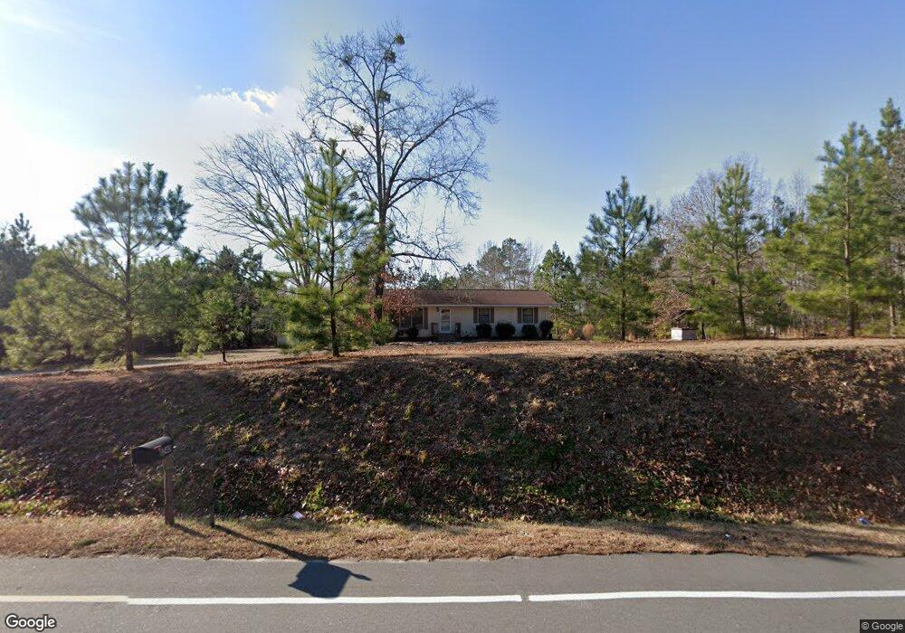
4235 Jacksontown Rd Manson, NC 27553
Estimated Value: $116,000 - $262,000
3
Beds
1
Bath
1,152
Sq Ft
$177/Sq Ft
Est. Value
About This Home
This home is located at 4235 Jacksontown Rd, Manson, NC 27553 and is currently estimated at $204,369, approximately $177 per square foot. 4235 Jacksontown Rd is a home located in Vance County with nearby schools including E.O. Young Jr. Elementary School, Vance County Middle School, and Vance County High School.
Ownership History
Date
Name
Owned For
Owner Type
Purchase Details
Closed on
Aug 5, 2024
Sold by
Burnette Robert Alvin
Bought by
Burnette Victoria Janice
Current Estimated Value
Purchase Details
Closed on
May 15, 2019
Sold by
Burnette Robert A and Burnette Victoria Janice
Bought by
Burnette Robert Alvin and Burnette Victoria Janice
Purchase Details
Closed on
Nov 17, 2014
Sold by
Hill Gary
Bought by
Burnette Robert A
Create a Home Valuation Report for This Property
The Home Valuation Report is an in-depth analysis detailing your home's value as well as a comparison with similar homes in the area
Home Values in the Area
Average Home Value in this Area
Purchase History
| Date | Buyer | Sale Price | Title Company |
|---|---|---|---|
| Burnette Victoria Janice | -- | None Listed On Document | |
| Burnette Victoria Janice | -- | None Listed On Document | |
| Burnette Robert Alvin | -- | None Available | |
| Burnette Robert A | -- | None Available | |
| Burnette Robert A | $49,896 | None Available |
Source: Public Records
Tax History Compared to Growth
Tax History
| Year | Tax Paid | Tax Assessment Tax Assessment Total Assessment is a certain percentage of the fair market value that is determined by local assessors to be the total taxable value of land and additions on the property. | Land | Improvement |
|---|---|---|---|---|
| 2025 | $1,241 | $154,575 | $36,168 | $118,407 |
| 2024 | $1,335 | $154,575 | $36,168 | $118,407 |
| 2023 | $830 | $72,551 | $22,988 | $49,563 |
| 2022 | $830 | $72,551 | $22,988 | $49,563 |
| 2021 | $710 | $72,551 | $22,988 | $49,563 |
| 2020 | $827 | $72,551 | $22,988 | $49,563 |
| 2019 | $822 | $72,551 | $22,988 | $49,563 |
| 2018 | $552 | $59,066 | $9,476 | $49,590 |
| 2017 | $657 | $59,066 | $9,476 | $49,590 |
| 2016 | $657 | $59,066 | $9,476 | $49,590 |
| 2015 | $491 | $66,360 | $8,968 | $57,392 |
| 2014 | $657 | $66,366 | $8,968 | $57,398 |
Source: Public Records
Map
Nearby Homes
- 00 Bullocksville Park Rd
- 71 George H Bullock Ln
- Lot 33 Aruba Ln
- Lot 15 Key Largo Ln
- Lot 13 Key Largo Ln
- Lot 12 Key Largo Ln
- Lot 11 Aruba Ln
- Lot 8 Aruba Ln
- Lot 7 Aruba Ln
- 452 Burchette Rd
- 00 Frank Bullock Rd
- 212 Ellington's Path
- 420 Spring Ln
- 89 Mount Pleasant Ln
- 159 Manson-Drewry Rd
- 96 Holly Cir
- 946 Jacksontown Rd
- 0 Collins Road Lot 3 Rd Unit 10097236
- 0 Collins Rd
- 169 Skippers Landing
- 4240 Jacksontown Rd
- 4343 Jacksontown Rd
- 4350 Jacksontown Rd
- 4198 Jacksontown Rd
- 4188 Jacksontown Rd
- 4066 Jacksontown Rd
- 4440 Jacksontown Rd
- 23 Ridgeway Drewery Rd
- 23 Drewry Rd
- 171 Bullocksville Park Rd
- 85 Bullocksville Park Rd
- 877 Manson Drewry Rd
- 24 Ridgeway Drewry Rd
- 3845 Jacksontown Rd
- 64 Ridgeway Drewry Rd
- 1218 Manson Drewery
- 231 Bullocksville Park Rd
- 23 Ridgeway Drewry Rd Unit R
- 23 Ridgeway - Drewry Rd
- 20 Bullocksville Park Rd