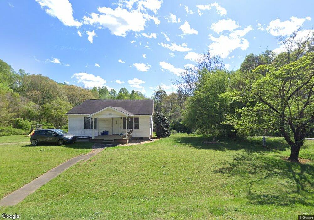
4235 Matt Hwy Cumming, GA 30028
Estimated Value: $724,000 - $827,000
4
Beds
3
Baths
3,150
Sq Ft
$247/Sq Ft
Est. Value
About This Home
This home is located at 4235 Matt Hwy, Cumming, GA 30028 and is currently estimated at $776,501, approximately $246 per square foot. 4235 Matt Hwy is a home with nearby schools including Coal Mountain Elementary School, North Forsyth Middle School, and North Forsyth High School.
Ownership History
Date
Name
Owned For
Owner Type
Purchase Details
Closed on
Jan 31, 2019
Sold by
Lanier Residential Inc
Bought by
Kansagrad Nicklas Paul and Kansagrad Brittany Dee-Anne
Current Estimated Value
Home Financials for this Owner
Home Financials are based on the most recent Mortgage that was taken out on this home.
Original Mortgage
$355,000
Outstanding Balance
$312,109
Interest Rate
4.5%
Mortgage Type
New Conventional
Estimated Equity
$464,392
Purchase Details
Closed on
Aug 21, 2018
Sold by
Thackery Dean L
Bought by
Lanier Residential Inc
Purchase Details
Closed on
Apr 30, 2015
Sold by
Chambers Jane Bennet
Bought by
Thackery Dean L and Thackery Dawn M
Create a Home Valuation Report for This Property
The Home Valuation Report is an in-depth analysis detailing your home's value as well as a comparison with similar homes in the area
Home Values in the Area
Average Home Value in this Area
Purchase History
| Date | Buyer | Sale Price | Title Company |
|---|---|---|---|
| Kansagrad Nicklas Paul | $444,039 | -- | |
| Lanier Residential Inc | $80,000 | -- | |
| Thackery Dean L | $44,000 | -- |
Source: Public Records
Mortgage History
| Date | Status | Borrower | Loan Amount |
|---|---|---|---|
| Open | Kansagrad Nicklas Paul | $355,000 |
Source: Public Records
Tax History Compared to Growth
Tax History
| Year | Tax Paid | Tax Assessment Tax Assessment Total Assessment is a certain percentage of the fair market value that is determined by local assessors to be the total taxable value of land and additions on the property. | Land | Improvement |
|---|---|---|---|---|
| 2025 | $5,051 | $296,864 | $82,104 | $214,760 |
| 2024 | $5,051 | $294,992 | $88,420 | $206,572 |
| 2023 | $6,344 | $257,732 | $69,476 | $188,256 |
| 2022 | $5,659 | $177,576 | $43,468 | $134,108 |
| 2021 | $4,904 | $177,576 | $43,468 | $134,108 |
| 2020 | $4,675 | $169,304 | $43,468 | $125,836 |
| 2019 | $2,785 | $100,716 | $30,588 | $70,128 |
| 2018 | $847 | $30,640 | $30,588 | $52 |
| 2017 | $672 | $24,224 | $24,148 | $76 |
| 2016 | $488 | $17,600 | $17,600 | $0 |
| 2015 | $537 | $19,320 | $19,320 | $0 |
| 2014 | $511 | $19,320 | $0 | $0 |
Source: Public Records
Map
Nearby Homes
- 6230 Dana Way
- 6445 Crystal Ln
- 7005 Walnut Mill Landing
- 4420 Belcrest Way
- 3940 Twin Lakes Rd
- 4905 Rosarian Dr
- 4855 Rosarian Dr
- 4710 Rosarian Dr
- 4555 Dennington Trace
- 4115 Sierra Vista Cir
- 4095 Sierra Vista Cir
- 7620 Ivy Grove St
- 7480 Ivy Grove St
- 3995 Sierra Lake Dr
- 3810 Sierra Lake Dr
- 4015 Sierra Vista Cir
- 3725 Sierra Lake Dr
- 3735 Sierra Lake Dr
- 4805 Blossom Ct
- 6240 Susans Trail
- 6230 Susans Trail
- 6215 Dexters Dr
- 6250 Susans Trail
- 4231 Matt Hwy
- 4255 Matt Hwy
- 6205 Dexters Dr
- 4241 Matt Hwy
- 6225 Dexters Dr
- 0 Susans Trail Unit 7502396
- 0 Susans Trail
- 6245 Susans Trail
- 6210 Hendrix Rd
- 6225 Susans Trail
- 6190 Hendrix Rd
- 6215 Susans Trail
- 6215 Susans Trail Unit 1
- 6180 Hendrix Rd
- 6235 Dexters Dr
- 6170 Hendrix Rd