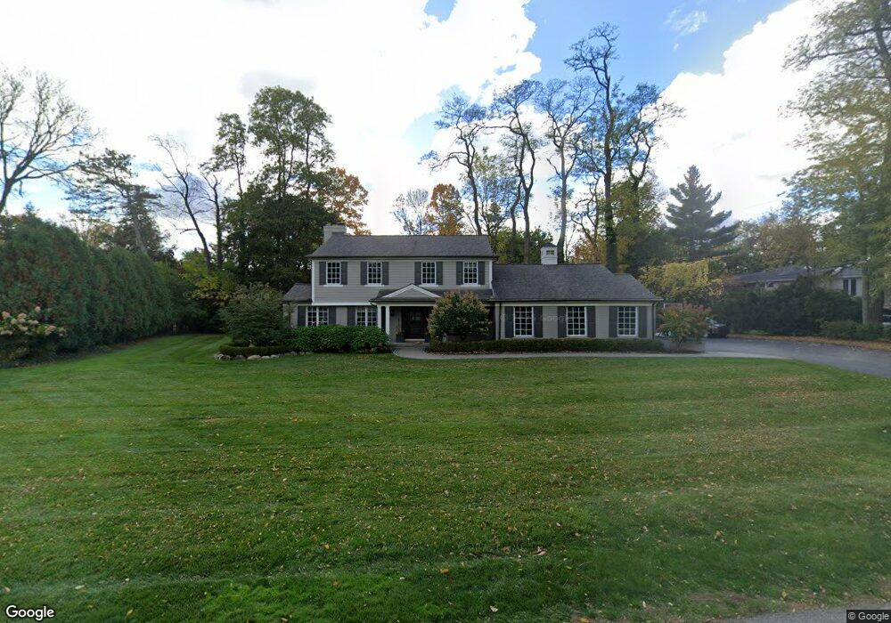
4235 Sandy Ln Bloomfield Hills, MI 48301
Estimated Value: $922,000 - $978,000
4
Beds
3
Baths
3,305
Sq Ft
$290/Sq Ft
Est. Value
About This Home
This home is located at 4235 Sandy Ln, Bloomfield Hills, MI 48301 and is currently estimated at $957,552, approximately $289 per square foot. 4235 Sandy Ln is a home located in Oakland County with nearby schools including Conant Elementary School, South Hills Middle School, and Bloomfield Hills High School.
Ownership History
Date
Name
Owned For
Owner Type
Purchase Details
Closed on
Mar 31, 2003
Sold by
Graham Carol J and Carol J Graham Declaration Of
Bought by
Fitzpatrick Michael and Fitzpatrick Amy
Current Estimated Value
Purchase Details
Closed on
May 5, 1998
Sold by
Graham Jeffrey P
Bought by
Carol J Graham Tr
Purchase Details
Closed on
Aug 24, 1995
Sold by
Fuqua Bertha S
Bought by
Graham Jeffrey and Graham Carol J
Create a Home Valuation Report for This Property
The Home Valuation Report is an in-depth analysis detailing your home's value as well as a comparison with similar homes in the area
Home Values in the Area
Average Home Value in this Area
Purchase History
| Date | Buyer | Sale Price | Title Company |
|---|---|---|---|
| Fitzpatrick Michael | $650,000 | -- | |
| Carol J Graham Tr | -- | -- | |
| Graham Jeffrey | $325,000 | -- |
Source: Public Records
Mortgage History
| Date | Status | Borrower | Loan Amount |
|---|---|---|---|
| Closed | Graham Jeffrey | -- |
Source: Public Records
Tax History Compared to Growth
Tax History
| Year | Tax Paid | Tax Assessment Tax Assessment Total Assessment is a certain percentage of the fair market value that is determined by local assessors to be the total taxable value of land and additions on the property. | Land | Improvement |
|---|---|---|---|---|
| 2024 | $5,560 | $396,980 | $0 | $0 |
| 2023 | $5,381 | $380,780 | $0 | $0 |
| 2022 | $10,324 | $337,730 | $0 | $0 |
| 2021 | $10,092 | $347,830 | $0 | $0 |
| 2020 | $4,922 | $345,120 | $0 | $0 |
| 2019 | $11,768 | $319,920 | $0 | $0 |
| 2018 | $10,093 | $318,820 | $0 | $0 |
| 2017 | $9,422 | $311,360 | $0 | $0 |
| 2016 | $9,526 | $299,550 | $0 | $0 |
| 2015 | -- | $244,220 | $0 | $0 |
| 2014 | -- | $207,920 | $0 | $0 |
| 2011 | -- | $188,180 | $0 | $0 |
Source: Public Records
Map
Nearby Homes
- 5904 Wing Lake Rd
- 750 Trailwood Path Unit B
- 450 Billingsgate Ct Unit C
- 1760 Trailwood Path
- 5630 S Adams Way
- 6572 Spruce Dr
- 6386 Thorncrest Dr
- 4456 W Maple Rd
- 6660 Woodbank Dr
- 5361 Echo Rd
- 6360 Hills Dr
- 6750 Wing Lake Rd
- 6701 Franklin Rd
- 5741 Snowshoe Cir
- 6450 Gilbert Lake Rd
- 4597 Broughton Dr
- 6041 Eastmoor Rd
- 4603 Hedgewood Dr
- 6940 Wing Lake Rd
- 5340 Franklin Rd
- 6065 Worlington Rd
- 6085 Worlington Rd
- 4225 Sandy Ln
- 6045 Worlington Rd
- 6070 N Cross St
- 4234 Sandy Ln
- 6105 Worlington Rd
- 6050 W Surrey Rd
- 6025 Worlington Rd
- 6060 Worlington Rd
- 4246 Sandy Ln
- 4246 Sandy Ln
- 6044 Worlington Rd
- 4205 Sandy Ln
- 6080 Worlington Rd
- 6020 N Cross St
- 6125 Worlington Rd
- 6104 Worlington Rd
- 4210 Sandy Ln
- 6080 N Cross St