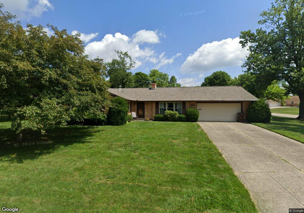
4236 Burning Tree Dr Dayton, OH 45440
Estimated Value: $288,143 - $307,000
3
Beds
2
Baths
1,694
Sq Ft
$175/Sq Ft
Est. Value
About This Home
This home is located at 4236 Burning Tree Dr, Dayton, OH 45440 and is currently estimated at $296,036, approximately $174 per square foot. 4236 Burning Tree Dr is a home located in Montgomery County with nearby schools including Prass Elementary School, Kettering Middle School, and Kettering Fairmont High School.
Ownership History
Date
Name
Owned For
Owner Type
Purchase Details
Closed on
May 31, 2013
Sold by
Fisher Lloyd B
Bought by
Miner Andrea K
Current Estimated Value
Home Financials for this Owner
Home Financials are based on the most recent Mortgage that was taken out on this home.
Original Mortgage
$85,000
Outstanding Balance
$18,139
Interest Rate
2.58%
Mortgage Type
Future Advance Clause Open End Mortgage
Estimated Equity
$277,897
Purchase Details
Closed on
Aug 18, 2004
Sold by
Keith Louis H and Keith Evelyn M
Bought by
Fisher Lloyd B and Ballard Fisher Dixie
Create a Home Valuation Report for This Property
The Home Valuation Report is an in-depth analysis detailing your home's value as well as a comparison with similar homes in the area
Home Values in the Area
Average Home Value in this Area
Purchase History
| Date | Buyer | Sale Price | Title Company |
|---|---|---|---|
| Miner Andrea K | $135,000 | None Available | |
| Miner Andrea K | $135,000 | None Available | |
| Fisher Lloyd B | $135,000 | None Available |
Source: Public Records
Mortgage History
| Date | Status | Borrower | Loan Amount |
|---|---|---|---|
| Open | Miner Andrea K | $85,000 |
Source: Public Records
Tax History Compared to Growth
Tax History
| Year | Tax Paid | Tax Assessment Tax Assessment Total Assessment is a certain percentage of the fair market value that is determined by local assessors to be the total taxable value of land and additions on the property. | Land | Improvement |
|---|---|---|---|---|
| 2024 | $4,359 | $78,670 | $12,900 | $65,770 |
| 2023 | $4,359 | $78,670 | $12,900 | $65,770 |
| 2022 | $4,282 | $62,710 | $10,320 | $52,390 |
| 2021 | $3,964 | $62,710 | $10,320 | $52,390 |
| 2020 | $3,976 | $62,710 | $10,320 | $52,390 |
| 2019 | $3,524 | $50,940 | $10,320 | $40,620 |
| 2018 | $3,543 | $50,940 | $10,320 | $40,620 |
| 2017 | $3,267 | $50,940 | $10,320 | $40,620 |
| 2016 | $2,944 | $44,380 | $10,320 | $34,060 |
| 2015 | $2,814 | $44,380 | $10,320 | $34,060 |
| 2014 | $2,814 | $44,380 | $10,320 | $34,060 |
| 2012 | -- | $47,730 | $10,400 | $37,330 |
Source: Public Records
Map
Nearby Homes
- 4210 Wallington Dr
- 4370 Wilmington Pike
- 2409 Burning Tree Dr
- 2233 Cherry Oak Dr
- 4464 Woodner Dr
- 4408 Glenheath Dr
- 2447 Hemphill Rd
- 4190 Woodman Dr
- 2313 Glenheath Dr
- 4086 Glenheath Dr
- 4508 Rean Meadow Dr
- 4533 Drayton Ct
- 2021 Stayman Dr
- 2648 Parklawn Dr
- 2816 Corlington Dr
- 1968 Carol Pkwy
- 3033 Glenmere Ct
- 2841 Corlington Dr
- 2217 Westlawn Dr
- 3073 Santa Rosa Dr
- 4231 Wallington Dr
- 4230 Burning Tree Dr
- 4261 Burning Tree Dr
- 4240 Wallington Dr
- 4251 Burning Tree Dr
- 4221 Wallington Dr
- 4220 Burning Tree Dr
- 4241 Burning Tree Dr
- 4230 Wallington Dr
- 2350 Burning Tree Dr
- 4311 Wallington Dr
- 4231 Burning Tree Dr
- 2359 Burning Tree Dr
- 4220 Wallington Dr
- 4211 Wallington Dr
- 4210 Burning Tree Dr
- 2650 Hazelhurst Ct
- 4310 Wallington Dr
- 2358 Burning Tree Dr
- 4366 Sillman Place