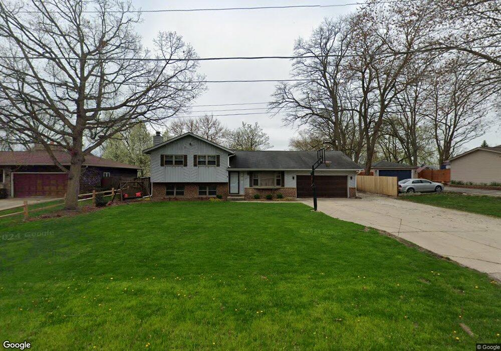
4237 Harper Ave Gurnee, IL 60031
Estimated Value: $276,012 - $329,000
Studio
2
Baths
1,164
Sq Ft
$265/Sq Ft
Est. Value
About This Home
This home is located at 4237 Harper Ave, Gurnee, IL 60031 and is currently estimated at $308,753, approximately $265 per square foot. 4237 Harper Ave is a home located in Lake County with nearby schools including Spaulding Elementary School, Viking Middle School, and Warren Township High School.
Ownership History
Date
Name
Owned For
Owner Type
Purchase Details
Closed on
Oct 22, 1998
Sold by
Benge Daniel L and Benge Dannielle M
Bought by
Fallos Jack M and Fallos Patricia D
Current Estimated Value
Purchase Details
Closed on
Jun 13, 1994
Sold by
Wilkerson Douglas L and Wilkerson Kelly A
Bought by
Benge Daniel L and Benge Dannielle M
Home Financials for this Owner
Home Financials are based on the most recent Mortgage that was taken out on this home.
Original Mortgage
$150,000
Interest Rate
8.58%
Create a Home Valuation Report for This Property
The Home Valuation Report is an in-depth analysis detailing your home's value as well as a comparison with similar homes in the area
Home Values in the Area
Average Home Value in this Area
Purchase History
| Date | Buyer | Sale Price | Title Company |
|---|---|---|---|
| Fallos Jack M | $158,500 | 1St American Title | |
| Benge Daniel L | $158,000 | Chicago Title Insurance Co |
Source: Public Records
Mortgage History
| Date | Status | Borrower | Loan Amount |
|---|---|---|---|
| Previous Owner | Benge Daniel L | $150,000 |
Source: Public Records
Tax History
| Year | Tax Paid | Tax Assessment Tax Assessment Total Assessment is a certain percentage of the fair market value that is determined by local assessors to be the total taxable value of land and additions on the property. | Land | Improvement |
|---|---|---|---|---|
| 2024 | $7,021 | $87,389 | $11,405 | $75,984 |
| 2023 | $6,192 | $77,226 | $10,079 | $67,147 |
| 2022 | $6,192 | $67,612 | $10,570 | $57,042 |
| 2021 | $5,327 | $61,808 | $9,663 | $52,145 |
| 2020 | $5,159 | $60,288 | $9,425 | $50,863 |
| 2019 | $5,028 | $58,537 | $9,151 | $49,386 |
| 2018 | $4,643 | $54,064 | $9,339 | $44,725 |
| 2017 | $4,592 | $52,514 | $9,071 | $43,443 |
| 2016 | $4,448 | $50,176 | $8,667 | $41,509 |
| 2015 | $4,313 | $47,587 | $8,220 | $39,367 |
| 2014 | $4,451 | $50,367 | $8,098 | $42,269 |
| 2012 | $4,226 | $50,753 | $8,160 | $42,593 |
Source: Public Records
Map
Nearby Homes
- 4232 Kenwood Ave
- 134 Heritage Ct Unit B
- 287 Kensington Ct Unit 4
- 995 Norman Ave
- 450 Tanglewood Dr
- 3877 Grandview Ave
- 468 Tanglewood Dr
- 3861 Sutherland Dr
- 546 Thorndale Ave
- 33718 N Oplaine Rd
- 387 Long Hill Rd
- 4185 Eastwood Place
- 963 Belle Plaine Ave
- 3810 1st St
- 1070 Belle Plaine Ave
- 4437-4495 W Kennedy Dr
- 3517 Glen Flora Ave
- 5135 Grand Ave
- 4520 W Lawn Ave
- 3408 Jen Ave
- 4221 Harper Ave
- 4243 Harper Ave
- 4230 Blackstone Ave
- 4244 Blackstone Ave
- 4209 Harper Ave
- 4232 Harper Ave
- 312 N 1st St
- 4269 Harper Ave
- 4250 Harper Ave
- 4258 Blackstone Ave
- 358 N 1st St
- 4260 Harper Ave
- 4270 Harper Ave
- 4187 Harper Ave
- 4231 Blackstone Ave
- 4231 Kenwood Ave
- 4239 Kenwood Ave
- 4219 Blackstone Ave
- 4243 Blackstone Ave
- 313 N 1st St
Your Personal Tour Guide
Ask me questions while you tour the home.