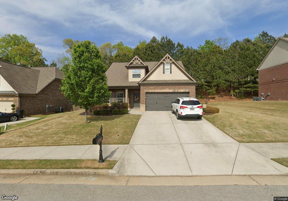
4238 Brentwood Dr Unit 15 Buford, GA 30518
Estimated Value: $529,175 - $583,000
4
Beds
3
Baths
2,268
Sq Ft
$242/Sq Ft
Est. Value
About This Home
This home is located at 4238 Brentwood Dr Unit 15, Buford, GA 30518 and is currently estimated at $549,294, approximately $242 per square foot. 4238 Brentwood Dr Unit 15 is a home located in Hall County with nearby schools including Buford Elementary School, Buford Academy, and Buford Senior Academy.
Ownership History
Date
Name
Owned For
Owner Type
Purchase Details
Closed on
Feb 10, 2025
Sold by
Morris Frederick
Bought by
Morris Maryann Tr
Current Estimated Value
Purchase Details
Closed on
Jun 25, 2018
Sold by
Davidson David B
Bought by
Morris Frederick and Morris Maryann
Purchase Details
Closed on
Mar 21, 2014
Sold by
Davidson David B
Bought by
Davidson David B and Davidson Shawna Norene
Home Financials for this Owner
Home Financials are based on the most recent Mortgage that was taken out on this home.
Original Mortgage
$213,750
Interest Rate
4.36%
Mortgage Type
New Conventional
Purchase Details
Closed on
Jun 27, 2012
Sold by
Barrington Estates Builder
Bought by
Bowen
Purchase Details
Closed on
Dec 21, 2009
Sold by
Mb Regional Enterprises Llc
Bought by
Barrington Estates Builders Llc
Purchase Details
Closed on
Aug 13, 2007
Sold by
Mb Regional Enterprises Llc
Bought by
Mb Regional Enterprises Llc & Brentwood
Create a Home Valuation Report for This Property
The Home Valuation Report is an in-depth analysis detailing your home's value as well as a comparison with similar homes in the area
Home Values in the Area
Average Home Value in this Area
Purchase History
| Date | Buyer | Sale Price | Title Company |
|---|---|---|---|
| Morris Maryann Tr | -- | -- | |
| Morris Frederick | $295,000 | -- | |
| Davidson David B | -- | -- | |
| Davidson David B | $225,000 | -- | |
| Bowen | $200,000 | -- | |
| Barrington Estates Builders Llc | -- | -- | |
| Mb Regional Enterprises Llc & Brentwood | $540,000 | -- |
Source: Public Records
Mortgage History
| Date | Status | Borrower | Loan Amount |
|---|---|---|---|
| Previous Owner | Davidson David B | $213,750 |
Source: Public Records
Tax History Compared to Growth
Tax History
| Year | Tax Paid | Tax Assessment Tax Assessment Total Assessment is a certain percentage of the fair market value that is determined by local assessors to be the total taxable value of land and additions on the property. | Land | Improvement |
|---|---|---|---|---|
| 2024 | $4,314 | $205,880 | $34,000 | $171,880 |
| 2023 | $1,598 | $189,000 | $34,000 | $155,000 |
| 2022 | $1,507 | $164,600 | $34,000 | $130,600 |
| 2021 | $1,255 | $130,080 | $23,000 | $107,080 |
| 2020 | $1,315 | $133,240 | $20,000 | $113,240 |
| 2019 | $1,193 | $126,480 | $20,000 | $106,480 |
| 2018 | $1,147 | $112,520 | $20,000 | $92,520 |
| 2017 | $1,059 | $100,280 | $20,000 | $80,280 |
| 2016 | $868 | $90,560 | $14,000 | $76,560 |
| 2015 | $119 | $88,560 | $12,000 | $76,560 |
| 2014 | $119 | $12,000 | $12,000 | $0 |
Source: Public Records
Map
Nearby Homes
- 4235 Crestwood Bend Cir
- 3984 Crimson Ridge Way
- 6714 Corryton St
- 6737 Leigh St
- 6745 Leigh St
- 6740 Leigh St
- 6732 Leigh St
- 6749 Leigh St
- 6121 Stillwater Trail
- 6732 Willowbrook Trail
- 6237 Stillwater Place
- SUDBURY 24' TOWNHOME Plan at Waypoint
- ADDINGTON Plan at Waypoint
- SALISBURY 24' TOWNHOME Plan at Waypoint
- AMESBURY Plan at Waypoint
- 4238 Brentwood Dr
- 4234 Brentwood Dr
- 4234 Brentwood Dr Unit 14
- 4242 Brentwood Dr
- 6245 Huckleberry Ridge
- 4230 Brentwood Dr
- 4230 Brentwood Dr Unit 13A
- 4246 Brentwood Dr
- 4246 Brentwood Dr Unit 17-A
- 4249 Brentwood Dr
- 4305 Chesterfield Ct
- 4245 Brentwood Dr
- 6241 Huckleberry Ridge
- 4229 Brentwood Dr
- 4226 Brentwood Dr
- 4226 Brentwood Dr Unit 12-A
- 6242 Huckleberry Ridge
- 4250 Brentwood Dr
- 4308 Chesterfield Ct Unit 23
- 4308 Chesterfield Ct