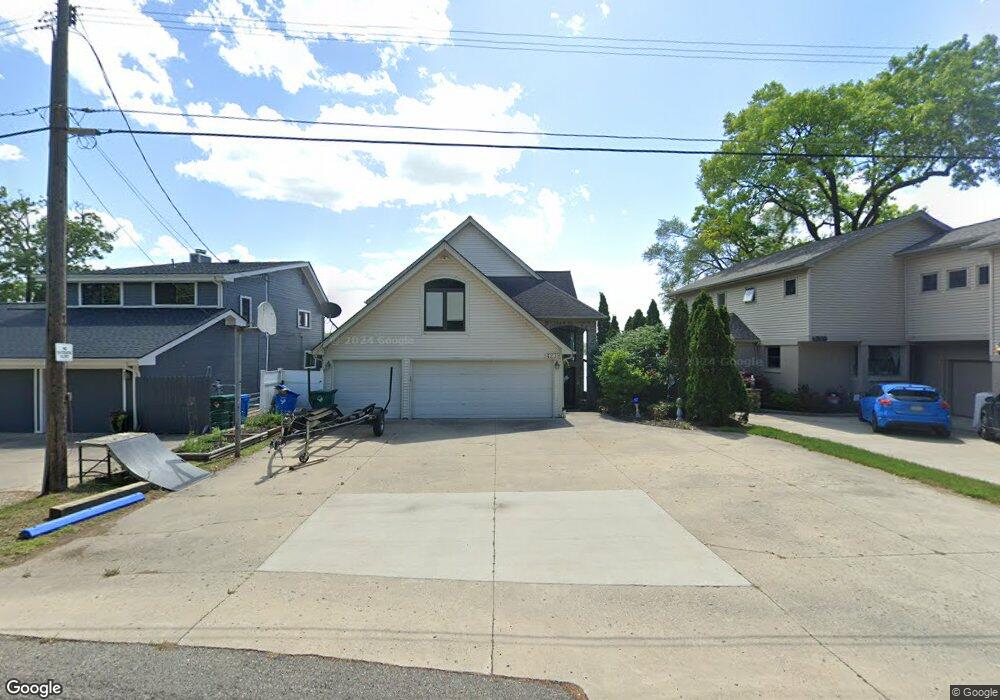
4239 Bluebird Dr Commerce Township, MI 48382
Estimated Value: $633,000 - $953,000
3
Beds
3
Baths
2,989
Sq Ft
$254/Sq Ft
Est. Value
About This Home
This home is located at 4239 Bluebird Dr, Commerce Township, MI 48382 and is currently estimated at $760,127, approximately $254 per square foot. 4239 Bluebird Dr is a home located in Oakland County with nearby schools including Glengary Elementary School, Walled Lake Northern High School, and St. Matthew Lutheran School.
Ownership History
Date
Name
Owned For
Owner Type
Purchase Details
Closed on
Jul 9, 2020
Sold by
Behm Robert A and Behm Margaret
Bought by
Behm Robert A and Behm Margaret L
Current Estimated Value
Home Financials for this Owner
Home Financials are based on the most recent Mortgage that was taken out on this home.
Original Mortgage
$485,000
Interest Rate
3.1%
Mortgage Type
New Conventional
Purchase Details
Closed on
May 2, 2018
Sold by
Behm Robert A and Behm Margaret L
Bought by
Behm Robert A and Behm Margaret L
Create a Home Valuation Report for This Property
The Home Valuation Report is an in-depth analysis detailing your home's value as well as a comparison with similar homes in the area
Home Values in the Area
Average Home Value in this Area
Purchase History
| Date | Buyer | Sale Price | Title Company |
|---|---|---|---|
| Behm Robert A | -- | None Available | |
| Behm Robert A | -- | None Available | |
| Behm Robert A | -- | None Available |
Source: Public Records
Mortgage History
| Date | Status | Borrower | Loan Amount |
|---|---|---|---|
| Closed | Behm Robert A | $485,000 |
Source: Public Records
Tax History
| Year | Tax Paid | Tax Assessment Tax Assessment Total Assessment is a certain percentage of the fair market value that is determined by local assessors to be the total taxable value of land and additions on the property. | Land | Improvement |
|---|---|---|---|---|
| 2025 | $7,790 | $446,930 | $0 | $0 |
| 2024 | $4,884 | $412,320 | $0 | $0 |
| 2023 | $4,605 | $407,300 | $0 | $0 |
| 2022 | $6,961 | $390,650 | $0 | $0 |
| 2021 | $6,851 | $378,030 | $0 | $0 |
| 2020 | $4,550 | $367,440 | $0 | $0 |
| 2019 | $6,549 | $352,410 | $0 | $0 |
| 2018 | $6,500 | $319,480 | $0 | $0 |
| 2017 | $6,402 | $319,480 | $0 | $0 |
| 2016 | $6,316 | $306,580 | $0 | $0 |
| 2015 | -- | $279,420 | $0 | $0 |
| 2014 | -- | $258,230 | $0 | $0 |
| 2011 | -- | $212,520 | $0 | $0 |
Source: Public Records
Map
Nearby Homes
- 211 Cardinal St
- 900 Polvadera St
- 4659 Camelina St
- 4615 S Commerce Rd
- 3813 Watuga St
- 3510 Sutton Ln
- 260 Forest Crest Dr
- 2065 Ridgemont St
- 716 Commercial St
- 3165 Chenoa St
- 945 N Commerce Rd
- 3302 Newton Rd
- 3099 Chenoa St
- 3370 Sutton Ln
- 9393 Boncrest St
- 00 S Lot 77 80
- 000 Midwood Lot 74 80
- 3070 Twinleaf St
- 3291 Timberlake Dr
- 3346 Royal Blvd
- 4235 Bluebird Dr
- 4247 Bluebird Dr
- 4231 Bluebird Dr
- 4253 Bluebird Dr
- 4223 Bluebird Dr
- 4215 Bluebird Dr
- 255 Cardinal St
- 4207 Bluebird Dr
- 294 Cardinal St
- 4275 Bluebird Dr
- 4256 Bluebird Dr
- 240 Robin Rd
- 4199 Bluebird Dr Unit Bldg-Unit
- 4199 Bluebird Dr
- 4283 Bluebird Dr
- 244 Cardinal St
- 233 Cardinal St
- 4288 Bluebird Dr
- 265 Oriole St
- 4289 Bluebird Dr
Your Personal Tour Guide
Ask me questions while you tour the home.