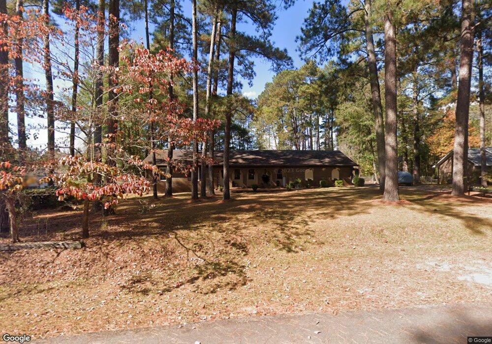
424 Ginger Cir Lagrange, GA 30240
Estimated Value: $222,000 - $263,000
4
Beds
3
Baths
2,126
Sq Ft
$115/Sq Ft
Est. Value
About This Home
This home is located at 424 Ginger Cir, Lagrange, GA 30240 and is currently estimated at $245,090, approximately $115 per square foot. 424 Ginger Cir is a home located in Troup County with nearby schools including Berta Weathersbee Elementary School, Long Cane Elementary School, and Whitesville Road Elementary School.
Ownership History
Date
Name
Owned For
Owner Type
Purchase Details
Closed on
Nov 27, 2023
Sold by
Mayfield Gerald Lamont
Bought by
Kelly Sheila Rene Mayfield and Mayfield Kelly Sheila
Current Estimated Value
Purchase Details
Closed on
Apr 29, 1998
Sold by
Gerald Lamont Mayfield
Bought by
Mayfield Gerald L and Mayfield Shelia M
Purchase Details
Closed on
Nov 23, 1994
Sold by
Nola P Smith
Bought by
Gerald Lamont Mayfield
Purchase Details
Closed on
Oct 9, 1981
Sold by
Robert B Smith
Bought by
Nola P Smith
Purchase Details
Closed on
Aug 10, 1976
Bought by
Robert B Smith
Purchase Details
Closed on
Jul 1, 1970
Sold by
John John P and John John
Create a Home Valuation Report for This Property
The Home Valuation Report is an in-depth analysis detailing your home's value as well as a comparison with similar homes in the area
Purchase History
We collect this data history from publicly available records. To have your information removed, we recommend requesting removal directly through your county’s website.
| Date | Buyer | Sale Price | Title Company |
|---|---|---|---|
| Kelly Sheila Rene Mayfield | -- | -- | |
| Mayfield Gerald L | -- | -- | |
| Gerald Lamont Mayfield | $78,900 | -- | |
| Nola P Smith | -- | -- | |
| Robert B Smith | $40,500 | -- | |
| -- | $2,500 | -- |
Source: Public Records
Tax History
| Year | Tax Paid | Tax Assessment Tax Assessment Total Assessment is a certain percentage of the fair market value that is determined by local assessors to be the total taxable value of land and additions on the property. | Land | Improvement |
|---|---|---|---|---|
| 2025 | $2,471 | $90,604 | $10,000 | $80,604 |
| 2024 | $1,964 | $72,004 | $10,000 | $62,004 |
| 2023 | $1,892 | $71,376 | $8,000 | $63,376 |
| 2022 | $1,836 | $67,776 | $8,000 | $59,776 |
| 2021 | $1,540 | $53,040 | $8,000 | $45,040 |
| 2020 | $1,540 | $53,040 | $8,000 | $45,040 |
| 2019 | $1,083 | $37,892 | $4,200 | $33,692 |
Source: Public Records
Map
Nearby Homes
- 245 Teaver Rd
- 36 Hill Rd
- 20 Hill Rd
- 53 Horace Carter Rd
- 0 Bradfield Dr Unit 10568803
- 117 Brookwood Dr
- 227 W Lakeview Dr
- 129 Angela East Dr
- 4.51 ACRES Whatley Rd N
- 0 Deming St Unit 10550189
- 104 Spring Valley Dr
- 3658 W Point Rd
- 203 Shawnee Dr
- 0 Unit 10514554
- 22 Freeman Rd
- 6 Hastings Ct
- 82 Newton Rd
- 105 Redwood Dr
- 851 Vernon Ferry Rd
- 134 N Lake Dr
Your Personal Tour Guide
Ask me questions while you tour the home.