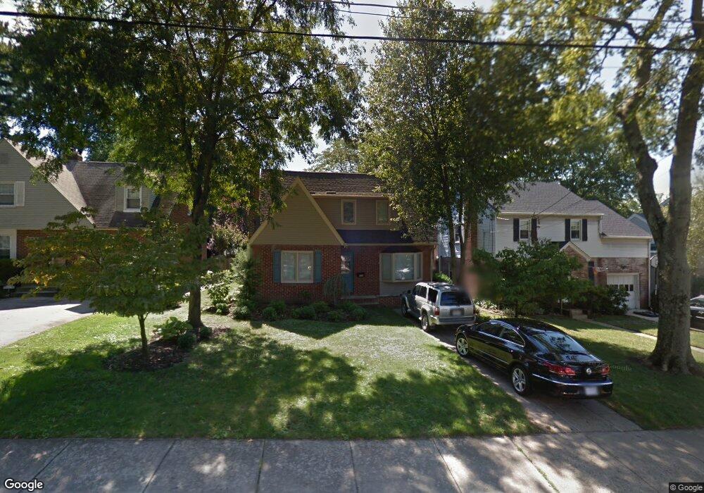
424 Hobart Dr Haddonfield, NJ 08033
Estimated Value: $443,000 - $676,000
--
Bed
--
Bath
1,604
Sq Ft
$320/Sq Ft
Est. Value
About This Home
This home is located at 424 Hobart Dr, Haddonfield, NJ 08033 and is currently estimated at $513,572, approximately $320 per square foot. 424 Hobart Dr is a home located in Camden County with nearby schools including Avon Elementary School, Woodland Elementary School, and Haddonfield Friends School.
Ownership History
Date
Name
Owned For
Owner Type
Purchase Details
Closed on
Feb 28, 2005
Sold by
Specht Carl H
Bought by
Lausi David B
Current Estimated Value
Home Financials for this Owner
Home Financials are based on the most recent Mortgage that was taken out on this home.
Original Mortgage
$230,400
Outstanding Balance
$117,193
Interest Rate
5.66%
Estimated Equity
$396,379
Purchase Details
Closed on
Aug 30, 2004
Sold by
Thomson Jane Colson
Bought by
Specht Carl H
Home Financials for this Owner
Home Financials are based on the most recent Mortgage that was taken out on this home.
Original Mortgage
$161,275
Interest Rate
5.89%
Create a Home Valuation Report for This Property
The Home Valuation Report is an in-depth analysis detailing your home's value as well as a comparison with similar homes in the area
Home Values in the Area
Average Home Value in this Area
Purchase History
| Date | Buyer | Sale Price | Title Company |
|---|---|---|---|
| Lausi David B | $288,000 | -- | |
| Specht Carl H | $172,000 | -- |
Source: Public Records
Mortgage History
| Date | Status | Borrower | Loan Amount |
|---|---|---|---|
| Open | Lausi David B | $230,400 | |
| Previous Owner | Specht Carl H | $161,275 |
Source: Public Records
Tax History Compared to Growth
Tax History
| Year | Tax Paid | Tax Assessment Tax Assessment Total Assessment is a certain percentage of the fair market value that is determined by local assessors to be the total taxable value of land and additions on the property. | Land | Improvement |
|---|---|---|---|---|
| 2025 | $10,026 | $209,400 | $61,800 | $147,600 |
| 2024 | $9,681 | $209,400 | $61,800 | $147,600 |
| 2023 | $9,681 | $209,400 | $61,800 | $147,600 |
| 2022 | $9,473 | $209,400 | $61,800 | $147,600 |
| 2021 | $9,369 | $209,400 | $61,800 | $147,600 |
| 2020 | $9,214 | $209,400 | $61,800 | $147,600 |
| 2019 | $9,174 | $209,400 | $61,800 | $147,600 |
| 2018 | $8,996 | $209,400 | $61,800 | $147,600 |
| 2017 | $8,772 | $209,400 | $61,800 | $147,600 |
| 2016 | $8,151 | $217,300 | $80,300 | $137,000 |
| 2015 | $7,884 | $217,300 | $80,300 | $137,000 |
| 2014 | $7,551 | $217,300 | $80,300 | $137,000 |
Source: Public Records
Map
Nearby Homes
- 1001 Wayne Rd
- 1201 Wayne Rd
- 425 Peltoma Rd
- 315 Hutchinson Ave
- 518 Carver Ct
- 523 Carver Ct
- 134 Kent Rd
- 95 Lane of Acres
- 104 Bell Ave
- 303 Highland Ave
- 35 Colonial Ridge Dr
- 351 Bellevue Ave
- 301 Bradshaw Ave
- 358 Quaker Rd
- 27 E Phoenix Ave
- 26 E Phoenix Ave
- 425 White Horse Pike
- 320 Warwick Rd
- 428 Mansfield Ave
- 0 Thomas Ave S