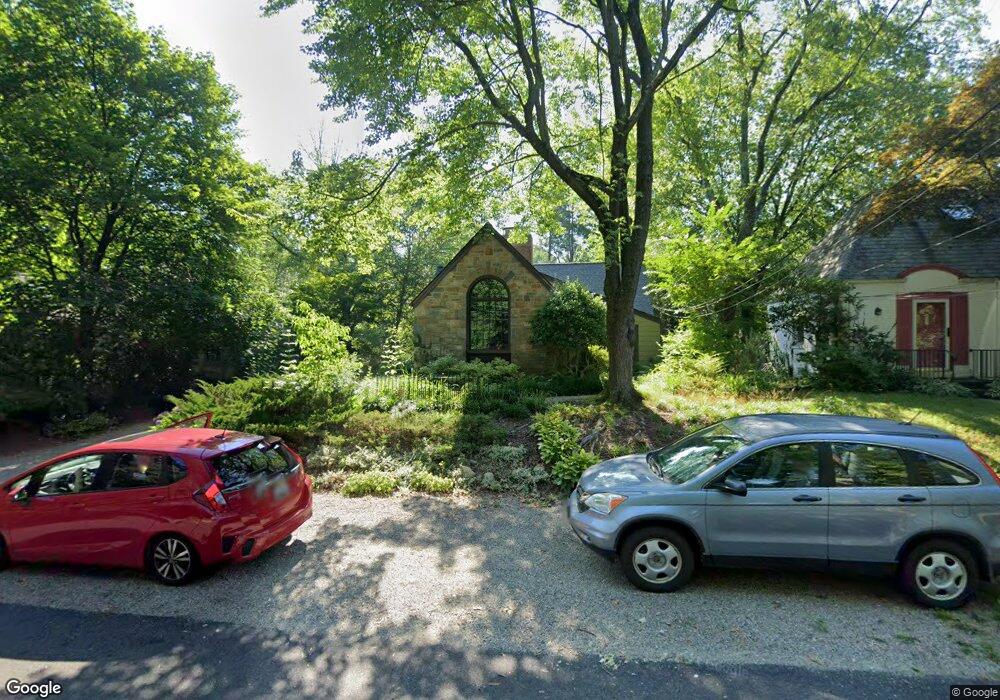
424 Pershing Dr Silver Spring, MD 20910
Silver Spring Park NeighborhoodEstimated Value: $695,870 - $881,000
Studio
2
Baths
1,604
Sq Ft
$496/Sq Ft
Est. Value
About This Home
This home is located at 424 Pershing Dr, Silver Spring, MD 20910 and is currently estimated at $794,968, approximately $495 per square foot. 424 Pershing Dr is a home located in Montgomery County with nearby schools including Sligo Creek Elementary School, Silver Spring International Middle School, and Northwood High School.
Ownership History
Date
Name
Owned For
Owner Type
Purchase Details
Closed on
Jan 5, 2015
Sold by
Mayfield Joan H and Fasulo Elizabeth
Bought by
Mayfield Joan H and Fasulo Elizabeth
Current Estimated Value
Purchase Details
Closed on
Dec 28, 2005
Sold by
Finigan Kathleen S
Bought by
Mayfield Joan H
Home Financials for this Owner
Home Financials are based on the most recent Mortgage that was taken out on this home.
Original Mortgage
$359,000
Outstanding Balance
$195,887
Interest Rate
5.78%
Mortgage Type
New Conventional
Estimated Equity
$599,081
Purchase Details
Closed on
Sep 29, 2005
Sold by
Finigan Kathleen S
Bought by
Mayfield Joan H
Home Financials for this Owner
Home Financials are based on the most recent Mortgage that was taken out on this home.
Original Mortgage
$359,000
Interest Rate
5.78%
Mortgage Type
New Conventional
Create a Home Valuation Report for This Property
The Home Valuation Report is an in-depth analysis detailing your home's value as well as a comparison with similar homes in the area
Home Values in the Area
Average Home Value in this Area
Purchase History
| Date | Buyer | Sale Price | Title Company |
|---|---|---|---|
| Mayfield Joan H | -- | None Available | |
| Mayfield Joan H | $711,000 | -- | |
| Mayfield Joan H | $711,000 | -- | |
| Mayfield Joan H | $711,000 | -- | |
| Mayfield Joan H | $711,000 | -- |
Source: Public Records
Mortgage History
| Date | Status | Borrower | Loan Amount |
|---|---|---|---|
| Open | Mayfield Joan H | $359,000 | |
| Closed | Mayfield Joan H | $359,000 | |
| Previous Owner | Mayfield Joan H | $359,000 |
Source: Public Records
Tax History
| Year | Tax Paid | Tax Assessment Tax Assessment Total Assessment is a certain percentage of the fair market value that is determined by local assessors to be the total taxable value of land and additions on the property. | Land | Improvement |
|---|---|---|---|---|
| 2025 | $7,368 | $601,233 | -- | -- |
| 2024 | $7,368 | $576,500 | $347,300 | $229,200 |
| 2023 | $6,588 | $570,800 | $0 | $0 |
| 2022 | $6,197 | $565,100 | $0 | $0 |
| 2021 | $5,897 | $559,400 | $347,300 | $212,100 |
| 2020 | $5,897 | $547,067 | $0 | $0 |
| 2019 | $5,725 | $534,733 | $0 | $0 |
| 2018 | $5,568 | $522,400 | $347,300 | $175,100 |
| 2017 | $5,544 | $511,900 | $0 | $0 |
| 2016 | $5,336 | $501,400 | $0 | $0 |
| 2015 | $5,336 | $490,900 | $0 | $0 |
| 2014 | $5,336 | $490,900 | $0 | $0 |
Source: Public Records
Map
Nearby Homes
- 512 Pershing Dr
- 311 Ellsworth Dr
- 9127 Sligo Creek Pkwy
- 9111 Sligo Creek Pkwy
- 9201 Three Oaks Dr
- 9214 Three Oaks Dr
- 9039 Sligo Creek Pkwy Unit 1409
- 9039 Sligo Creek Pkwy Unit 205
- 9039 Sligo Creek Pkwy Unit 809
- 9039 Sligo Creek Pkwy Unit 606
- 9210 Worth Ave
- 9217 Three Oaks Dr
- 8613 Cedar St
- 1102 Dale Dr
- 9329 Harvey Rd
- 9407 Colesville Rd
- 417 Mansfield Rd
- 700 Roeder Rd Unit 103
- 8 Melbourne Ave
- 930 Wayne Ave Unit 405
- 426 Pershing Dr
- 422 Pershing Dr
- 428 Pershing Dr
- 420 Pershing Dr
- 427 Greenbrier Dr
- 429 Greenbrier Dr
- 425 Pershing Dr
- 425 Greenbrier Dr
- 418 Pershing Dr
- 431 Greenbrier Dr
- 427 Pershing Dr
- 430 Pershing Dr
- 423 Pershing Dr
- 421 Greenbrier Dr
- 711 Dale Dr
- 705 Dale Dr
- 433 Greenbrier Dr
- 421 Pershing Dr
- 416 Pershing Dr
- 715 Dale Dr
Your Personal Tour Guide
Ask me questions while you tour the home.